Meteorologist: Marc de Keyser
Contact: marc.achiel@gmail.com or mobile +32 473 72 76 41
Date: 9 August 2015
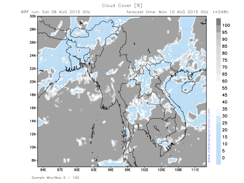
Meteogram | Precipitation | Accumulated Precipitation | Pressure | Relative Humidity | Surface Wind | Temperature | 80m AGL Wind | Satellite Image | Cloud Cover
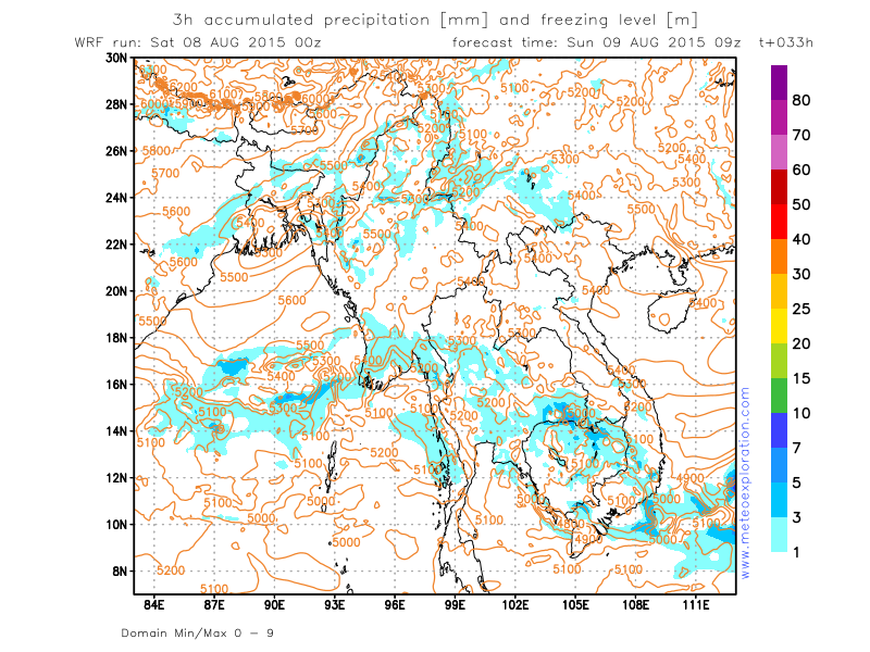
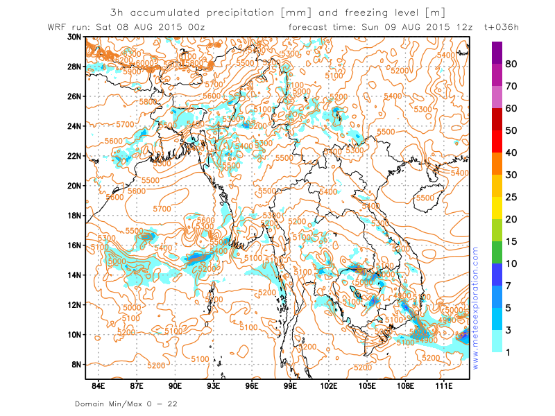
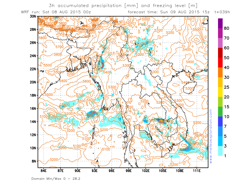
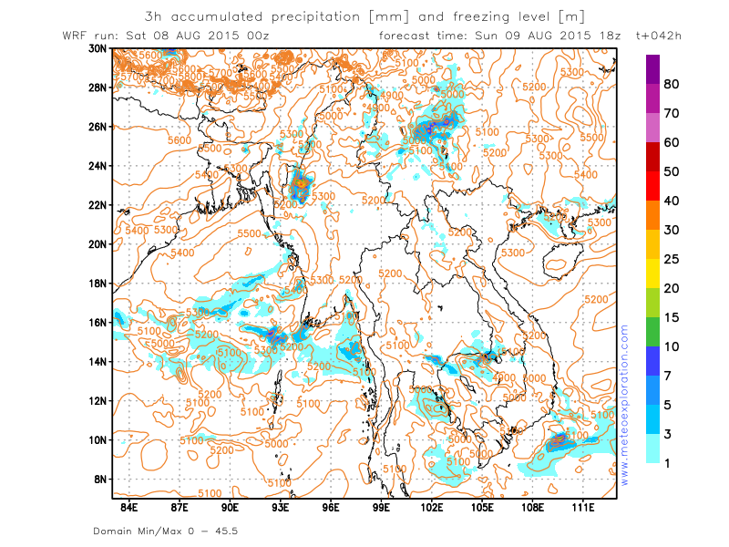
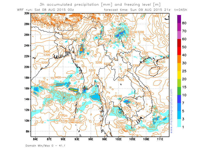
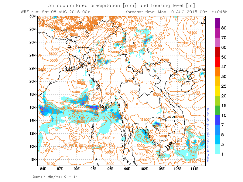
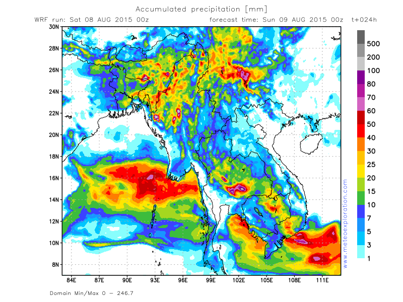
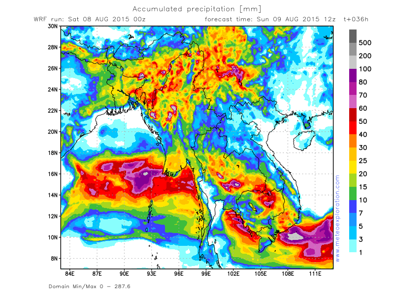
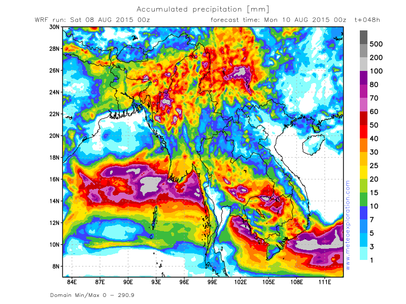
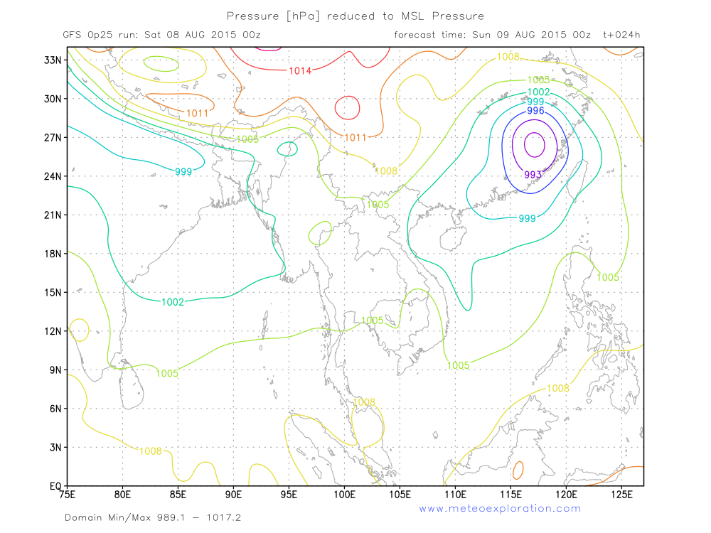
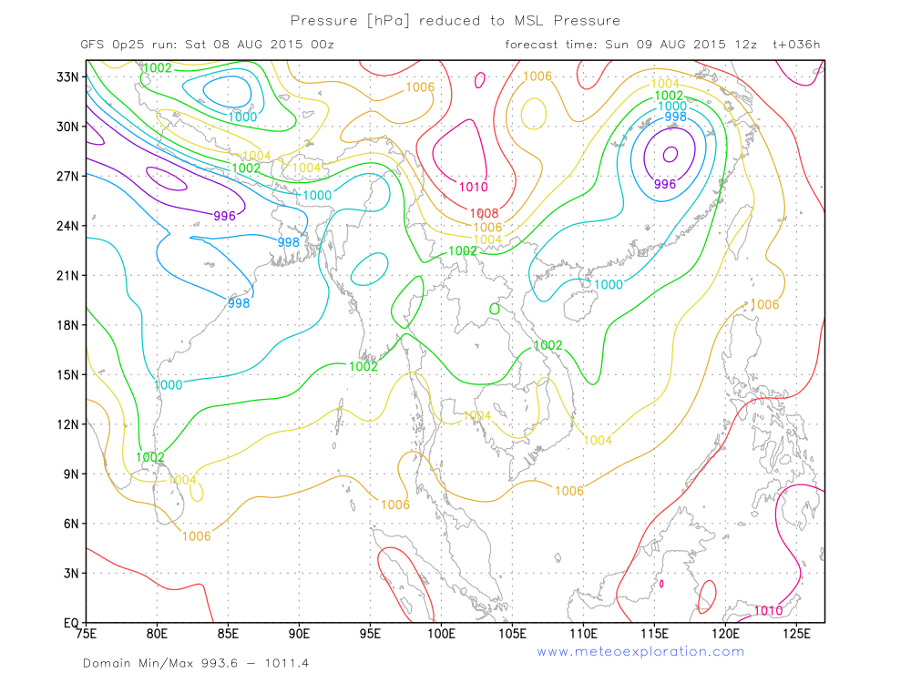
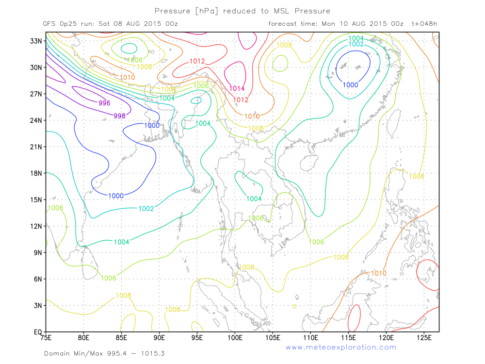
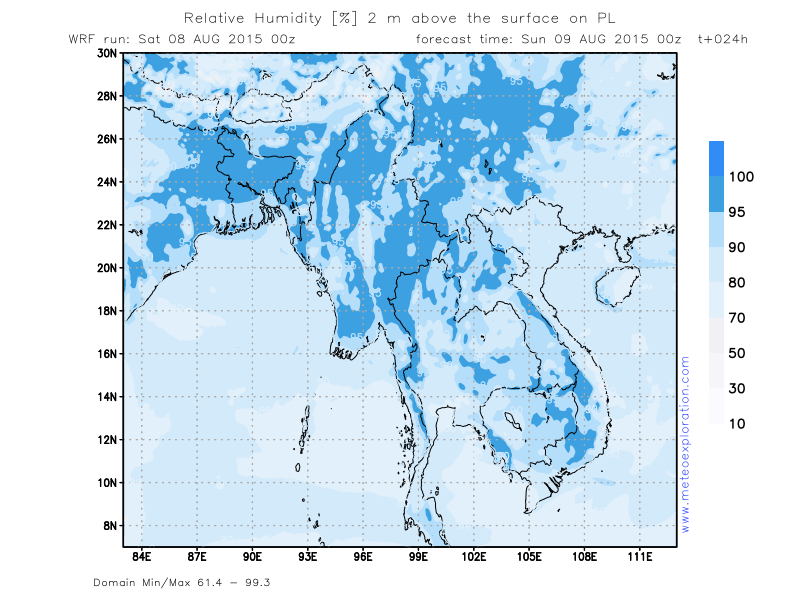
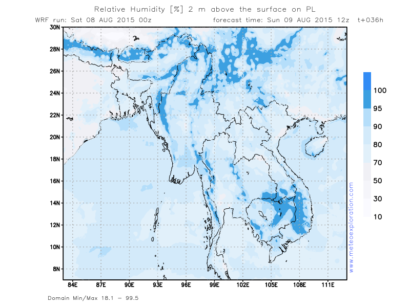
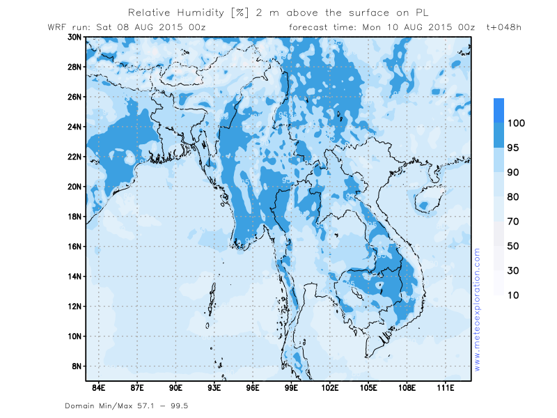
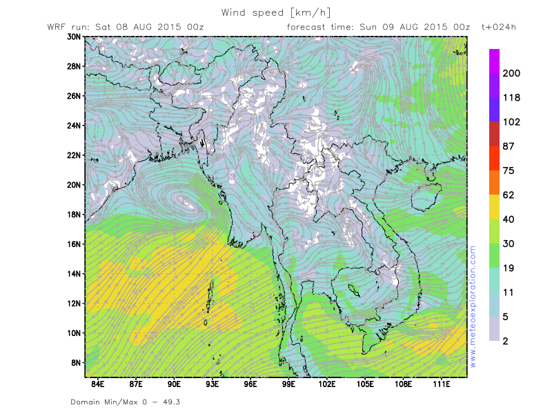
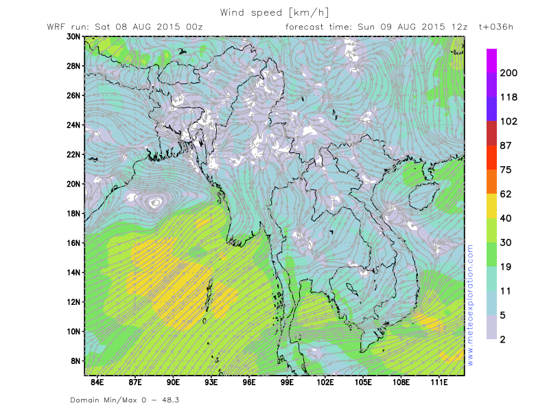
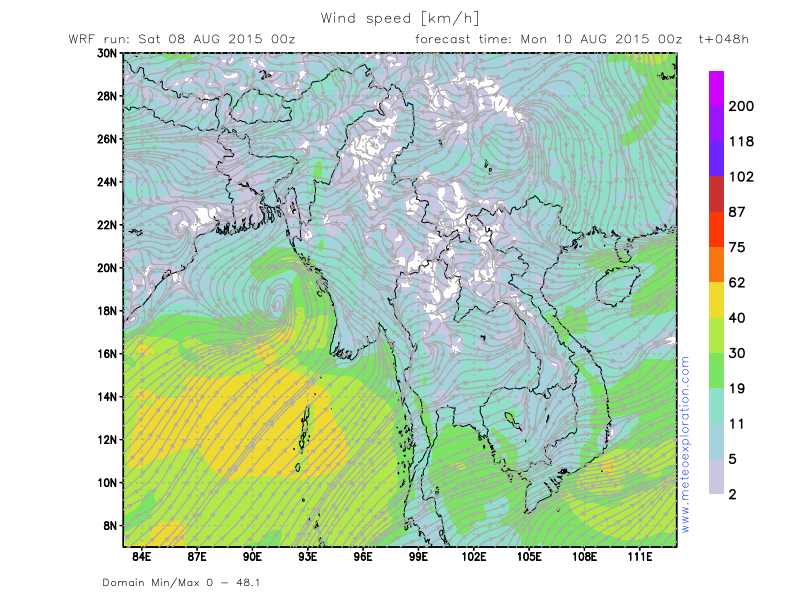
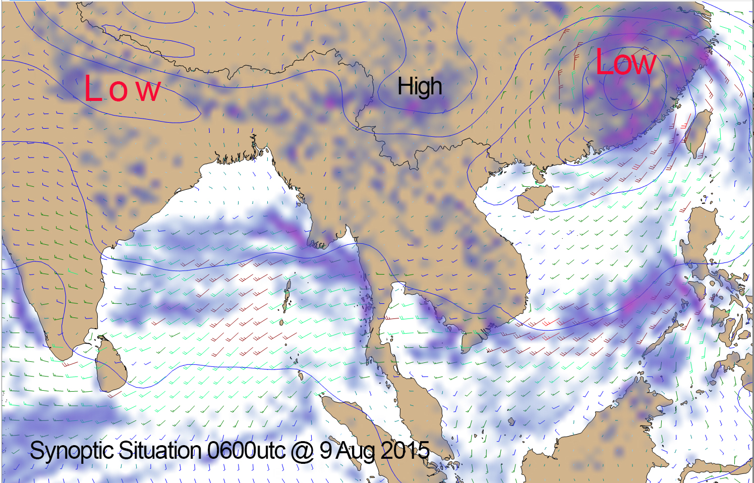
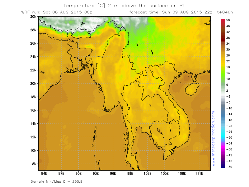
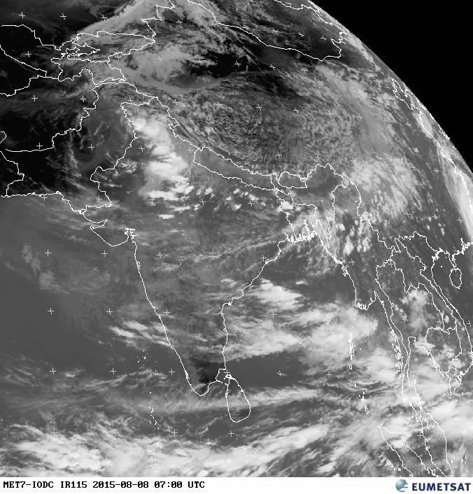
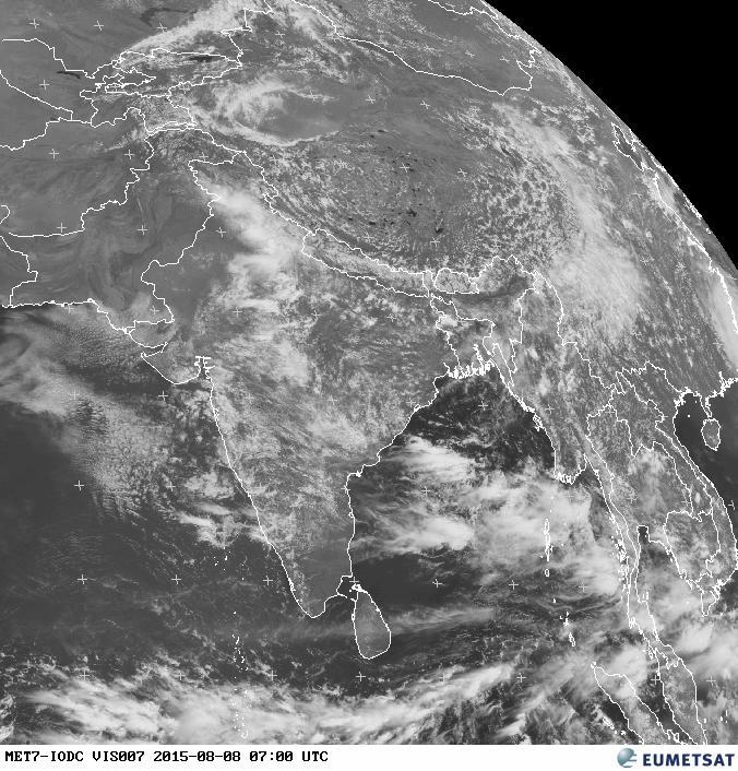
After the passage of the tropical cyclone over Taiwan, the synoptic situation over SE Asia is gradually recovering. This means that the low over Northern India is deepening again which means that the SW’ly gradient over the Bay of Bengal is getting stronger again.
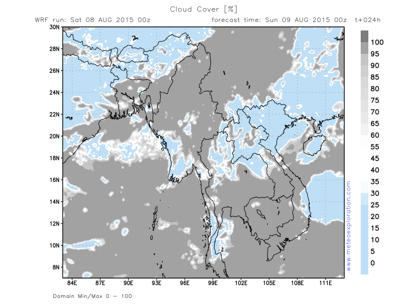
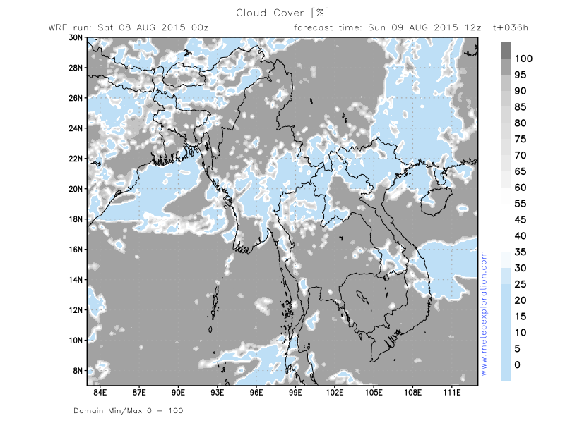
From the North of Myanmar a high pressure system builds towards the center of the country and as a result the conditions are likely to be pretty stable today for the best parts of the country. This will be only for one day as the high decays and more instability is expected for next week.
Over the NW of the country, provinces of Chin, Sagaing Magwe and Mandalay, moist and unstable air will trigger some convective cells today.
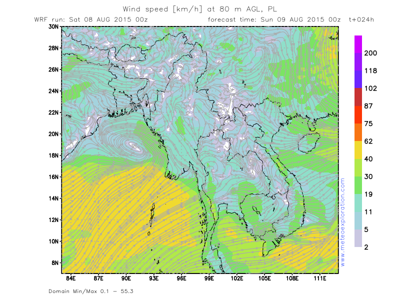
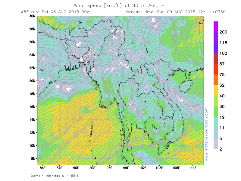
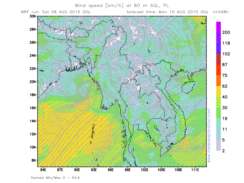
Moderately strong Westerly wind over the Southern parts of Myanmar and the Gulf of Thailand.
Warnings
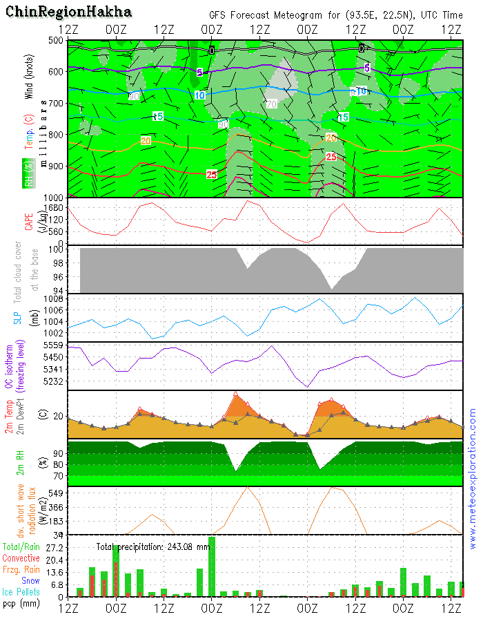
-At Chin Province –(Hakha): tonight-heavy precipitation with severe risk for flooding!
-Moderate to severe turbulence in the vicinity of thunderstorm
Forecast for different areas
Province of Chin (Hakha: 22.6/93.6)
-weather:
Mostly very cloudy to solidly overcast with outbreaks of rain and an isolated/embedded shower/thundery outbreak is possible (20-30%). But the most of the precipitation is continuous precip with prevailingly moderate to poor conditions.
-precipitation: total precipitation: 40-60mm between 00 and 12utc. Between 12 and 00utc for over 100mm
-wind at surface: weak 2-4kt to calm from variable directions
-outlook tomorrow:
The day starts with heavy rain but soon decreasing and somehow better conditions develop. It looks like a period of about 24-30 hours with little or no rain.
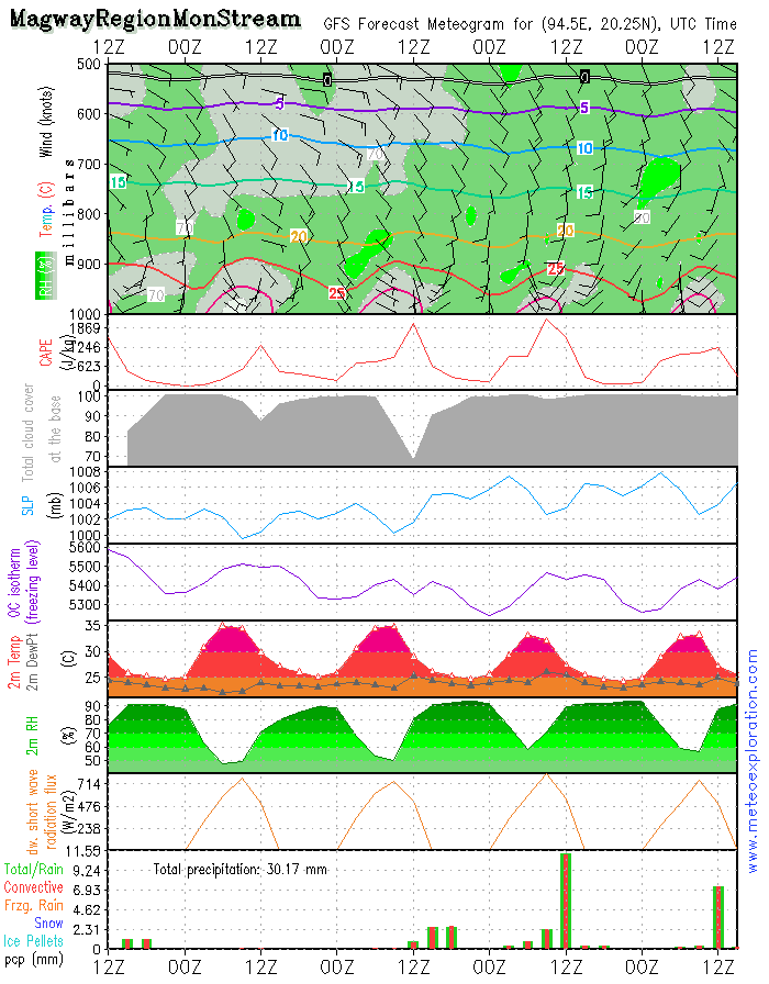
Province of Magway (Mon Stream: 20.2/94.4)
-weather:
mix of sunny spells and cloudy periods. We need to make the distinction between the South and the North of this province: I expect the Southern parts of the province remaining pretty dry and rather good conditions prevail. A local shower is not excluded. However the Northern parts of this province will have some heavy rain showers, probably with thundery outbreaks.
-precipitation: around this location precipitation is less than 2mm.
-wind at surface: in general pretty weak from variable directionsafter 12/14utc temporarily increasing to 6-10kt from SE.
-outlook tomorrow: the first part of the day is still pretty stable but gradually clouds form and showers develop. At this stage it looks like the whole of the province will have showery/thundery outbreaks on Monday
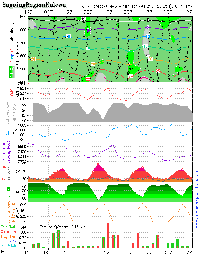
Province Sagaing (Kalewa: 23.2/94.3)
-weather: also over this part of country we can expect a lot of cloudiness with rain or showery outbreaks with a local thunderstorm. In between a few sunny spells can develop. Take in account that fog or mist patches can form. precipitation: 8-12 mm
-wind at surface: weak to calm from variable directions
-outlook tomorrow: instability increases which means that the intensity of the showers/thunderstorms increases again. More precipitation again.
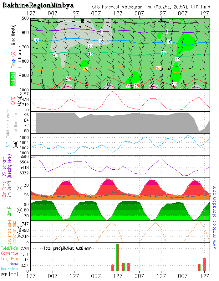
Province of Rakhine (Minbya: 20.4/93.3)
-weather: especially the coastal area may enjoy a rather dry day-further inland shower and thunderstorms are likely to develop. At this specific location of Minbya, the model indicates no significant precipitation. Overnight fog formation is likely.
-precipitation: less than 2mm
-wind at surface: SE 6-10kt increasing after 12/15utc: SE 14-18kt
-outlook tomorrow: the air mass is getting more instable so the risk for heavy showers and thunderstorms increases again
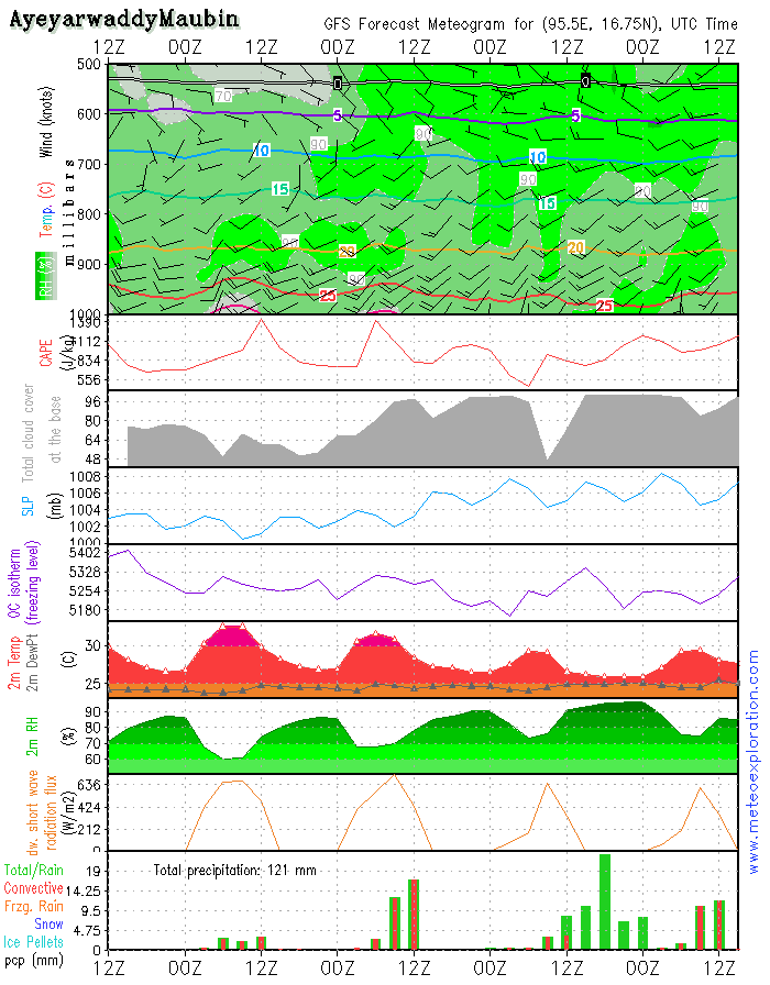
Province of Ayeyarwaddy(Maubin: 16.7/95.6)
-weather: sunny spells in the beginning of the day but soon clouds develop and result in moderate showery/thundery outbreaks. Easing again after 12utc.
-precipitation: during showers18-23mm
-wind at surface: SSW 10-15kt after 8/10utc increasing up to 20-25kt, later again decreasing
-outlook tomorrow: mix of sunny spells and cloudy periods with less showery activity
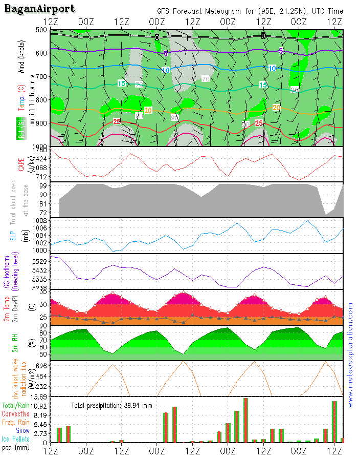
Bagan: 21.2/94.9 (Airport) - Airfield forecast
-Weather: sunny spells and cloudy periods, remaining mainly dry. A local showery outbreak is not excluded but normally it should remain pretty dry.
-Clouds: 2-5/8 CuSc around 3000-3500ft –
-Visibility: in the early morning possibly a few mist or fog patches but soon dissipating. Good.
-Precipitation: on significant precip expected
-wind at surface: weak from variable directions after 12/14utc increasing to S 10kt
-wind at 1000ft: weak becoming SSE10kt
-wind at 3000ft: SSW 5-10kt becoming SSE 10-15kt
-wind at 5000ft: SSW 5-10kt becoming SSE 10-15kt
-Turbulence: lightaround 1000ft
-Outlook for Sunday10 August:
Increasingly becoming unstable resulting some showery/thundery outbreaks-especially after 12utc some heavy cells can develop.
After the passage of the tropical cyclone over Taiwan, the synoptic situation over SE Asia is gradually recovering. This means that the low over Northern India is deepening again which means that the SW’ly gradient over the Bay of Bengal is getting stronger again.
From the North of Myanmar a high pressure system builds towards the center of the country and as a result the conditions are likely to be pretty stable today for the best parts of the country. This will be only for one day as the high decays and more instability is expected for next week.
Over the NW of the country, provinces of Chin, Sagaing Magwe and Mandalay, moist and unstable air will trigger some convective cells today.
Moderately strong Westerly wind over the Southern parts of Myanmar and the Gulf of Thailand.
Warnings
-At Chin Province –(Hakha): tonight-heavy precipitation with severe risk for flooding!
-Moderate to severe turbulence in the vicinity of thunderstormm
After the passage of the tropical cyclone over Taiwan, the synoptic situation over SE Asia is gradually recovering. This means that the low over Northern India is deepening again which means that the SW’ly gradient over the Bay of Bengal is getting stronger again.
From the North of Myanmar a high pressure system builds towards the center of the country and as a result the conditions are likely to be pretty stable today for the best parts of the country. This will be only for one day as the high decays and more instability is expected for next week.
Over the NW of the country, provinces of Chin, Sagaing Magwe and Mandalay, moist and unstable air will trigger some convective cells today.
Moderately strong Westerly wind over the Southern parts of Myanmar and the Gulf of Thailand.
Warnings
-At Chin Province –(Hakha): tonight-heavy precipitation with severe risk for flooding!
-Moderate to severe turbulence in the vicinity of thunderstorm

No. (11) A , Khapaung Street , Hlaing Township ,
Yangon , Myanmar .

95 - 1 - 538549 , 504418

administrator@apexpetro.com

www.apexpetro.com