Meteorologist: Marc de Keyser
Contact: marc.achiel@gmail.com or mobile +32 473 72 76 41
Date: 7 August 2015
Forecast valid for the 8th of August - based on the 07/00utc run
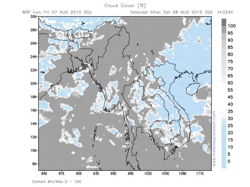
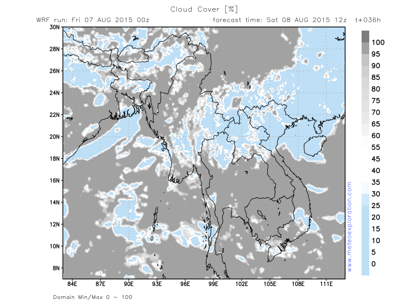
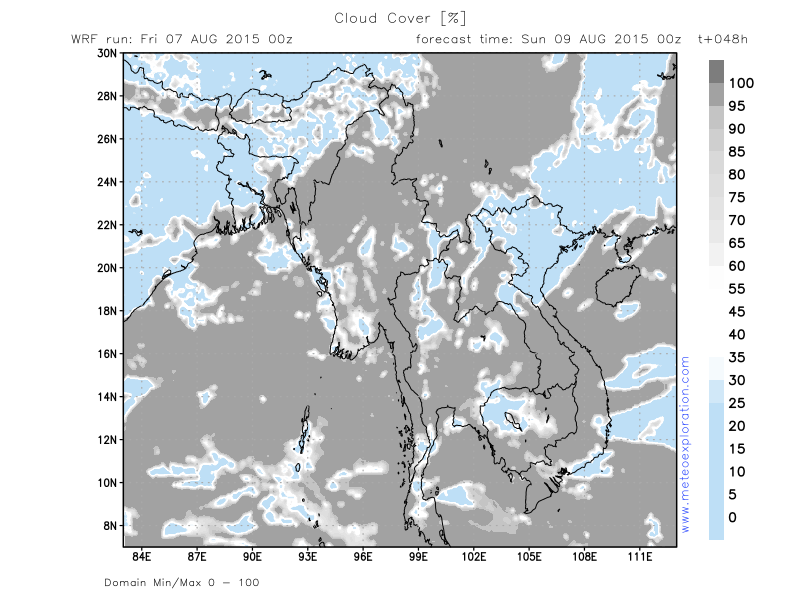
Meteogram | Precipitation | Accumulated Precipitation | Pressure | Relative Humidity | Surface Wind | Temperature | 80m AGL Wind | Satellite Image | Cloud Cover
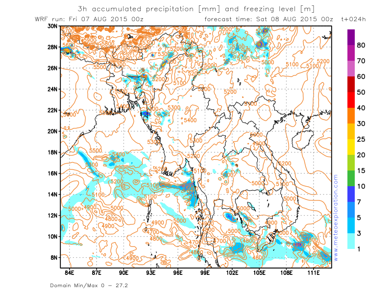
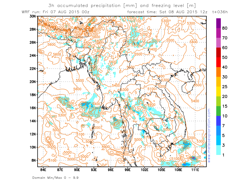
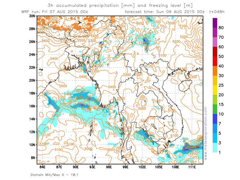
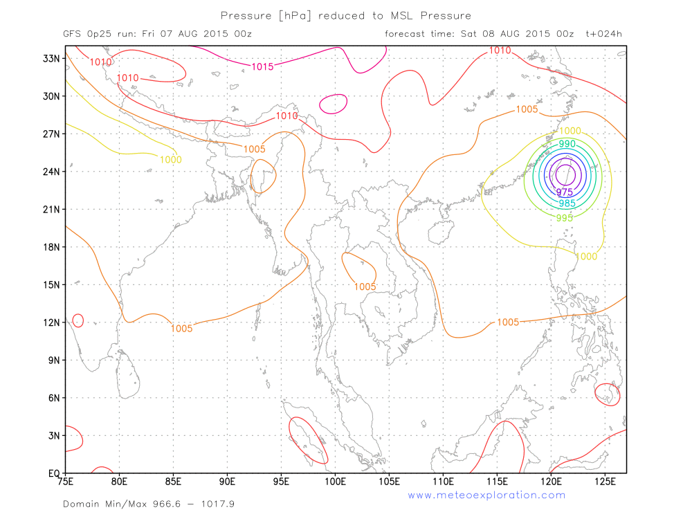
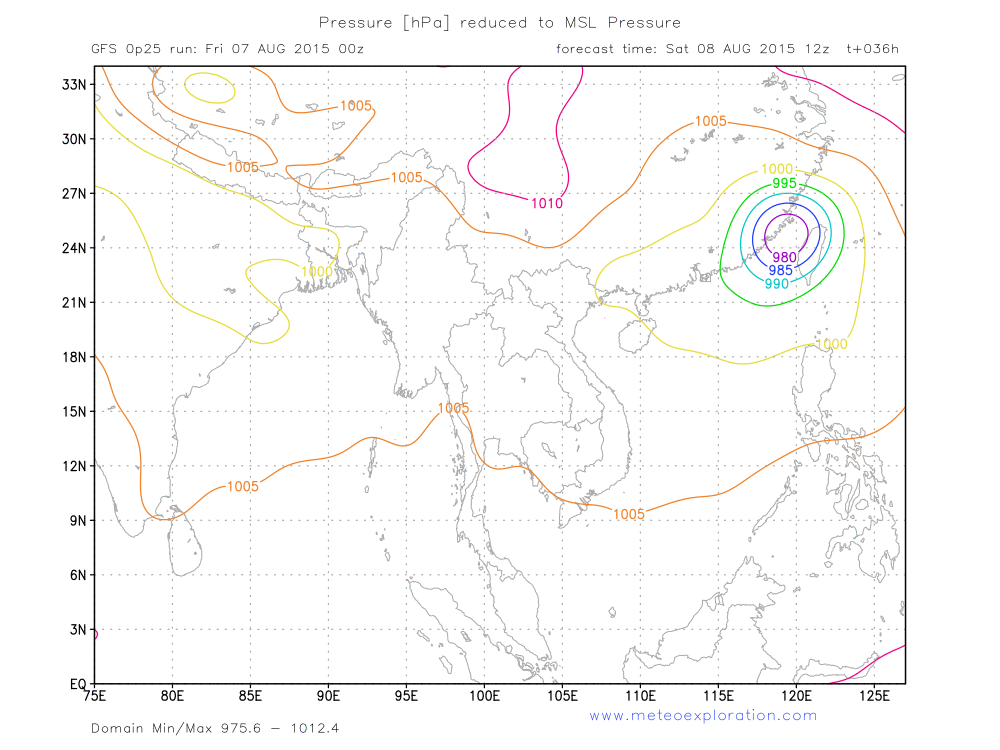
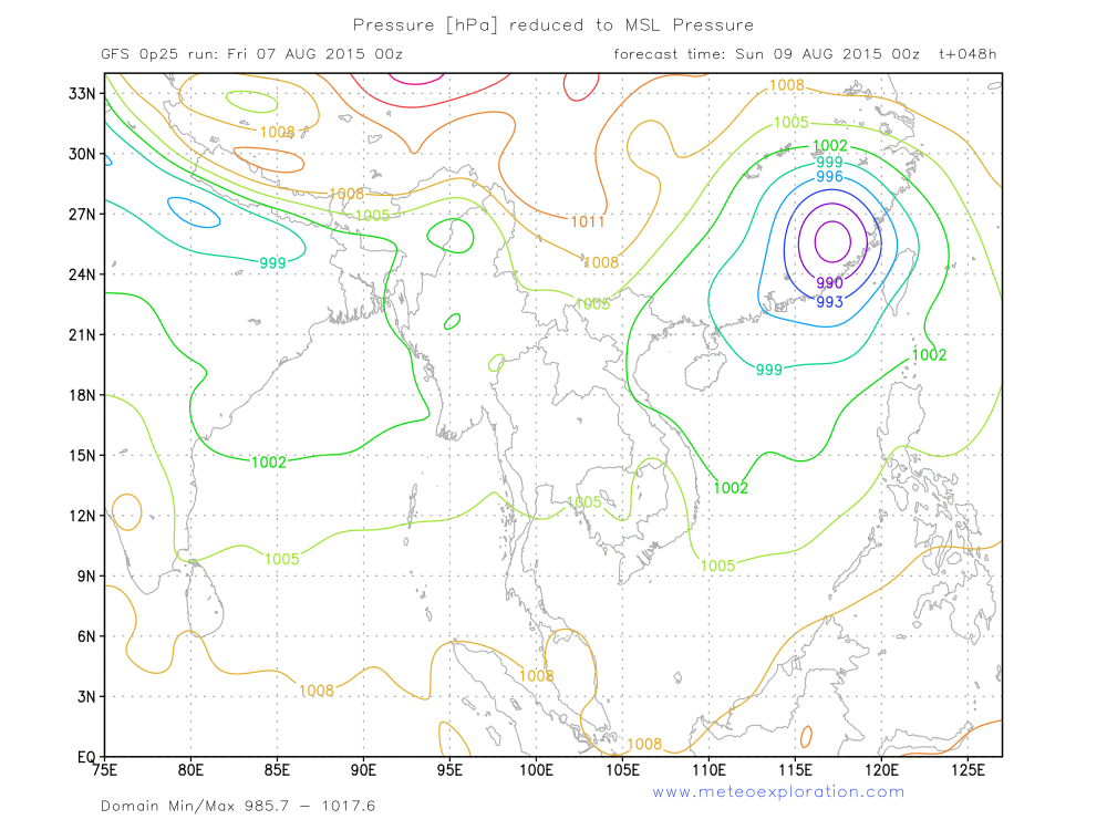
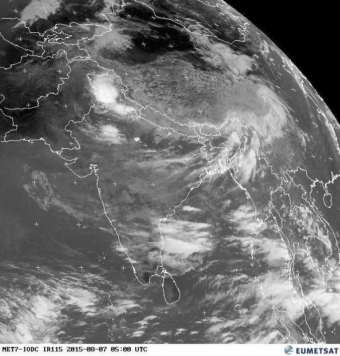
Today’s synoptic maps for Southeast Asia are dominated by the presence of the tropical cyclone that hits Taiwan today, at midnight (8Aug-00utc) the eye of the cyclone will be almost over the center of the island of Taiwan (see map SFC Pressure-8Aug00utc) with devastating consequences before and after the eye crosses.
This feature has impact on the atmospheric conditions elsewhere in SE Asia as well. It takes such an amount of warm air to feed this system that the other weather systems in SE Asia are affected as well.
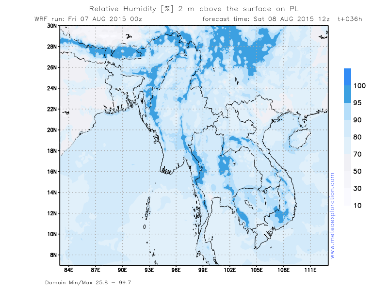
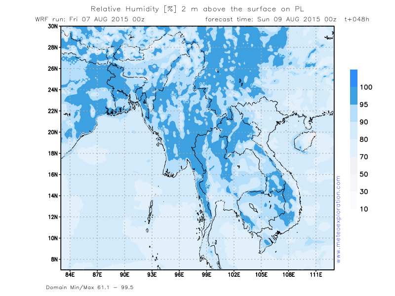
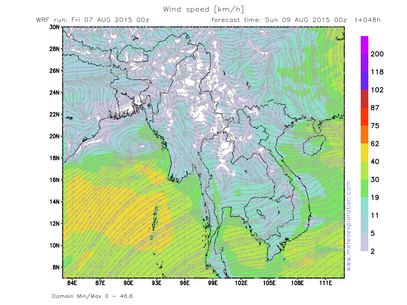
Specifically for Myanmar this means that the low pressure over Northern India fills and becomes weaker-so the SW wind that steers warm and moist air from the Bay of Bengal towards Myanmar becomes significantly weaker.
Later this week, when the tropical cyclone has dissipated, the situation becomes as before again.
Warnings
-At Chin Province –(Hakha): risk for heavy thunderstorms with heavy precipitation and gusts. Tonight possibly up
to 40-60mm!
-Moderate to severe turbulence in the vicinity of thunderstorm
Forecast for different areas
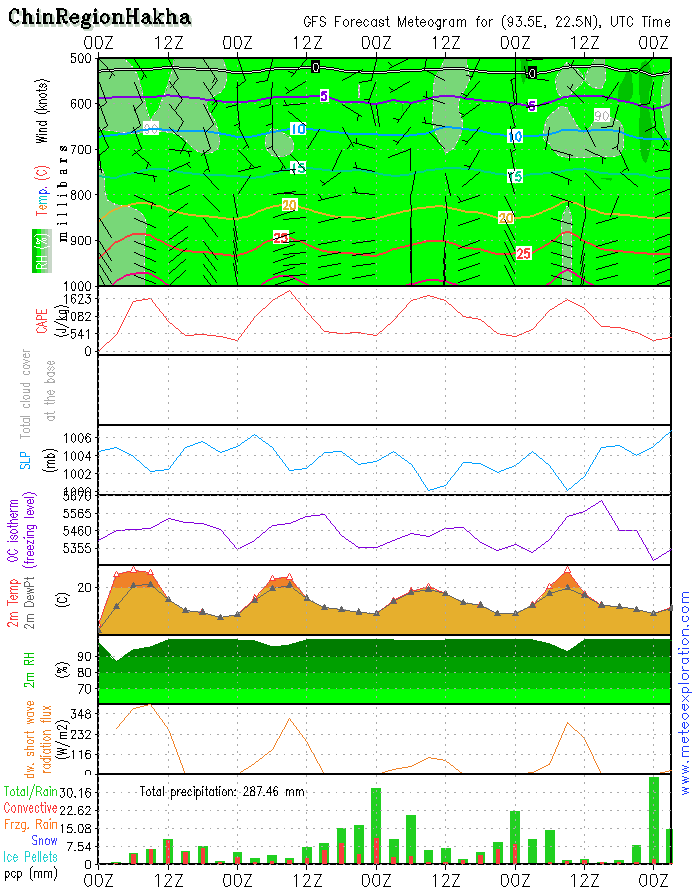
Province of Chin (Hakha: 22.6/93.6)
-weather:
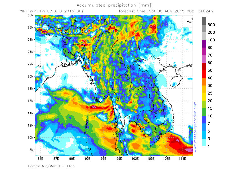
the air mass over this province is still very moist and unstable which means that convective cells form easily and heavy showers with thunderstorm are likely.
So most likely very cloudy to overcast with rain and showers, heavy at times! Also thunderstorms with possible gusts are very possible. Heaviest precipitation is expected after 12utc and overnight
-precipitation: total precipitation: 60-80mm!!!
-wind at surface: weak 2-4kt to calm from variable directions
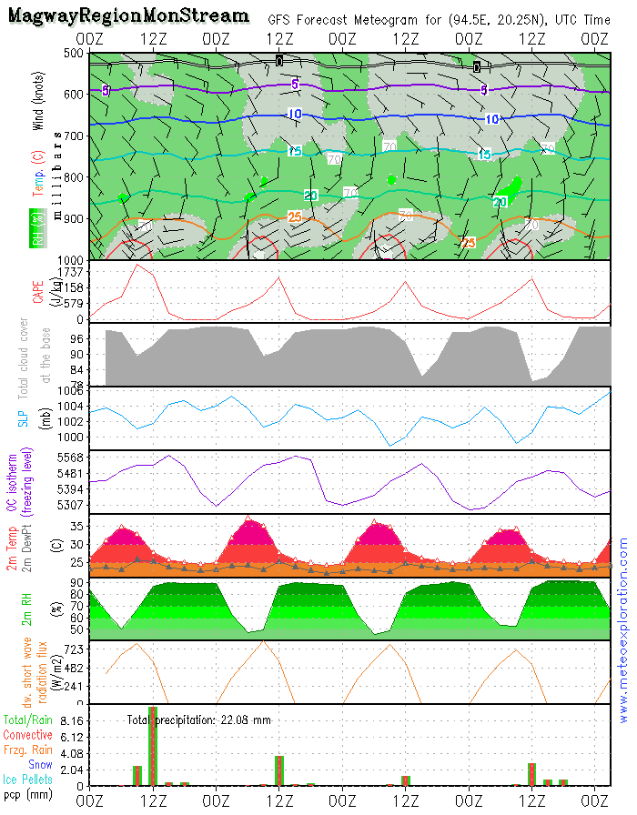
Province of Magway (Mon Stream: 20.2/94.4)
-weather:
start of the day: fog patches, soon dissipating. Sunny spells but due to diurnal heating convective cells form and showers fall. Risk for thunderstorms. After 12utc becoming dry
-precipitation: up to 12utc: 4-8mm
-wind at surface: in general pretty weak from SW’ly to variable directionstemporarily increasing to SW 4-8kt.
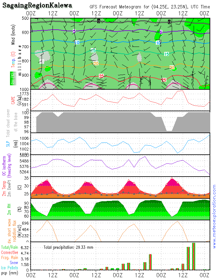
Province Sagaing (Kalewa: 23.2/94.3)
-weather:
as this province is rather far from the coast, I expect that the showery activity in this province will be very local and very limited. So mostly a mix of sunny spells and cloudy periods. A local shower can not be excluded.
-precipitation: less than 2 mm
-wind at surface: weak to calm from variable directions
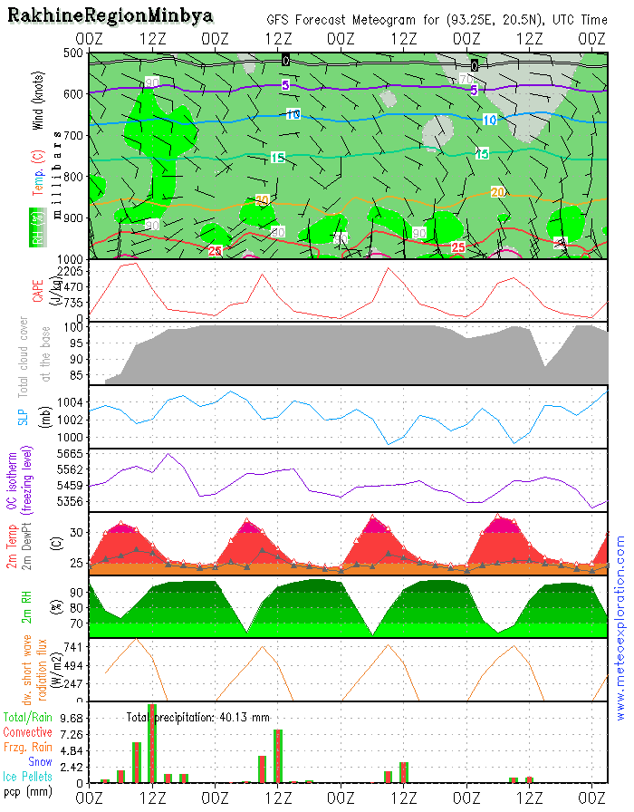
Province of Rakhine (Minbya: 20.4/93.3)
-weather:
Morning fog patches are likely-soon dissipating. Due to diurnal heating, shower cells develop and also thundery outbreaks. Especially a little bit inland some heavy showers/thunderstorms may develop. Along the coast the conditions are better/drier. Showers will again be dying out tonight and fog patches will form.
-precipitation: during showery outbreaks up to 20mm can fall
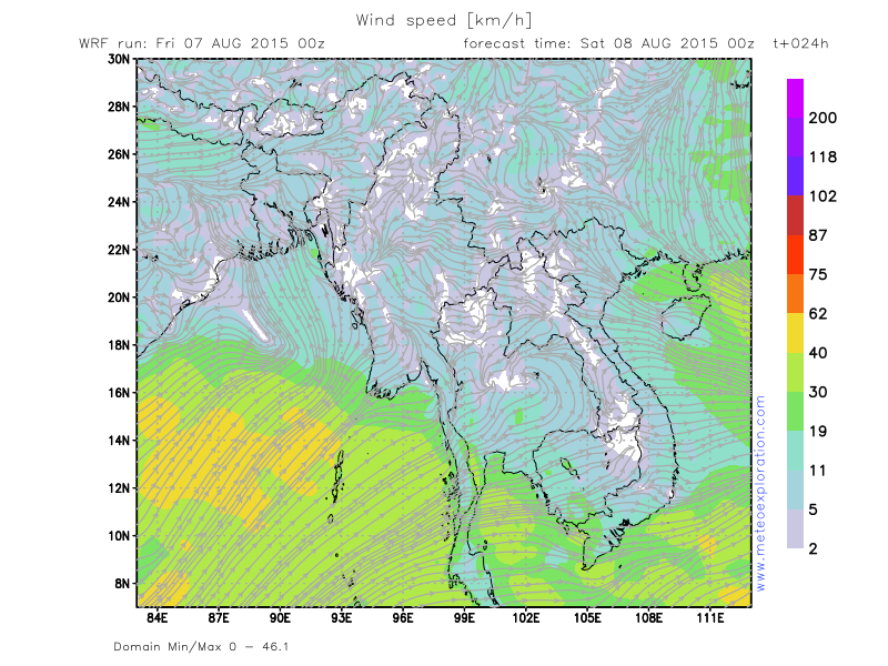
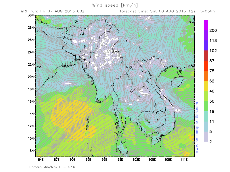
-wind at surface: is weak from variable directions –after 9utc SW10kt for a while! Gusts during thunderstorms!
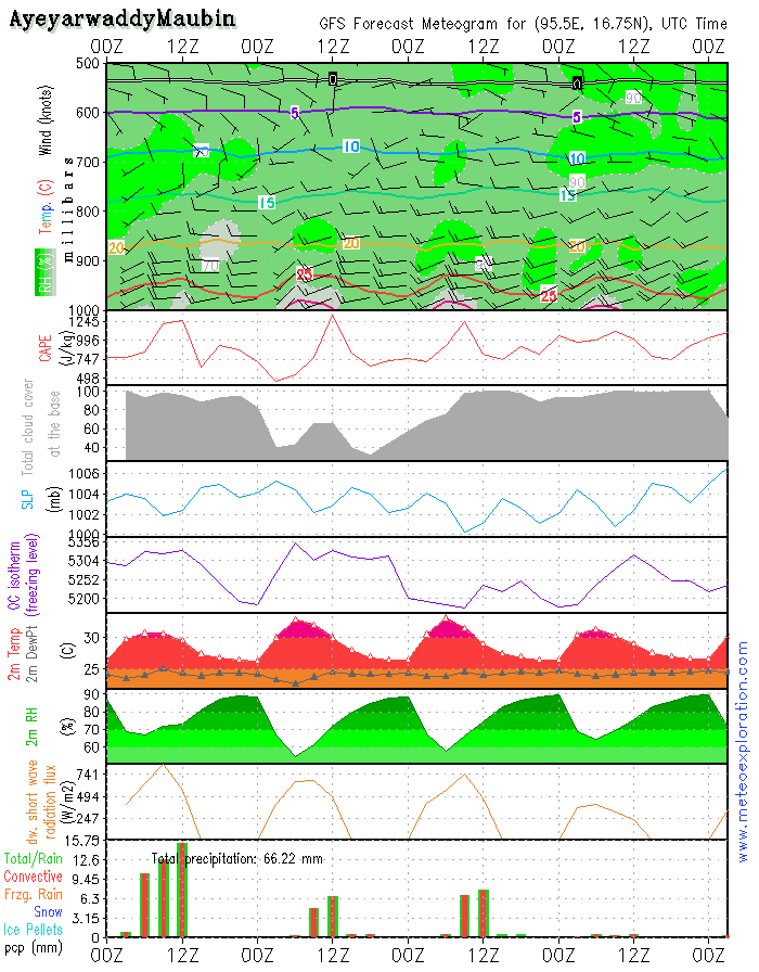
Province of Ayeyarwaddy(Maubin: 16.7/95.6)
-weather:
In the morning: sunny spells but soon over inland regions some heavy showers/thunderstorms can develop-coastal areas are likely to remain pretty dry.
-precipitation during the showers up to 15-20mm can fall in a short time
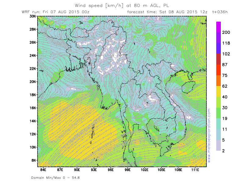
-wind at surface: SW6-10kt after 6utc increasing to 10-15kt. From 10/12utc again decreasing.
At 1500-2000ft wind increases up to 25-30kt-this could lead to mod to severe low level turbulence.
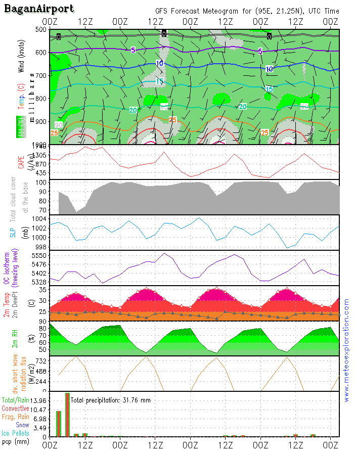
Bagan: 21.2/94.9 (Airport) - Airfield forecast
-Weather:
misty/foggy in the morning but after 6utc convective cell start to form and this will results in outbreaks of rain or thunderstorms. Easing again after 15utc
-Clouds: 4-6/8 Scaround 3000ft –tempo formation of Cumulonimbus up to tropo level.
-Visibility: mod to poor in the early hours of the day, soon improving. During any shower or thunderstorm becoming moderate to poor
-Precipitation: local up to 20-30mm
-wind at surface: weak from variable directions after 15utc increasing to SSW 10kt
-wind at 1000ft: weak becoming S 10-15kt
-wind at 3000ft: weak becoming S 10-15kt
-wind at 5000ft: SSE 4-6kt
-Turbulence: nil to light becoming mod to severe in vicinity of thunderstorms
-Outlook for Saturday 9 August: pretty much the same as today: local developing thunderstorm, however it look like the intensity and frequency becomes less
Today’s synoptic maps for Southeast Asia are dominated by the presence of the tropical cyclone that hits Taiwan today, at midnight (8Aug-00utc) the eye of the cyclone will be almost over the center of the island of Taiwan (see map SFC Pressure-8Aug00utc) with devastating consequences before and after the eye crosses.
This feature has impact on the atmospheric conditions elsewhere in SE Asia as well. It takes such an amount of warm air to feed this system that the other weather systems in SE Asia are affected as well.
Specifically for Myanmar this means that the low pressure over Northern India fills and becomes weaker-so the SW wind that steers warm and moist air from the Bay of Bengal towards Myanmar becomes significantly weaker.
Later this week, when the tropical cyclone has dissipated, the situation becomes as before again.
Warnings
-At Chin Province –(Hakha): risk for heavy thunderstorms with heavy precipitation and gusts. Tonight possibly up
to 40-60mm!
-Moderate to severe turbulence in the vicinity of thunderstorm

No. (11) A , Khapaung Street , Hlaing Township ,
Yangon , Myanmar .

95 - 1 - 538549 , 504418

administrator@apexpetro.com

www.apexpetro.com