Meteorologist: Marc de Keyser
Contact: marc.achiel@gmail.com or mobile +32 473 72 76 41
Date: 6 August 2015
Forecast valid for the 7th of August - based on the 06/00utc run
Meteogram | Precipitation | Accumulated Precipitation | Pressure | Relative Humidity | Surface Wind | Temperature | 80m AGL Wind | Satellite Image | Cloud Cover
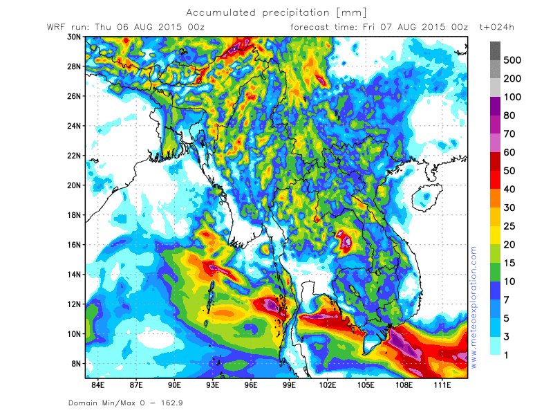
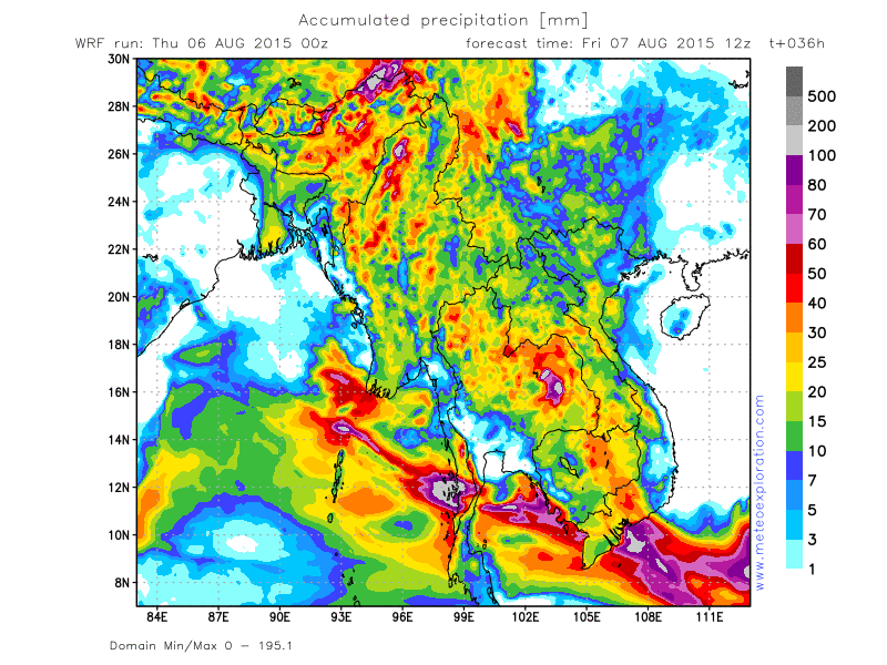
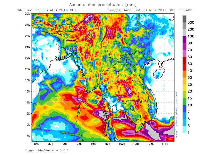
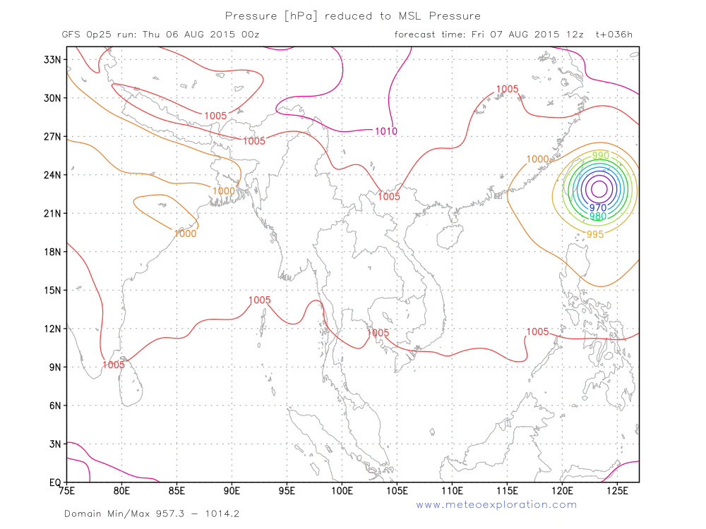
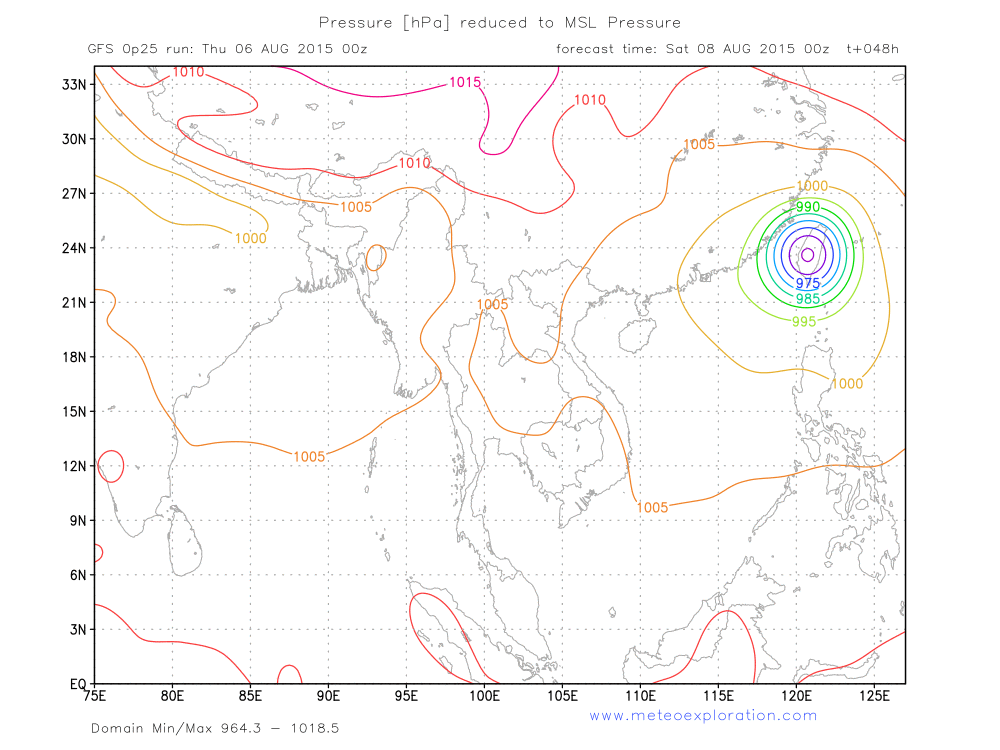
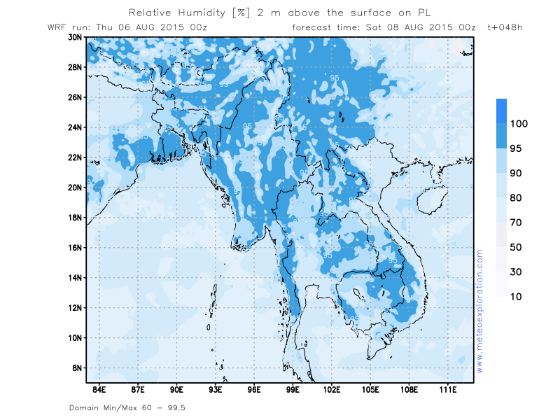
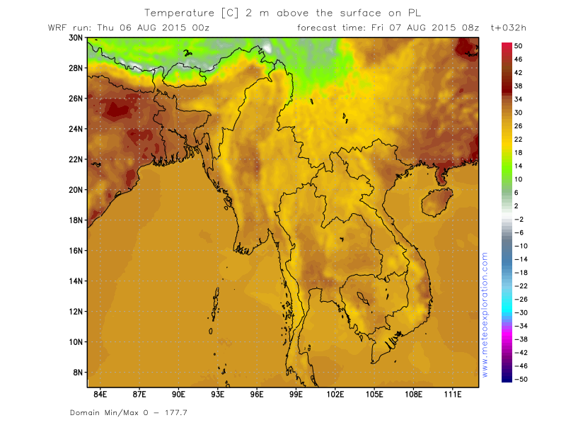
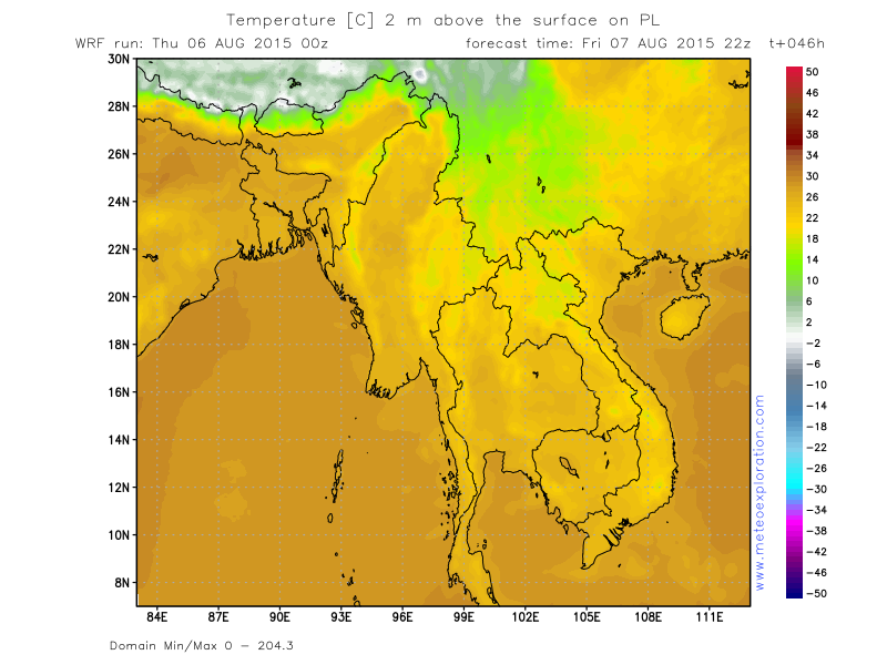
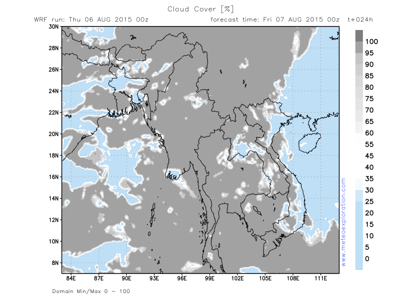
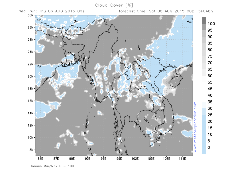
As the low pressure system over Northern India has become significantly weaker, the advection of warm, moist air towards Myanmar, has weakened and at most places stopped.
This means that at a lot of place the airmass has become drier, hence less clouds form and as a result the amount of
precipitation has become significantly less than last weeks.
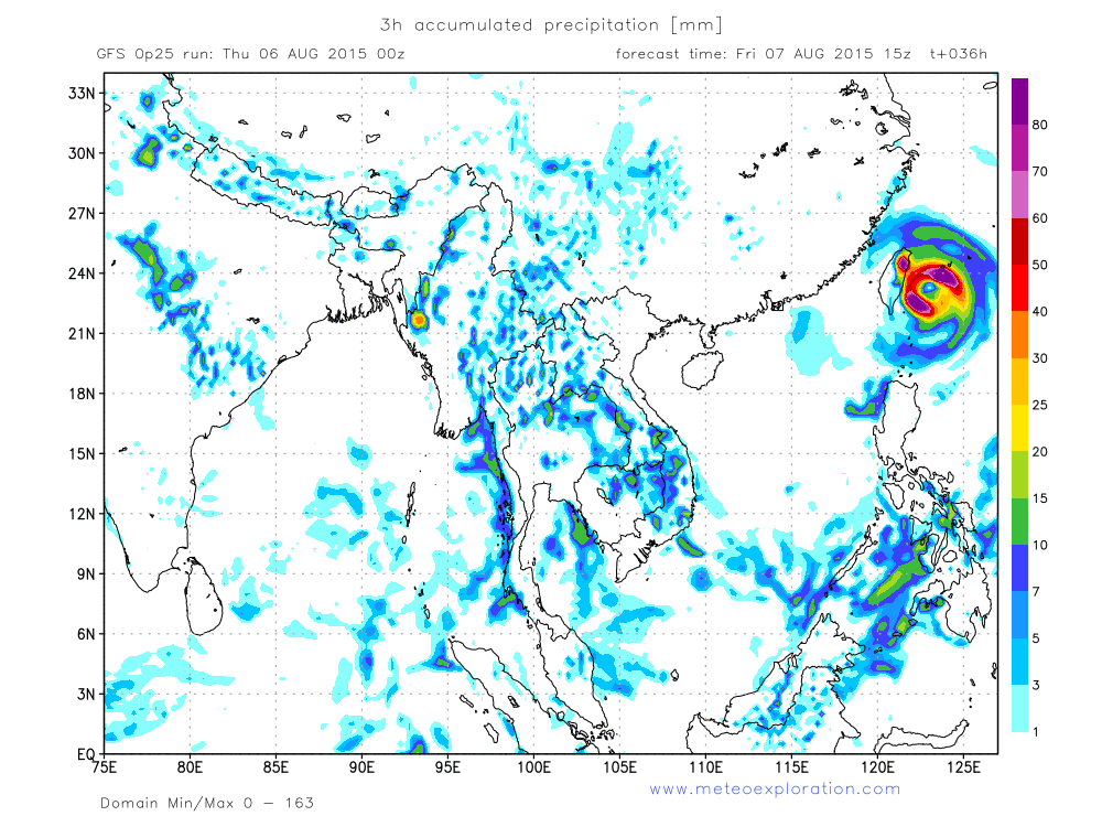
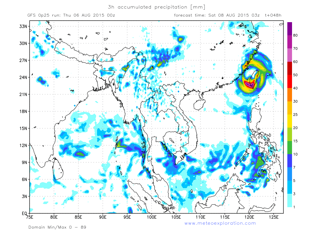
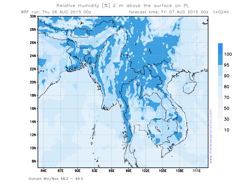
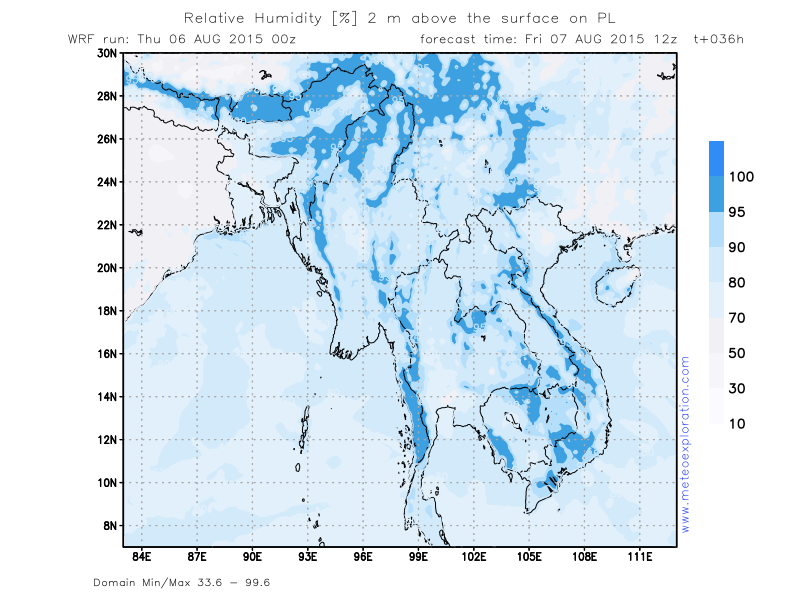
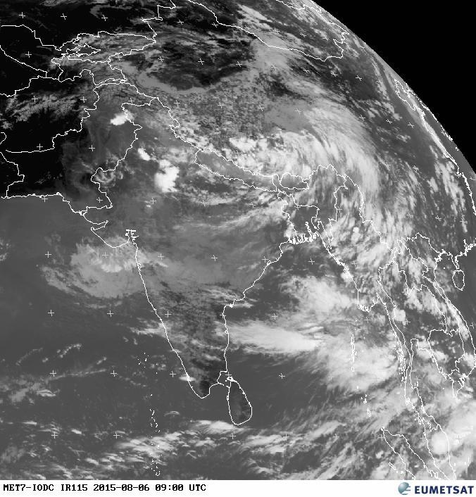
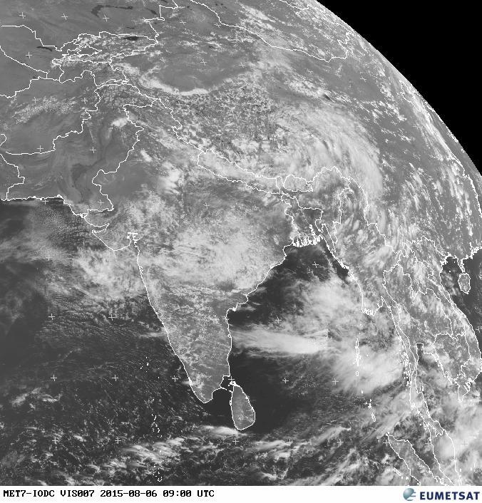
On the Satellite image one can still see a lot of clouds that are being advected from the Bay of Bengal towards the Southwestern and Southern parts of Myanmar: Southern Ayeyarwady and Mon. Up in the North we can see a lot of
cloud free area but also cells of convective clouds which can result in showers.
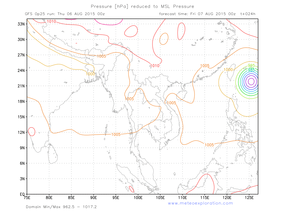
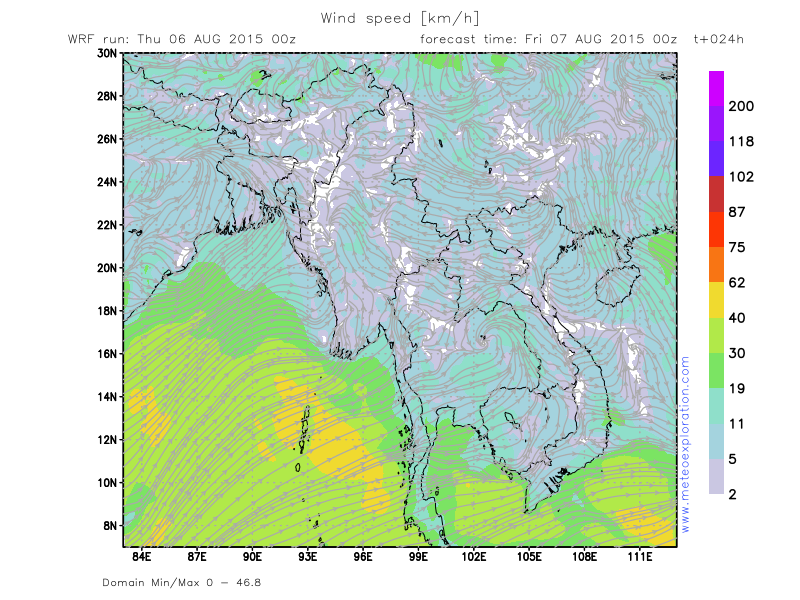
On the Surface pressure map you can see the tropical cyclone that is going to hit Taiwan Tonight and tomorrow.
Warnings
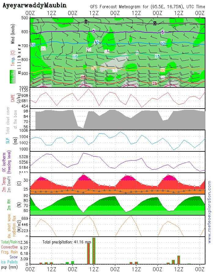
-At the Maubinarea: risk for heavy thunderstorm with heavy precipitation and gusts
-At the Minbya area: risk for heavy thunderstorm with heavy precipitation and gusts
-At the Hakha area: heavy rainfall for the most of the day
Forecast for different areas
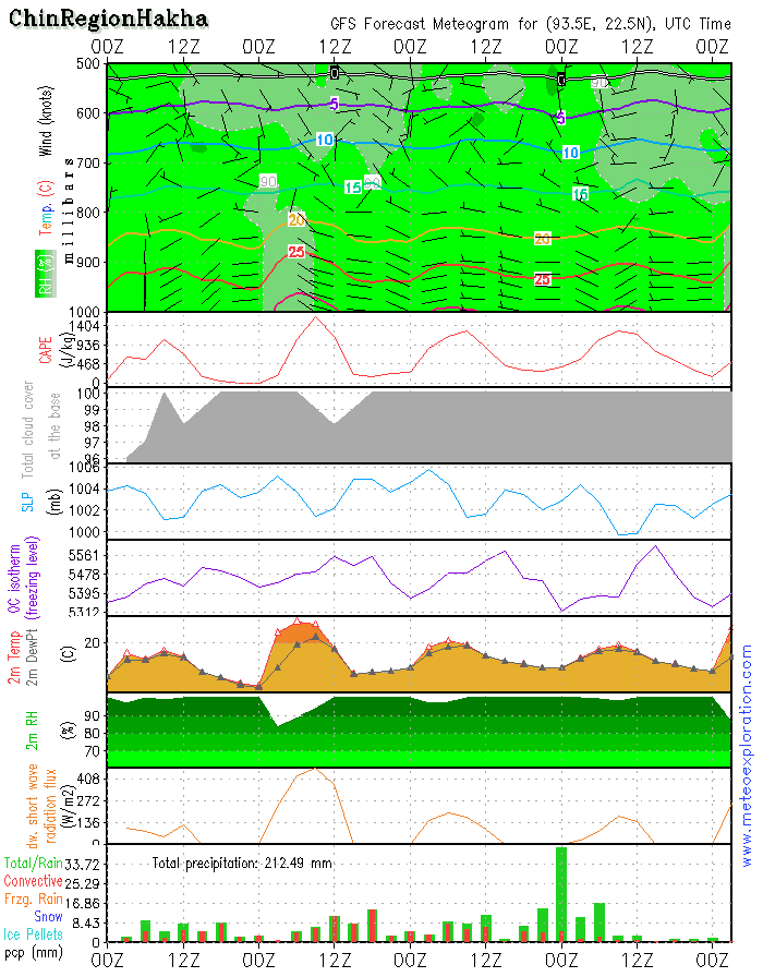
*Chin Region/Hakha: 22.6/93.6North and Northeast Myanmar
-weather:
after the morning fog a few very weak sunny spells may develop but soon, due to the daily heating, significant cloud cover forms which leads to rain and showers-possibly with a local thunderstorm. Poor visibility will prevail for the remainder of the day.
-precipitation: total precipitation: 40-60mm!!!
-wind at surface: weak 2-4kt from variable directions
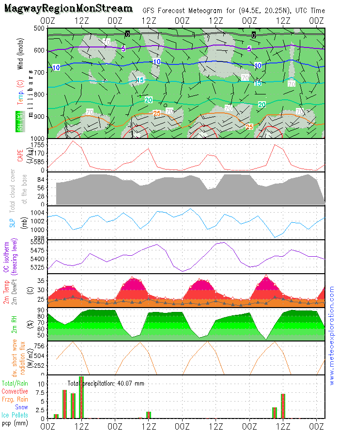
*Magway Region/Mon Stream: 20.2/94.4
-weather:
after the dissipation of the morning fog, nice sunny spells should develop-some scattered clouds around 2500ft. After 12utc the surface relative humidity increases and this results in a risk for fog patches.
-precipitation: around 12utc a few rather slight showery outbreaks: 2-4mm
-wind at surface: SW 6-10kt temporarily decreasing to SW 2-4kt. After 18utc again decreasing
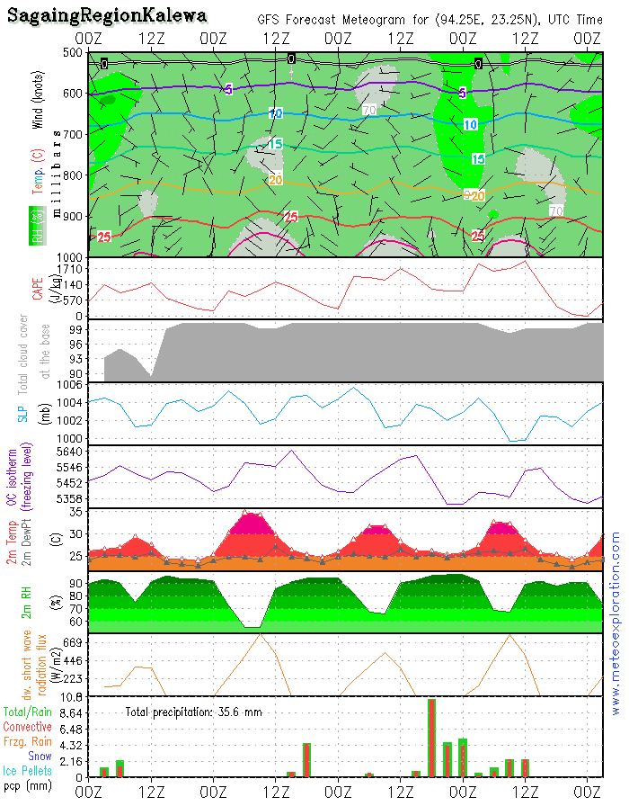
*Sagaing Region: Kalewa: 23.2/94.3
-weather:
a mix of sun and cloud but due to the daily heating more clouds form and this result into showery outbreaks after 12utc
-precipitation: during any shower 4-8mm of rain can fall
-wind at surface: weak to calm from variable directions
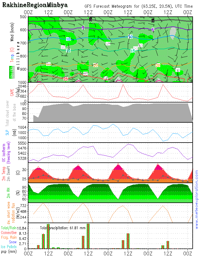
*Rakhine Region: Minbya: 20.4/93.3
-weather:
very cloudy with embedded Cumulonimbus that can result in some heavy showers, possibly with thundery outbreaks. In a short time a lot of rain can fall!!! Timing of showers: between 9 and 14utc
-precipitation: during showery outbreaks up to 20mm can fall
-wind at surface: is weak from variable directions –but during thunderstorm heavy gusts can suddenly pop up!
*Ayeyarwaddy: Maubin: 16.7/95.6
-weather:
possibly a few sunny spells to start the day but soon convective clouds develop: resulting in some heavy showers, possibly with thunderstorm. The showers are timed to develop between 6 and 14utc. During those thunderstorm, heavy precipitation may happen-also dangerous gusts
-precipitation during the showers up to 20mm can fall in a short time
-wind at surface: S 4-6kt after 9utc becoming W10-15kt. Watch out for dangerous gusts during thunderstorms
-weather: very cloudy with 4-6/8 St around 1000-1500ft and above 5-7/8 Sc around 6-7000ft – remaining mainly dry/most precipitation falls along the coasts
-precipitation: between 0-2mm
-wind at surface: W 15-20kt decreasing after 12utc WSW 10-15kt
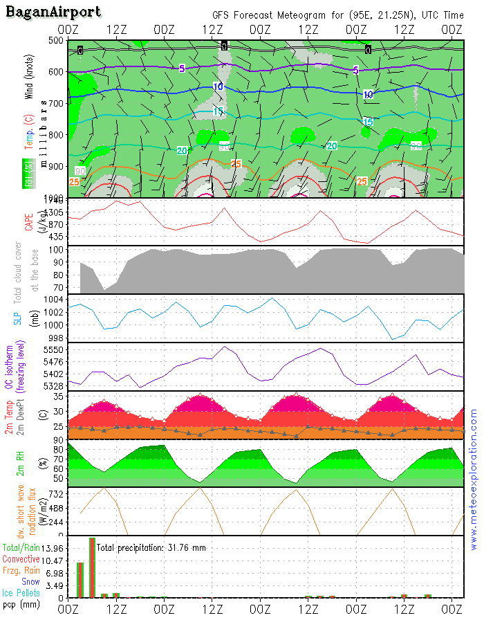
*Bagan: 21.2/94.9 (Airport) - Airfield forecast
-Weather:
a mix of sunny spells and clouds-no significant precipitation, rain or showers, indicated
-Clouds: 4-6/8 Scaround 3000ft - sunny spells in between. No risk for fog
-Visibility: good.
-Precipitation: no significant precipitation
-wind at surface: SSE to S 6-10kt temporarily decreasing to S 2-4kt
-wind at 1000ft: S6-10kt becoming S 4-6kt
-wind at 3000ft: SSE to SSW 4-6kt
-wind at 5000ft: SE to SSE 2-4kt
-Turbulence: nil to light
-Outlook for Friday 8 August: a similar day as the 7th: rather good conditions prevail: no precip and good visibility
As the low pressure system over Northern India has become significantly weaker, the advection of warm, moist air towards Myanmar, has weakened and at most places stopped.
This means that at a lot of place the airmass has become drier, hence less clouds form and as a result the amount of
precipitation has become significantly less than last weeks.
On the Satellite image one can still see a lot of clouds that are being advected from the Bay of Bengal towards the Southwestern and Southern parts of Myanmar: Southern Ayeyarwady and Mon. Up in the North we can see a lot of
cloud free area but also cells of convective clouds which can result in showers.
On the Surface pressure map you can see the tropical cyclone that is going to hit Taiwan Tonight and tomorrow.
Warnings
-At the Maubinarea: risk for heavy thunderstorm with heavy precipitation and gusts
-At the Minbya area: risk for heavy thunderstorm with heavy precipitation and gusts
-At the Hakha area: heavy rainfall for the most of the day
As the low pressure system over Northern India has become significantly weaker, the advection of warm, moist air towards Myanmar, has weakened and at most places stopped.
This means that at a lot of place the airmass has become drier, hence less clouds form and as a result the amount of precipitation has become significantly less than last weeks.
On the Satellite image one can still see a lot of clouds that are being advected from the Bay of Bengal towards the
Southwestern and Southern parts of Myanmar: Southern Ayeyarwady and Mon. Up in the North we can see a lot of cloud free area but also cells of convective clouds which can result in showers.
On the Surface pressure map you can see the tropical cyclone that is going to hit Taiwan Tonight and tomorrow.
Warnings
-At the Maubinarea: risk for heavy thunderstorm with heavy precipitation and gusts
-At the Minbya area: risk for heavy thunderstorm with heavy precipitation and gusts
-At the Hakha area: heavy rainfall for the most of the day
As the low pressure system over Northern India has become significantly weaker, the advection of warm, moist air towards Myanmar, has weakened and at most places stopped.
This means that at a lot of place the airmass has become drier, hence less clouds form and as a result the amount of precipitation has become significantly less than last weeks.
On the Satellite image one can still see a lot of clouds that are being advected from the Bay of Bengal towards the Southwestern and Southern parts of Myanmar: Southern Ayeyarwady and Mon. Up in the North we can see a lot of cloud free area but also cells of convective clouds which can result in showers.
On the Surface pressure map you can see the tropical cyclone that is going to hit Taiwan Tonight and tomorrow.
Warnings
-At the Maubinarea: risk for heavy thunderstorm with heavy precipitation and gusts
-At the Minbya area: risk for heavy thunderstorm with heavy precipitation and gusts
-At the Hakha area: heavy rainfall for the most of the day

No. (11) A , Khapaung Street , Hlaing Township ,
Yangon , Myanmar .

95 - 1 - 538549 , 504418

administrator@apexpetro.com

www.apexpetro.com