Meteorologist: Marc de Keyser
Contact: marc.achiel@gmail.com or mobile +32 473 72 76 41
Date of production: 17 August 2015
Forecast valid for the 17th of August - based on the 16/00utc run
Meteogram | Precipitation | Accumulated Precipitation | Pressure | Relative Humidity | Surface Wind | Temperature | 80m AGL Wind | Satellite Image | Cloud Cover
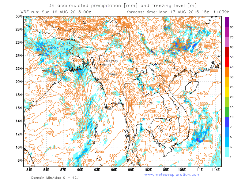
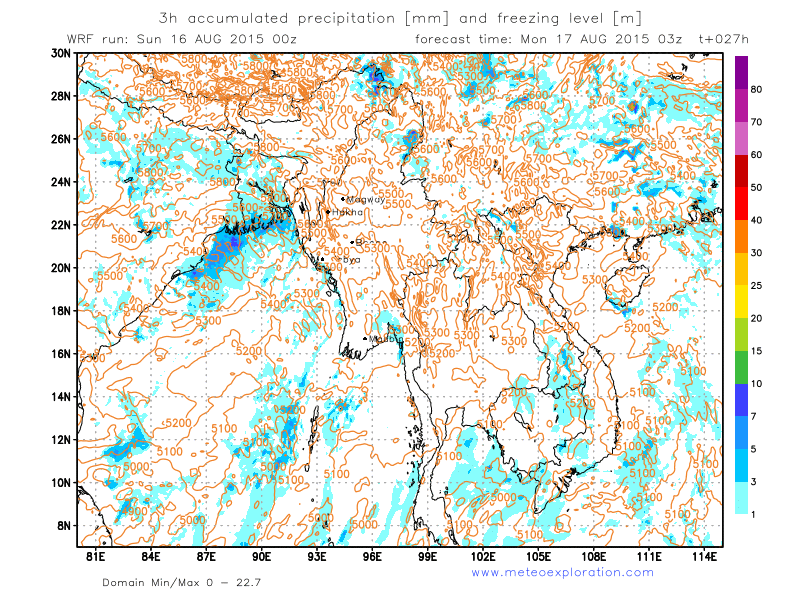
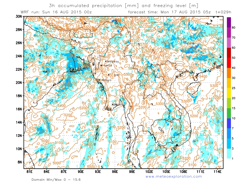
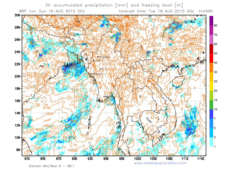
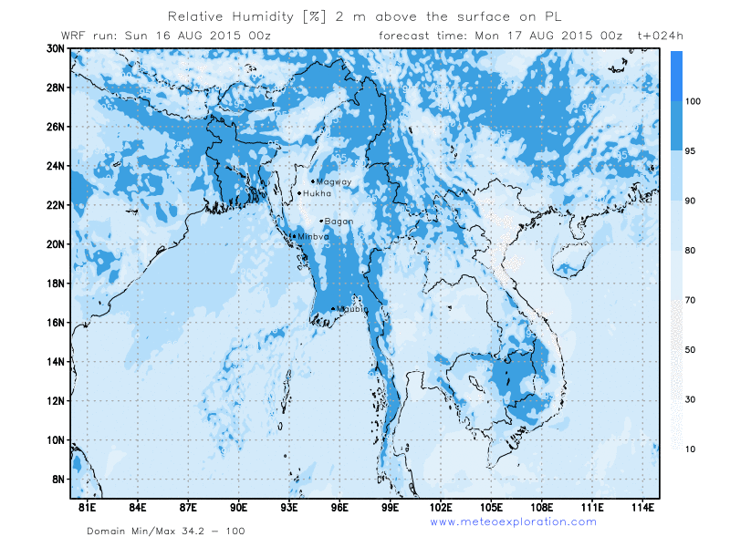
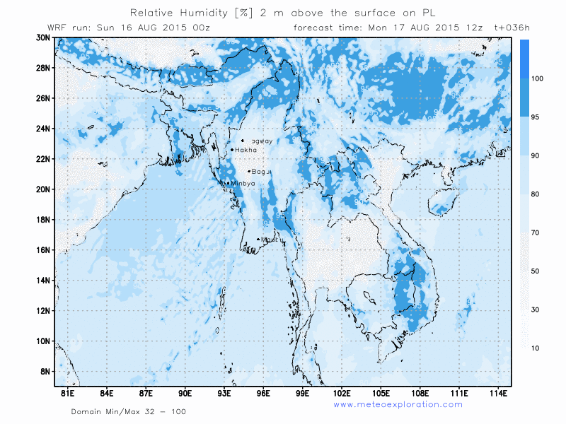
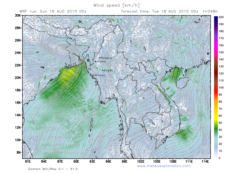
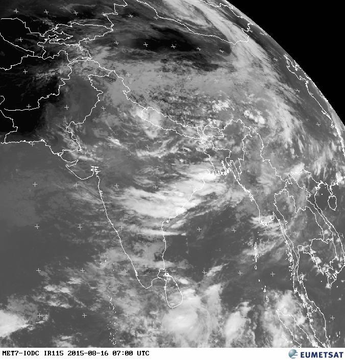
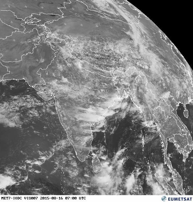
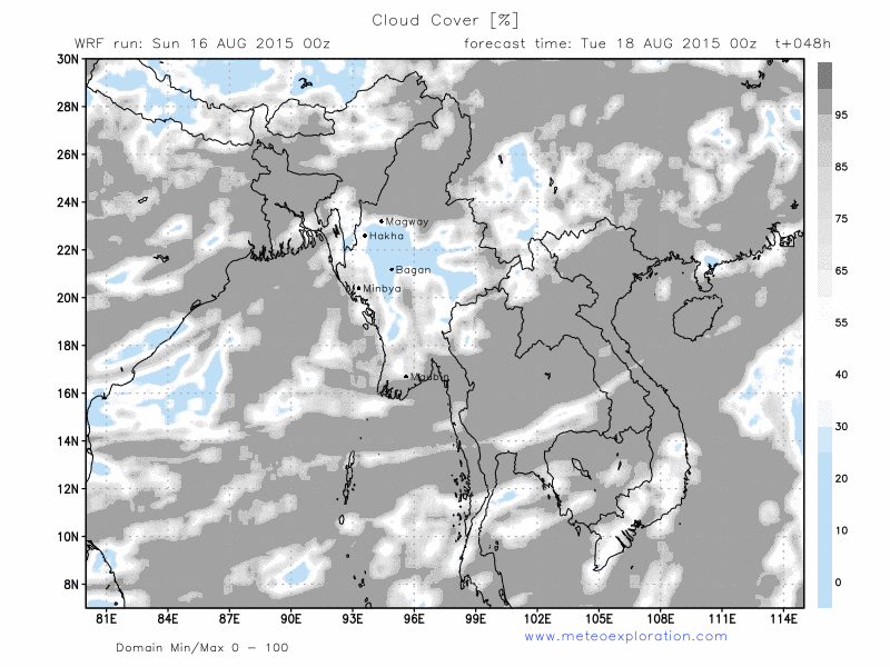
The Low pressure belt over Northern India hes extented towards the Bay of bengal and the Northern and Western provinces of Myanmar. This results in an increase of the instability over those regions, resulting in an increase of showery/thundery outbreaks.
Especially over the Northern Provinces of Saigang and Kachin we have to take in account a lot of developing convective cells, resulting in showery and thundery outbreaks.
Between 00 and 03utc a squall line moves from the Bay of Bengal into the Provinces of Rakhaing and Ayeyarwady, which generates some heavy showers and thunderstorms during the early day, but after 3/6utc the conditions should remain pretty dry.
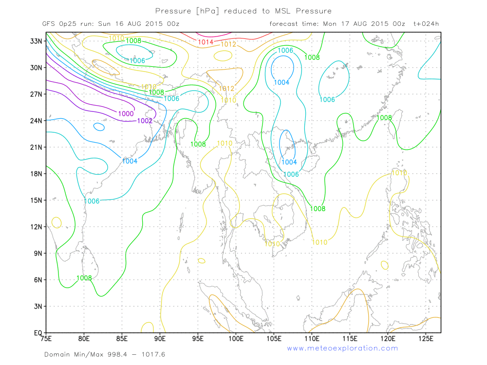
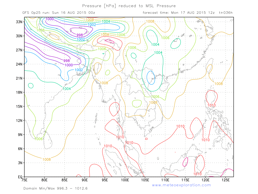
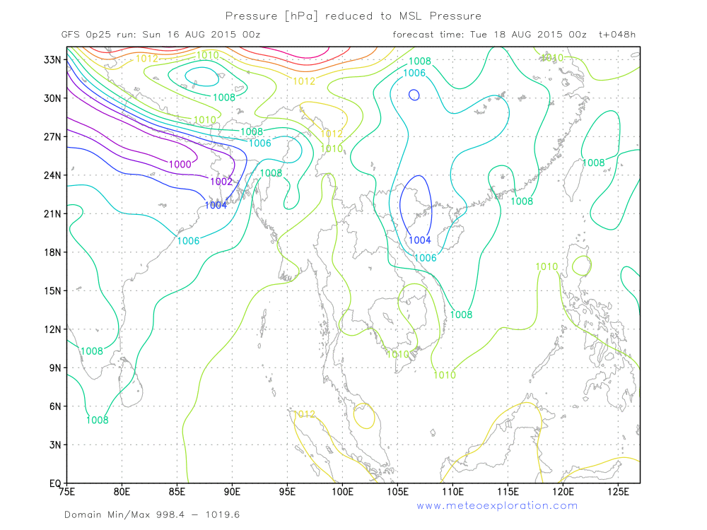
Also over the province of Shan over the East of Myanmar the instability is deep enough to trigger showers and thundertorms. During the following days no big changes happen: the advection of a deep unstable air mass with the development of frequent convective cells and thunderstorms. At first sight it looks loke especially the Northtern and Easern Provinces will be hit the most. Also the province of Ayeyarwady looks like to get some serious precipitation.Two low pressure systems dominate today’s weather maps: the first one is the quasi permanent belt of low pressure over Northern India and the second one can be found East of Myanmar with the center over Northern Vietnam. In between those two pressure system a weak ridge of high pressure extends over Central and Eastern Myanmar. This feature has a favorable infulence on the general weather conditions in the interior of Myanmar.
A trough of low pressure extends over the NE of Myanmar which generates unstable conditions over the districts of Sagaing and Kachin. This feature advects moist and warm air from the Bay of Bengal into those districts, leading to the formation of convective cells, with showery and thundery outbreaks.
Distribution of rain, showers and thunderstorms:
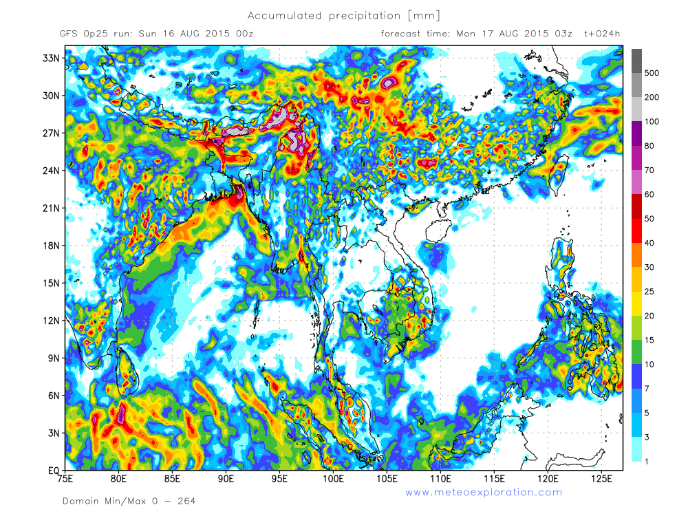
- between 00-06utc:
During the first part of the day rain an showers develop over the on shore regions of Ayeyarwaddyn Yangon, Bago
and Northern Mon. A second area of significant precipitation is the coast of Rakhaing. Also over the extreme East of
the district of Shan and the North of Sagaing and Kachin. The most of the interior of Myanmar remains dry.
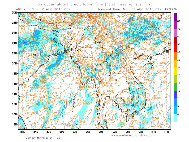
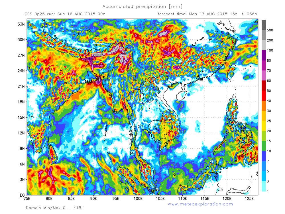
- between 06-12utc:
In this period most coatal precipitation disappears whilst also over the East and the North of Myanmar the precipitation decreas and becomes local.
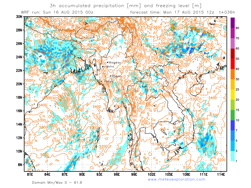
- between 12-18utc:
The district of Shan becomes completely dry, also over the extreme eastern parts of this district. But on the other hand we see that the coastal rains develop again, along the coast of Rakhaing, as well as over the coasts of Ayeyarwaddy, Yangon, Bago and Mon. Over the North of Kachin there are still quite heavy showery outbreaks.
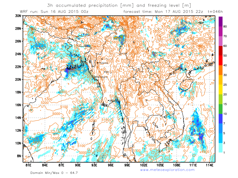
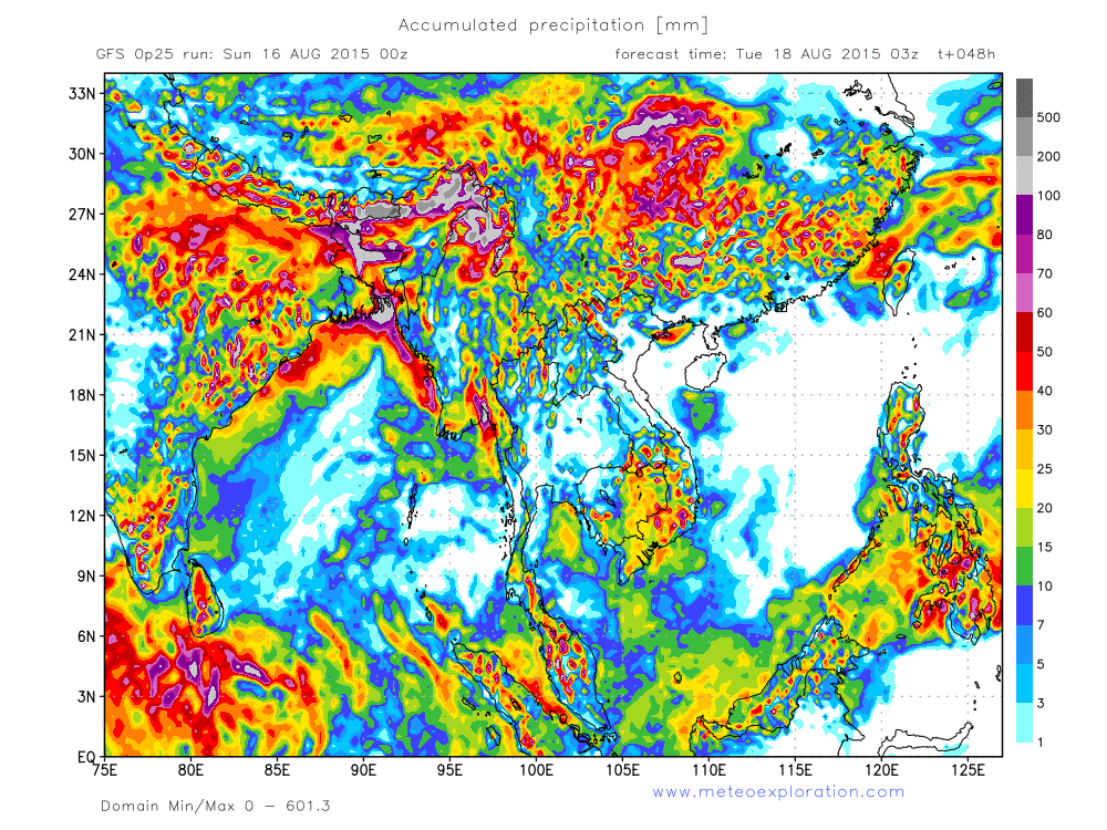
- between 18-24utc:
No significant change: rain over all coastal areas and some active cells over the district of Kachin.
Warnings
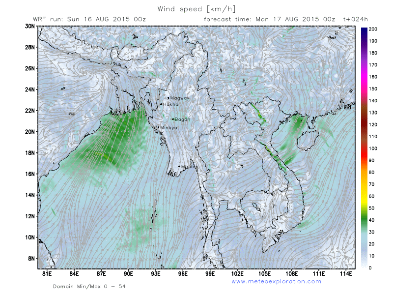
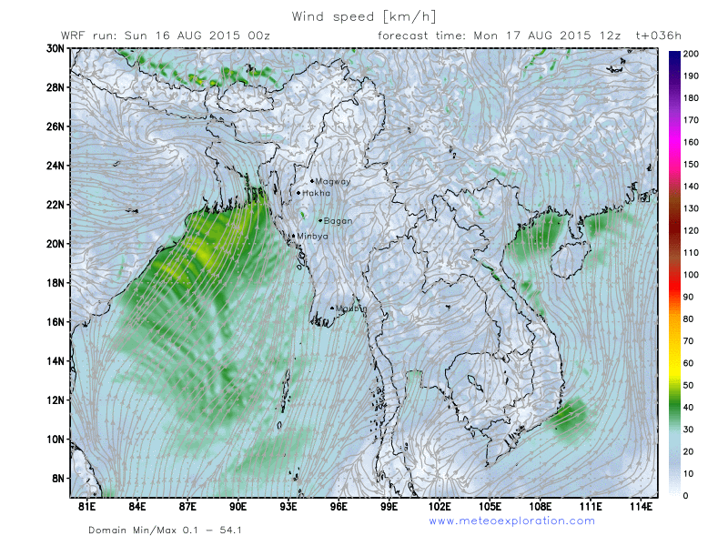
- Heavy precipitation/thunderstorms over the district of Kachin
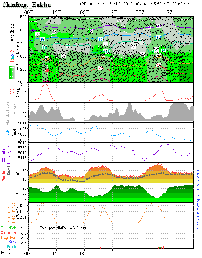
- Very windy at Hakha, in the morning gusting up to 25-30kt, after 18utc up to 35kt!!
- Sudden gusts up to 30kt at Magway – and moderate to severe near surface turbulence
- Very windy at Bagan: average up to 25-30kt gusting up to 40kt + moderate to severe near surface turbulence
Forecast for different areas
Province of Chin (Hakha: 22.6/93.6)
-Weather:
Mix of sunny spells and cloudy periods with only a little precipitation. After 12utc becoming overcas with low clouds.
-Precipitation: less than 1-2mm.
-Wind at surface: SW 20kt gusting 25-30kt decreasing to 10-15kt. After 18utc increasing again up to 25kt gusting up to 35kt!
-Outlook tomorrow (18 Aug 2015):
Fog patches in the early day but soon sunny with gradually formation of little convective clouds with e few slight local showers.
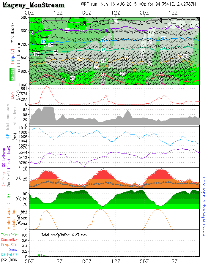
Province of Magway (Mon Stream: 20.2/94.4)
- Weather: After the dissipation of the morning fog and mist becoming a mix of sun and clouds – remaining dry!
- Precipitation: no significant precipitation
- Wind at surface: weak when the day starts but soon increasing to become: SW 10-15kt. After 12utc again becoming weak from SW. Gusts up to 30kt are likely! Near surface turbulence is expected to be moderate to severe
- Outlook tomorrow (18Aug 2015): No big changes: misty start, than mix sun and clouds-dry.
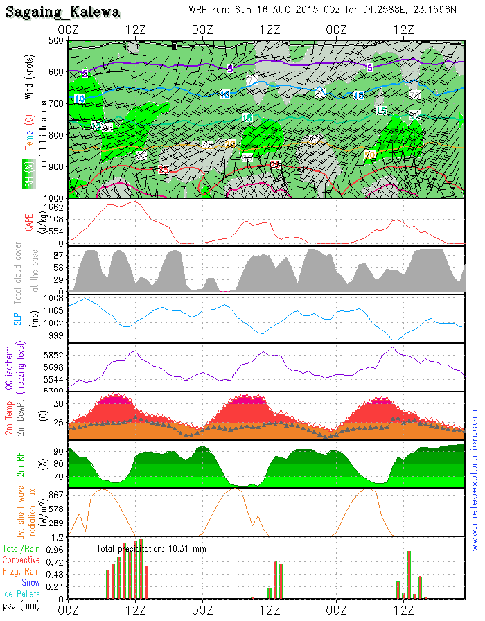
Province Sagaing (Kalewa: 23.2/94.3)
-Weather: Isolated fog patches will soon dissipate and than sunny spells develop. Gradually convective clouds graow, resulting into afew isolated showery outbreaks around 12utc
-Precipitation: in total between 2 and 4mm
-Wind at surface: SE 5-10kt, becoming weak from variable directions
-Outlook tomorrow (18Aug 2015):
Again more clouds and after 10utc more rain/showers but still no big amounts
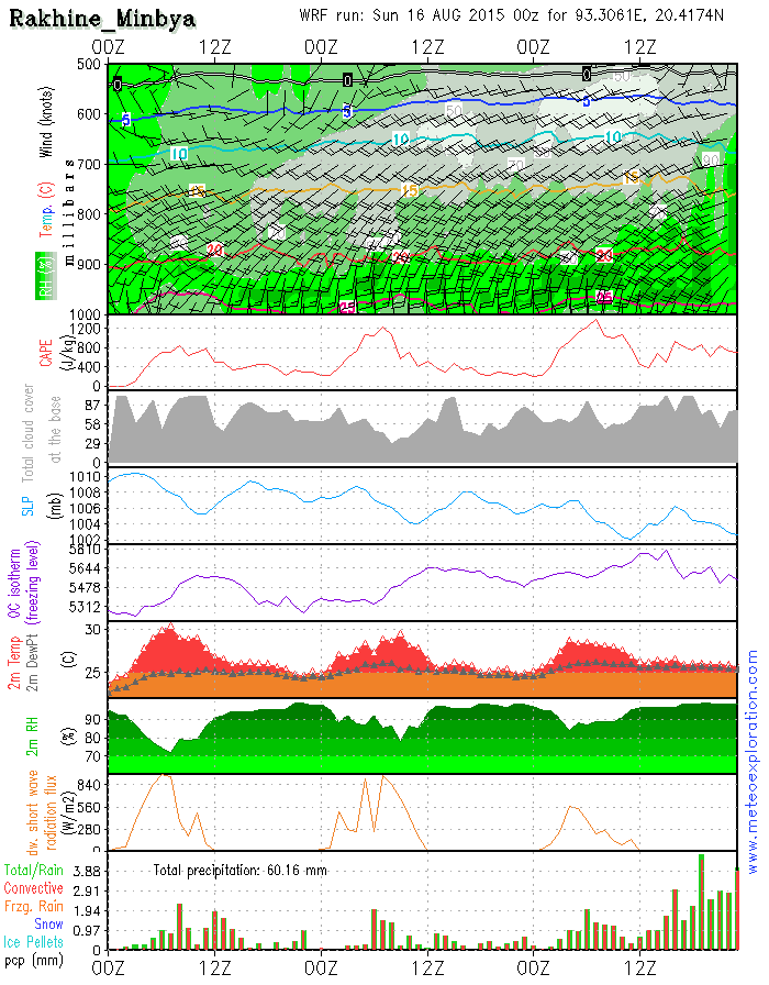
Province of Rakhine (Minbya: 20.4/93.3)
-Weather: Remaining very cloudy to overcast with outbreaks of rain or rain showers; mainly similar conditions throughout the day.
-Precipitation: a total of 12-18mm
-Wind at surface: SSE-SSW 5-10kt after 10utc increasing to 10-15kt
-Outlook tomorrow (18 Aug2015): pretty much the same as previous day, slightly worse: more rain up to 20-30mm.
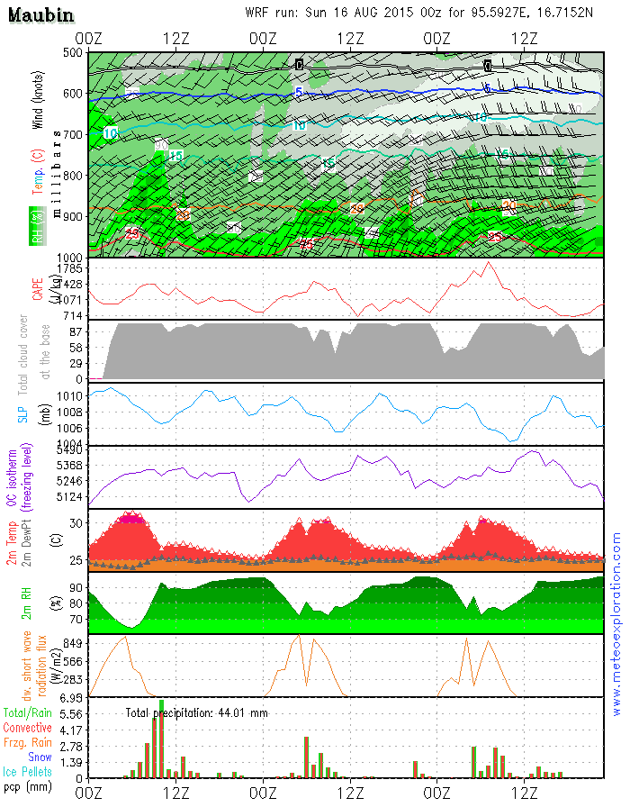
Province of Ayeyarwaddy(Maubin: 16.7/95.6)
-Weather: Misty/foggy start of the day but than remaining very cloudy with especially before 12utc a lot of rain/rain showers.
After 12utc becoming dry.
-Precipitation: 10-15mm
-Wind at surface: SW 10-15kt gusting 20-25kt after 9/10utc increasing to 15-20kt gusting 25-30kt
-Outlook tomorrow (18 Aug 2015): Unsettled with still a lot of cloudiness and outbreaks of rain. Gusty wind.
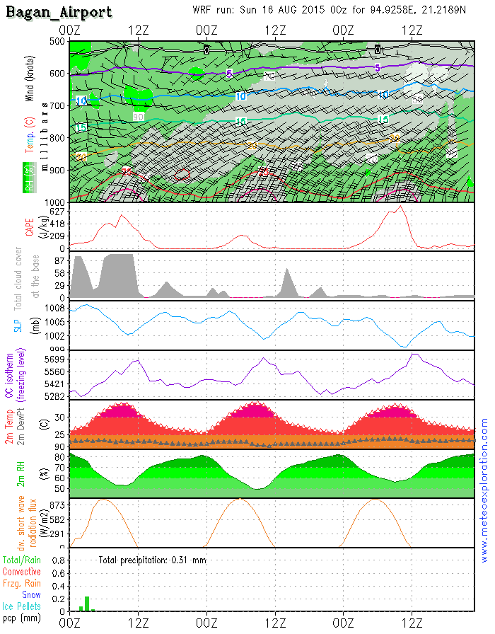
Bagan: 21.2/94.9 (Airport) - Airfield forecast
-Weather: Again a pretty good but very windy day with quite a lot of sunshine and no rain nor any rain showers.
-Clouds: 2-4/8 St around 1-1500ft cloudbase rises up to 2500ft.
-Visibility: good.
-Precipitation: 0 mm
-Wind at surface: mainly SSW 25-30kt gusting 35-40kt – temporarily decreasing 15-20kt
-Wind at 1000ft: SW 30-35kt
-Wind at 3000ft: WSW 30kt
-Wind at 5000ft: WSW 15-20kt
-Turbulence: mod to severe around 1-3000ft
-Outlook for 18 August:
Slightly less wind but still around SW 20kt/sunny spells and no rain
The Low pressure belt over Northern India hes extented towards the Bay of bengal and the Northern and Western provinces of Myanmar. This results in an increase of the instability over those regions, resulting in an increase of showery/thundery outbreaks.
Especially over the Northern Provinces of Saigang and Kachin we have to take in account a lot of developing convective cells, resulting in showery and thundery outbreaks.
Between 00 and 03utc a squall line moves from the Bay of Bengal into the Provinces of Rakhaing and Ayeyarwady, which generates some heavy showers and thunderstorms during the early day, but after 3/6utc the conditions should remain pretty dry.
Also over the province of Shan over the East of Myanmar the instability is deep enough to trigger showers and thundertorms. During the following days no big changes happen: the advection of a deep unstable air mass with the development of frequent convective cells and thunderstorms. At first sight it looks loke especially the Northtern and Easern Provinces will be hit the most. Also the province of Ayeyarwady looks like to get some serious precipitation.Two low pressure systems dominate today’s weather maps: the first one is the quasi permanent belt of low pressure over Northern India and the second one can be found East of Myanmar with the center over Northern Vietnam. In between those two pressure system a weak ridge of high pressure extends over Central and Eastern Myanmar. This feature has a favorable infulence on the general weather conditions in the interior of Myanmar.
A trough of low pressure extends over the NE of Myanmar which generates unstable conditions over the districts of Sagaing and Kachin. This feature advects moist and warm air from the Bay of Bengal into those districts, leading to the formation of convective cells, with showery and thundery outbreaks.
Distribution of rain, showers and thunderstorms:
- between 00-06utc:
During the first part of the day rain an showers develop over the on shore regions of Ayeyarwaddyn Yangon, Bago
and Northern Mon. A second area of significant precipitation is the coast of Rakhaing. Also over the extreme East of
the district of Shan and the North of Sagaing and Kachin. The most of the interior of Myanmar remains dry.
- between 06-12utc:
In this period most coatal precipitation disappears whilst also over the East and the North of Myanmar the precipitation decreas and becomes local.
- between 12-18utc:
The district of Shan becomes completely dry, also over the extreme eastern parts of this district. But on the other hand we see that the coastal rains develop again, along the coast of Rakhaing, as well as over the coasts of Ayeyarwaddy, Yangon, Bago and Mon. Over the North of Kachin there are still quite heavy showery outbreaks.
- between 18-24utc:
No significant change: rain over all coastal areas and some active cells over the district of Kachin.
Warnings
- Heavy precipitation/thunderstorms over the district of Kachin
- Very windy at Hakha, in the morning gusting up to 25-30kt, after 18utc up to 35kt!!
- Sudden gusts up to 30kt at Magway – and moderate to severe near surface turbulence
- Very windy at Bagan: average up to 25-30kt gusting up to 40kt + moderate to severe near surface turbulence

No. (11) A , Khapaung Street , Hlaing Township ,
Yangon , Myanmar .

95 - 1 - 538549 , 504418

administrator@apexpetro.com

www.apexpetro.com