Meteorologist: Marc de Keyser
Contact: marc.achiel@gmail.com or mobile +32 473 72 76 41
Date of production: 11 August 2015
Forecast valid for the 12th of August - based on the 11/00utc run
Meteogram | Precipitation | Accumulated Precipitation | Pressure | Relative Humidity | Surface Wind | Temperature | 80m AGL Wind | Satellite Image | Cloud Cover
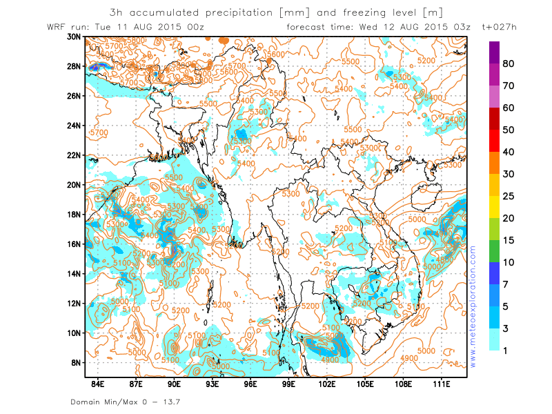
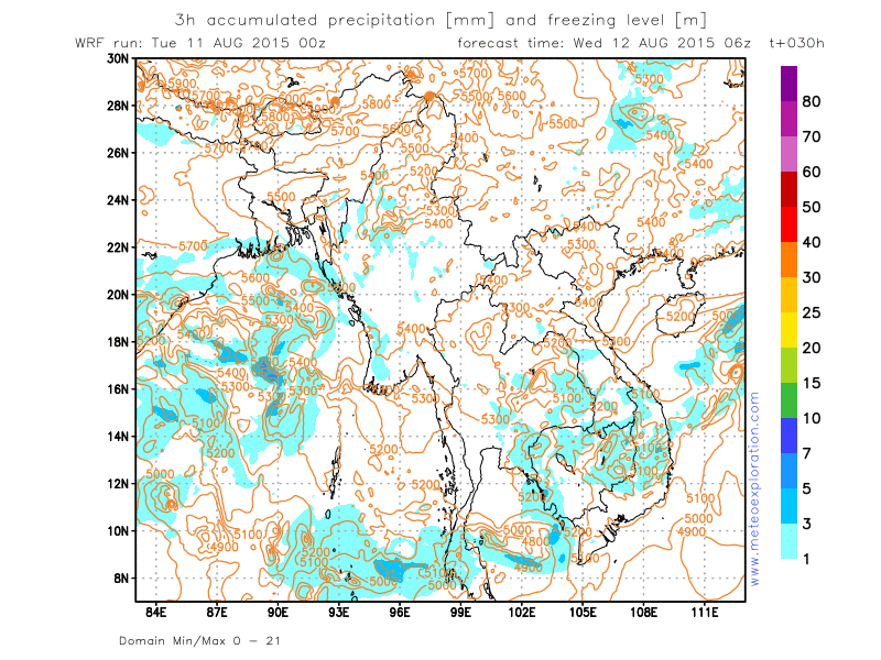
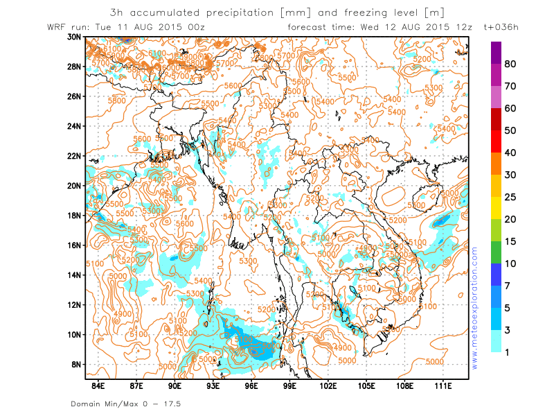
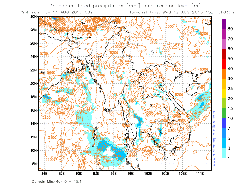
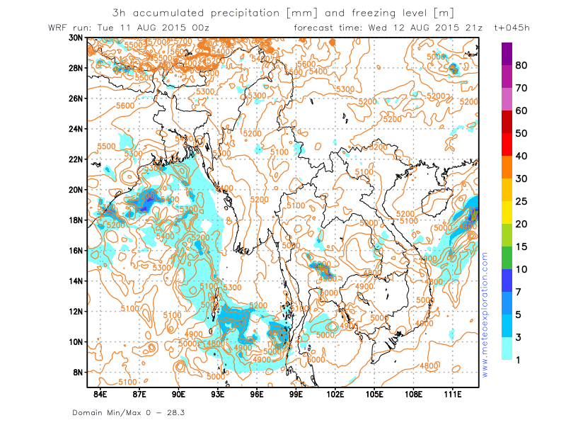
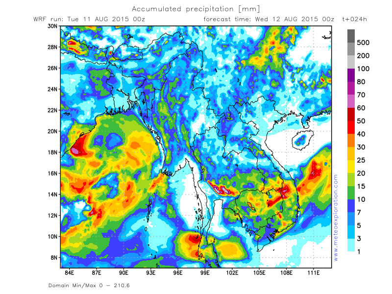
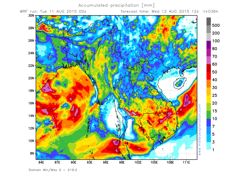
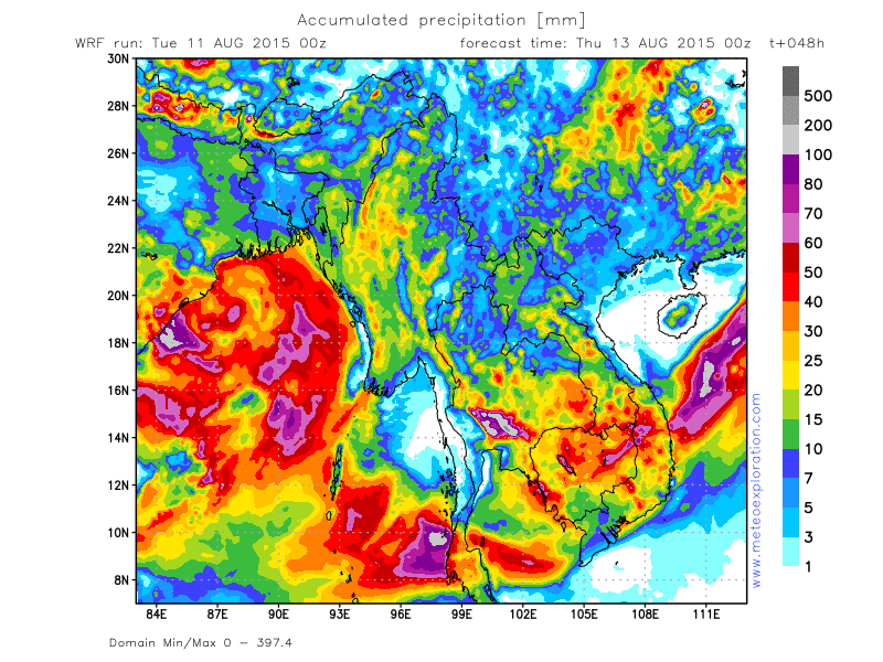
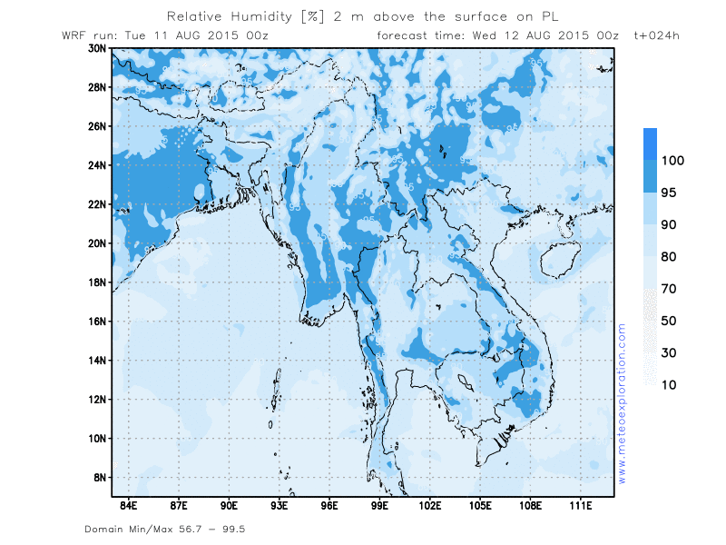
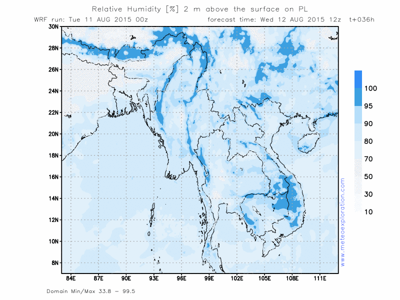
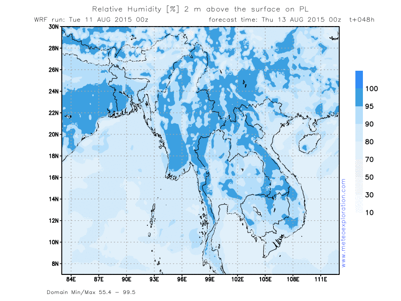
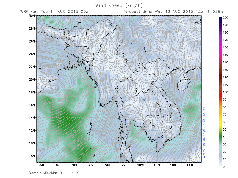
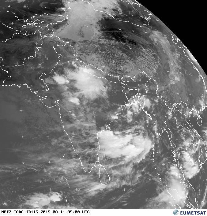
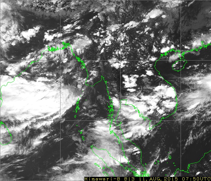
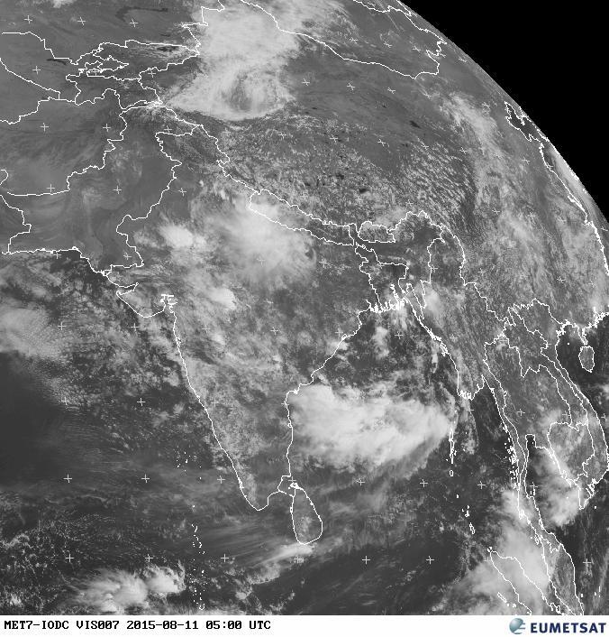
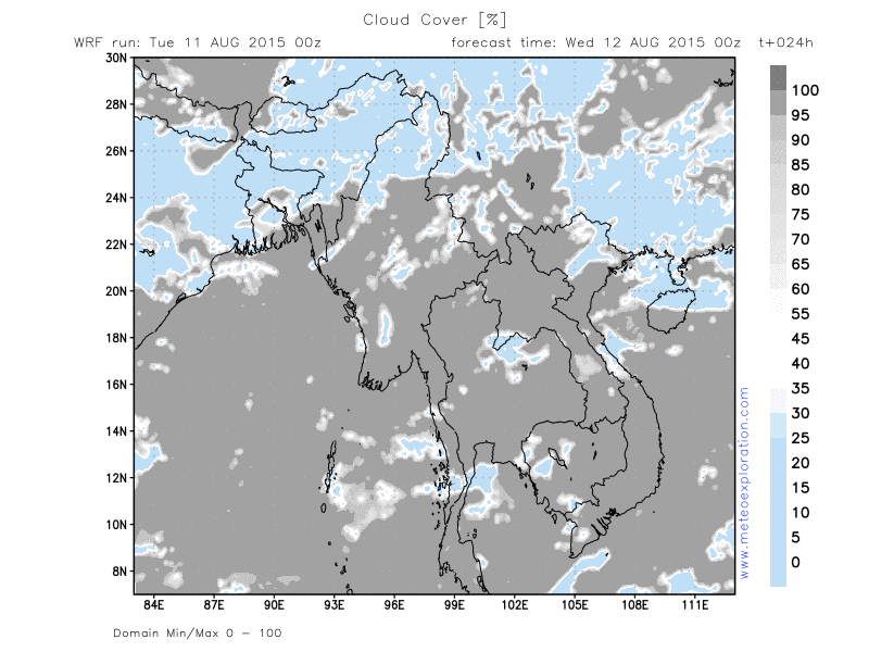
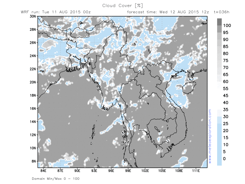
The Low pressure belt over Northern India hes extented towards the Bay of bengal and the Northern and Western provinces of Myanmar. This results in an increase of the instability over those regions, resulting in an increase of showery/thundery outbreaks.
Especially over the Northern Provinces of Saigang and Kachin we have to take in account a lot of developing convective cells, resulting in showery and thundery outbreaks.
Between 00 and 03utc a squall line moves from the Bay of Bengal into the Provinces of Rakhaing and Ayeyarwady, which generates some heavy showers and thunderstorms during the early day, but after 3/6utc the conditions should remain pretty dry.
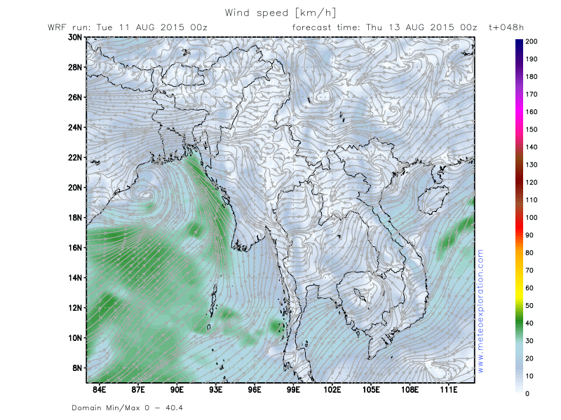
Also over the province of Shan over the East of Myanmar the instability is deep enough to trigger showers and thundertorms. During the following days no big changes happen: the advection of a deep unstable air mass with the development of frequent convective cells and thunderstorms. At first sight it looks loke especially the Northtern and Easern Provinces will be hit the most. Also the province of Ayeyarwady looks like to get some serious precipitation.
Warnings
-Moderate to severe turbulence in the vicinity of thunderstorms
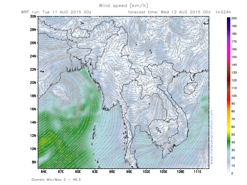
-Strong winds over the districts of Rakhine and Ayeyarwaddy
Forecast for different areas
Province of Chin (Hakha: 22.6/93.6)
-Weather: Mist and fog are very likely but after 00utc quickly dissipating. The rest of the day it is mainly very cloudy to temporarily overcast with outbreaks of showers and thunderstorms. After 12utc the showers decrease and turn into rain.
-Precipitation: a total of about 30-50mm
-Wind at surface: weak (2-4kt) from variable to Westerly directions-no significant change
-Outlook tomorrow (13 Aug 2015):
Pretty similar as the previous day: foggy and very cloudy with showers, thunderstorms and sometimes periods of condinuous rain

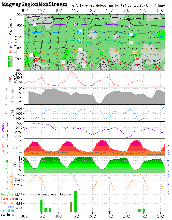
Province of Magway (Mon Stream: 20.2/94.4)
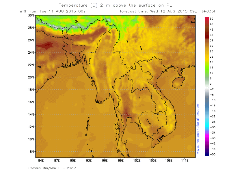
-Weather: Sunny spells but due to daily heating convective cells will form, resulting in a few heavy outbreaks of rain and thunderstorm. In a short spell of time a significant amount of precip can fall.
-Precipitation: during a shower/thunderstorm 15-20mm can fall.
-Wind at surface: 3-6kt from SE to SW – no significant change
-Outlook tomorrow (13 Aug 2015): The conditions remain pretty much the same as the previous day: an unstable air mass with convective cells that can trigger locally a lot of precip.
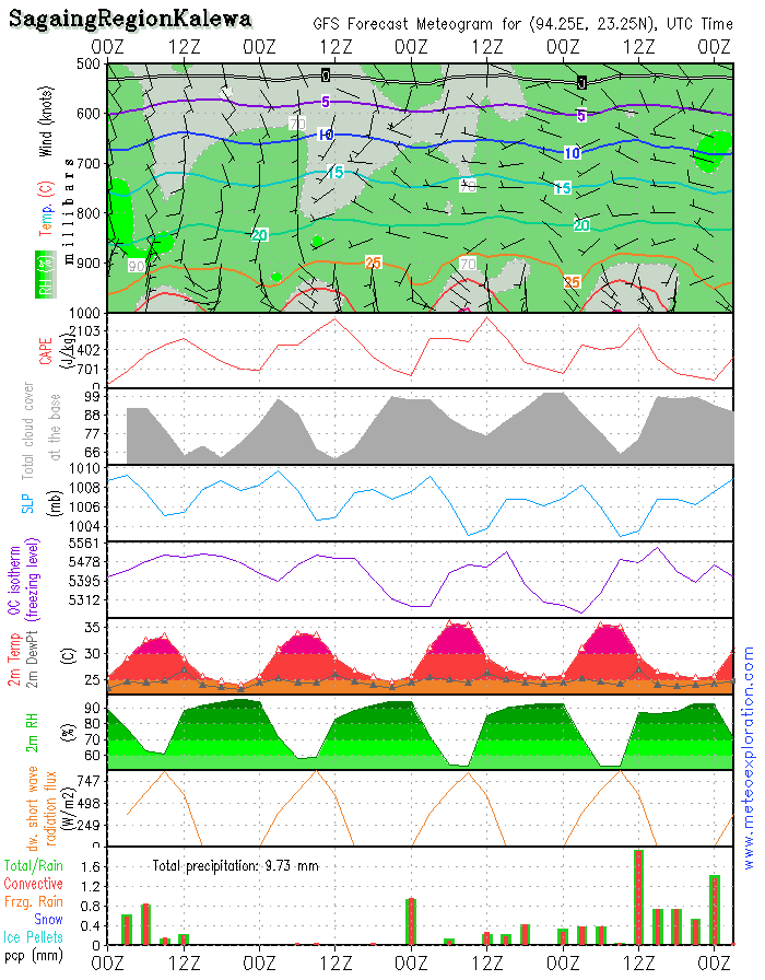
Province Sagaing (Kalewa: 23.2/94.3)
-Weather: Sunny spells and cloudy periods-isolated showery or thundery outbreaks can not be ruled out completely. In between the showers some nice sunny spells will develop.
-Precipitation: the model indicates less than1mm but during a shower/thunderstorm 10-15mm may fall
-Wind at surface: weak to calm from variable directions
-Outlook tomorrow (13 Aug 2015):
Showers and thunderstorms with in between sunny spells.
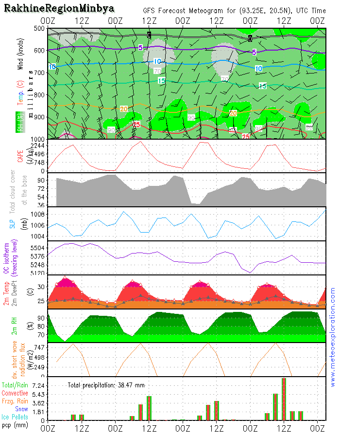
Province of Rakhine (Minbya: 20.4/93.3)
-Weather: Mix of sunny spells and cloudy periods with after 00utc outbreaks of rain and showers, decreasing after 6/9utc
-Precipitation: 10-15mm
-Wind at surface: SE 15k-20kt but gusting to 30kt – no significant change
-Outlook tomorrow (13 Aug2015): Sunny spells alternating cloudy periods with showers/thunderstorm, decreasing and becoming dry after 12utc
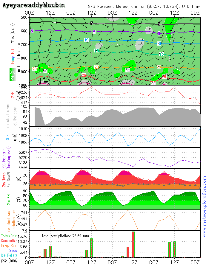
Province of Ayeyarwaddy(Maubin: 16.7/95.6)
-Weather: sunny spells but soon convective clouds for, resulting in heavy showers and thunderstorms, decreasing after 12/15utc
-Precipitation: 20-30mm
-Wind at surface: S 15-20kt gusting 30kt, after 9/12utc decreasing to SSW 10-15kt
-Outlook tomorrow:
Heavy showers and thunderstorms, decreasing after 12utc
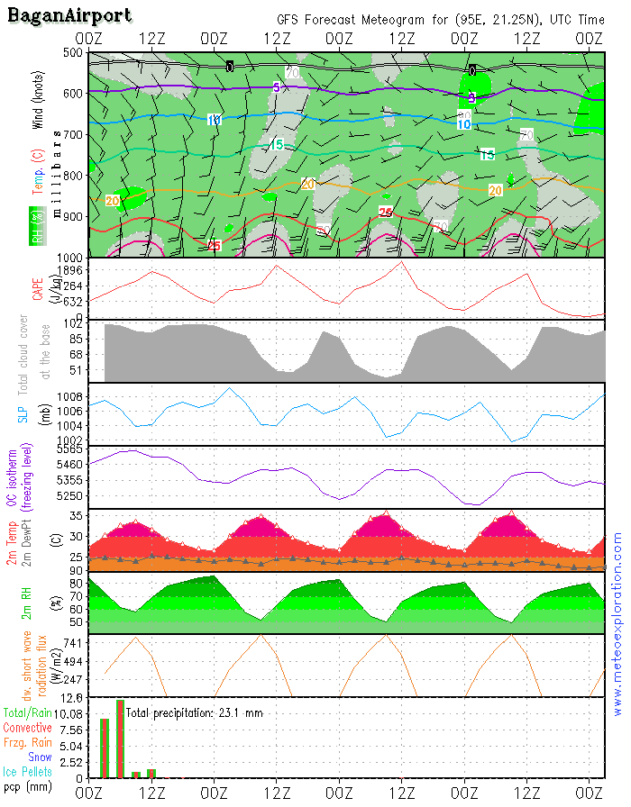
Bagan: 21.2/94.9 (Airport) - Airfield forecast
-Weather: very cloudy start buy gradually enlarging sunny spells and remaining dry. However an isolated shower/thunderstorms are possible but should remain pretty limited
-Clouds: 5-7/8 St around 1500ft gradually becoming 2-4/8 Cu around 2500ft
-Visibility: good but moderate to poor during rain/showers.
-Precipitation: no significant amount of precip indicated
-Wind at surface: varying between SSW and SSE 5-10kt
-Wind at 1000ft: S 5-10kt temporarily increasing to 10-15kt
-Wind at 3000ft: S to SSW 5-10kt tempo 15kt
-Wind at 5000ft: SSE to SSW 10-15kt
-Turbulence: light to mod near the surface
-Outlook for Thursday 13 August:
Similar as today
The Low pressure belt over Northern India hes extented towards the Bay of bengal and the Northern and Western provinces of Myanmar. This results in an increase of the instability over those regions, resulting in an increase of showery/thundery outbreaks.
Especially over the Northern Provinces of Saigang and Kachin we have to take in account a lot of developing convective cells, resulting in showery and thundery outbreaks.
Between 00 and 03utc a squall line moves from the Bay of Bengal into the Provinces of Rakhaing and Ayeyarwady, which generates some heavy showers and thunderstorms during the early day, but after 3/6utc the conditions should remain pretty dry.
Also over the province of Shan over the East of Myanmar the instability is deep enough to trigger showers and thundertorms. During the following days no big changes happen: the advection of a deep unstable air mass with the development of frequent convective cells and thunderstorms. At first sight it looks loke especially the Northtern and Easern Provinces will be hit the most. Also the province of Ayeyarwady looks like to get some serious precipitation.
Warnings
-Moderate to severe turbulence in the vicinity of thunderstorms
-Strong winds over the districts of Rakhine and Ayeyarwaddy
The Low pressure belt over Northern India hes extented towards the Bay of bengal and the Northern and Western provinces of Myanmar. This results in an increase of the instability over those regions, resulting in an increase of showery/thundery outbreaks.
Especially over the Northern Provinces of Saigang and Kachin we have to take in account a lot of developing convective cells, resulting in showery and thundery outbreaks.
Between 00 and 03utc a squall line moves from the Bay of Bengal into the Provinces of Rakhaing and Ayeyarwady, which generates some heavy showers and thunderstorms during the early day, but after 3/6utc the conditions should remain pretty dry.
Also over the province of Shan over the East of Myanmar the instability is deep enough to trigger showers and thundertorms. During the following days no big changes happen: the advection of a deep unstable air mass with the development of frequent convective cells and thunderstorms. At first sight it looks loke especially the Northtern and Easern Provinces will be hit the most. Also the province of Ayeyarwady looks like to get some serious precipitation.
2) Warnings
Warnings
-Moderate to severe turbulence in the vicinity of thunderstorms
-Strong winds over the districts of Rakhine and Ayeyarwaddy
The Low pressure belt over Northern India hes extented towards the Bay of bengal and the Northern and Western provinces of Myanmar. This results in an increase of the instability over those regions, resulting in an increase of showery/thundery outbreaks.
Especially over the Northern Provinces of Saigang and Kachin we have to take in account a lot of developing convective cells, resulting in showery and thundery outbreaks.
Between 00 and 03utc a squall line moves from the Bay of Bengal into the Provinces of Rakhaing and Ayeyarwady, which generates some heavy showers and thunderstorms during the early day, but after 3/6utc the conditions should remain pretty dry.
Also over the province of Shan over the East of Myanmar the instability is deep enough to trigger showers and thundertorms. During the following days no big changes happen: the advection of a deep unstable air mass with the development of frequent convective cells and thunderstorms. At first sight it looks loke especially the Northtern and Easern Provinces will be hit the most. Also the province of Ayeyarwady looks like to get some serious precipitation.
Warnings
-Moderate to severe turbulence in the vicinity of thunderstorms
-Strong winds over the districts of Rakhine and Ayeyarwaddy

No. (11) A , Khapaung Street , Hlaing Township ,
Yangon , Myanmar .

95 - 1 - 538549 , 504418

administrator@apexpetro.com

www.apexpetro.com