Meteorologist: Marc de Keyser
Contact: marc.achiel@gmail.com or mobile +32 473 72 76 41
Date of production: 10 August 2015
Forecast valid for the 11th of August - based on the 10/00utc run
Meteogram | Precipitation | Accumulated Precipitation | Pressure | Relative Humidity | Surface Wind | Temperature | 80m AGL Wind | Satellite Image | Cloud Cover
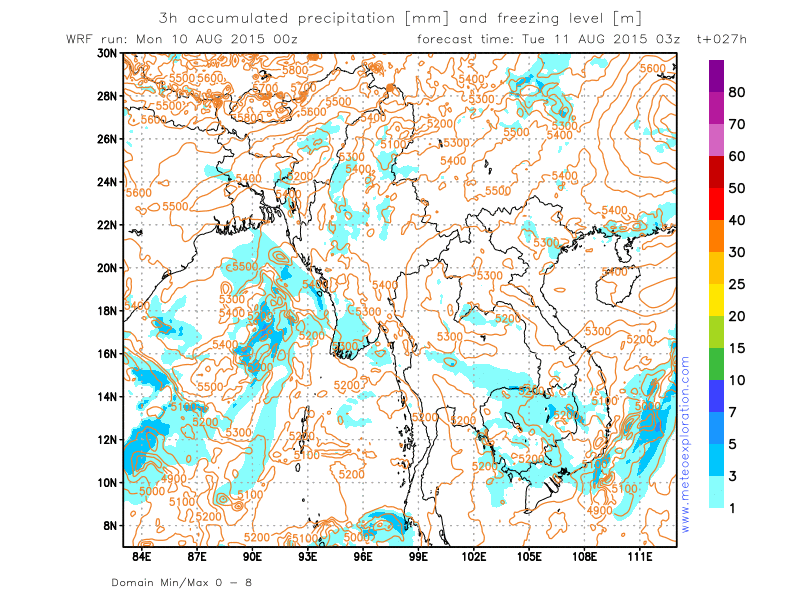
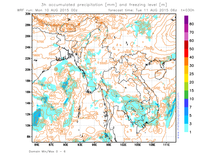
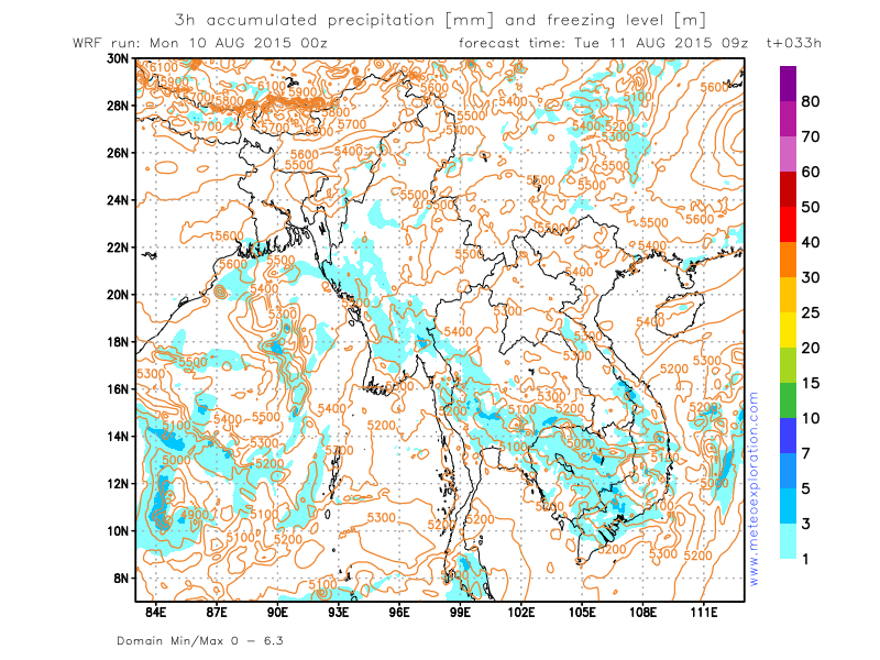
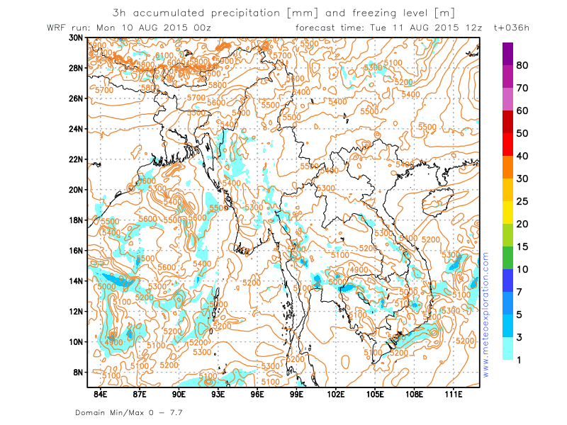
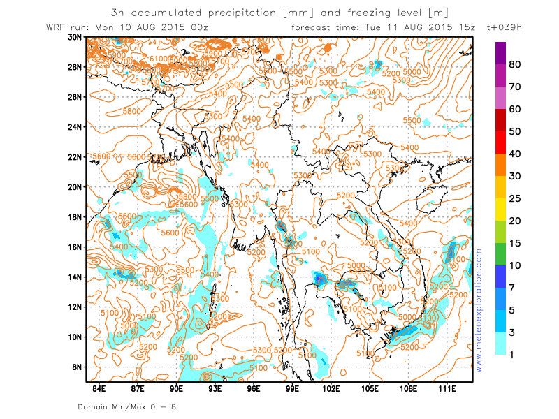
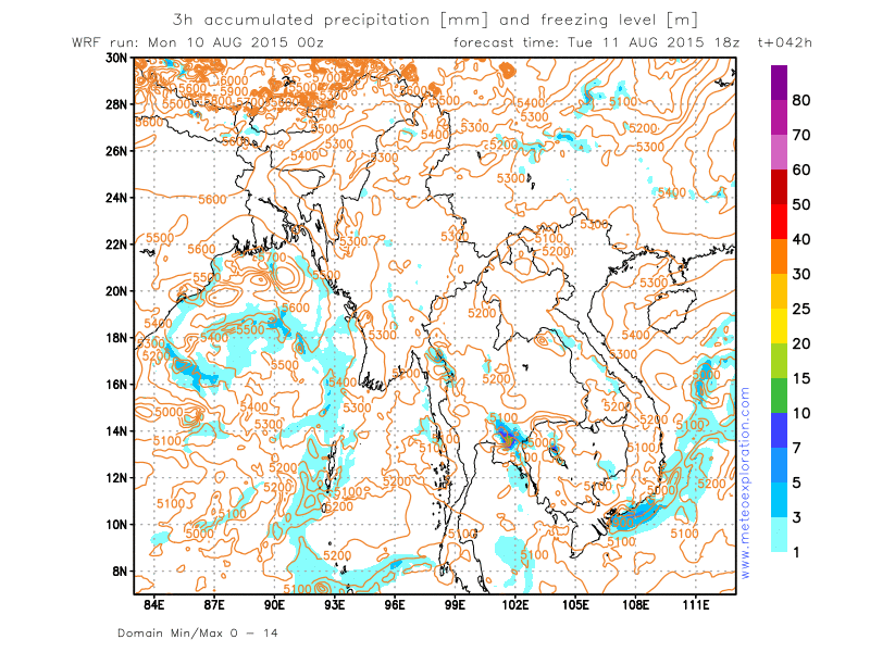
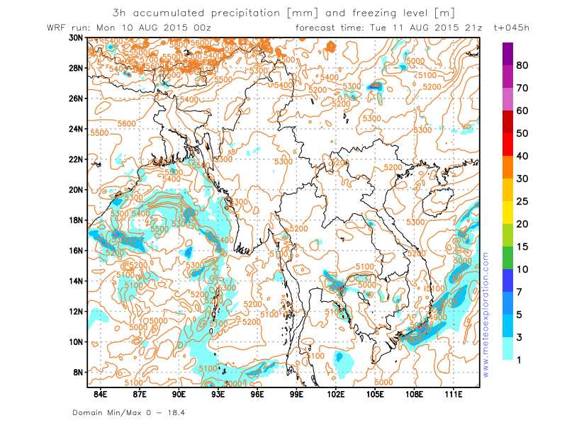
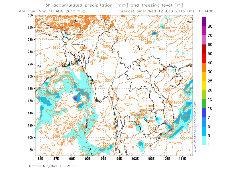
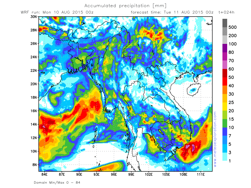
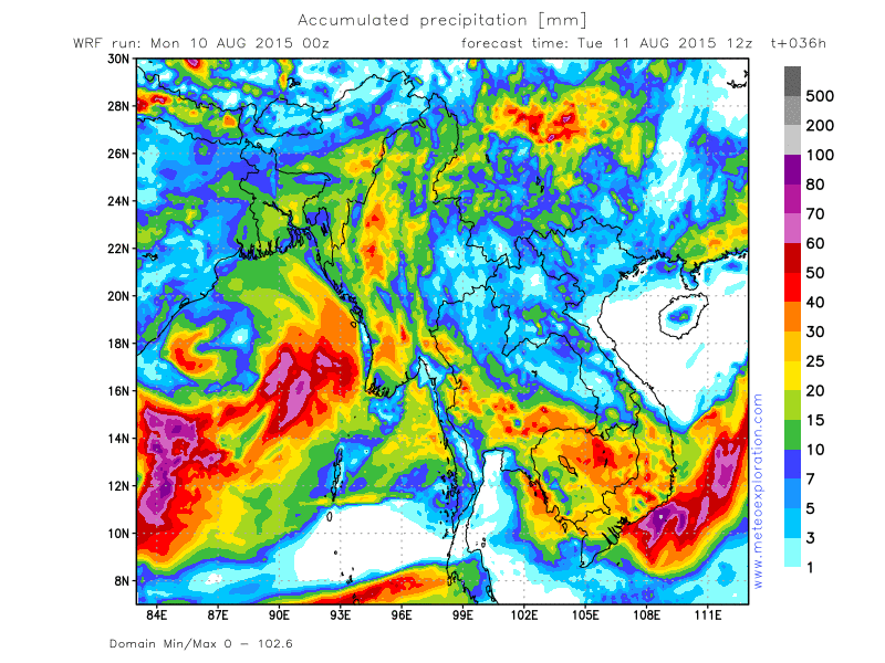
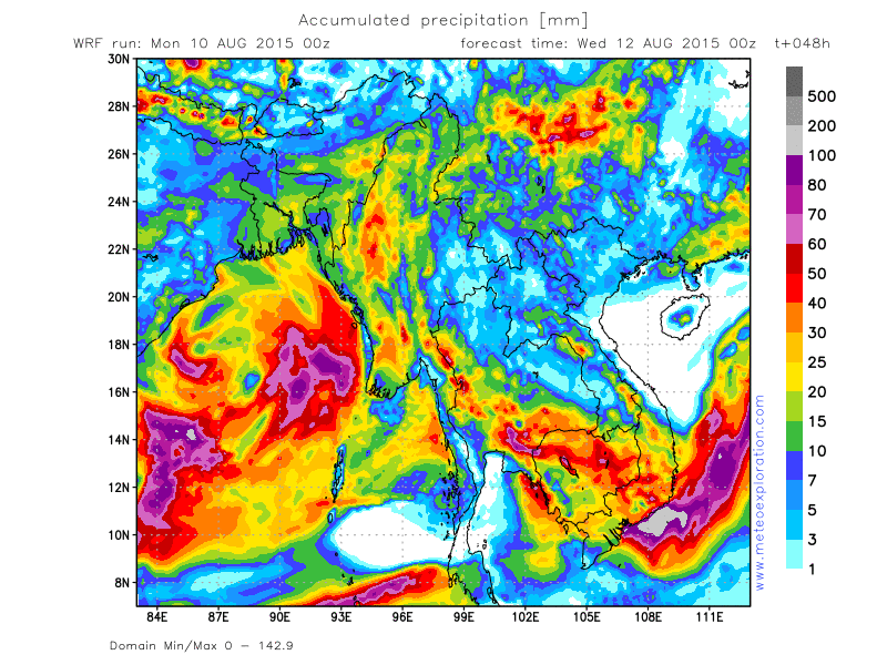
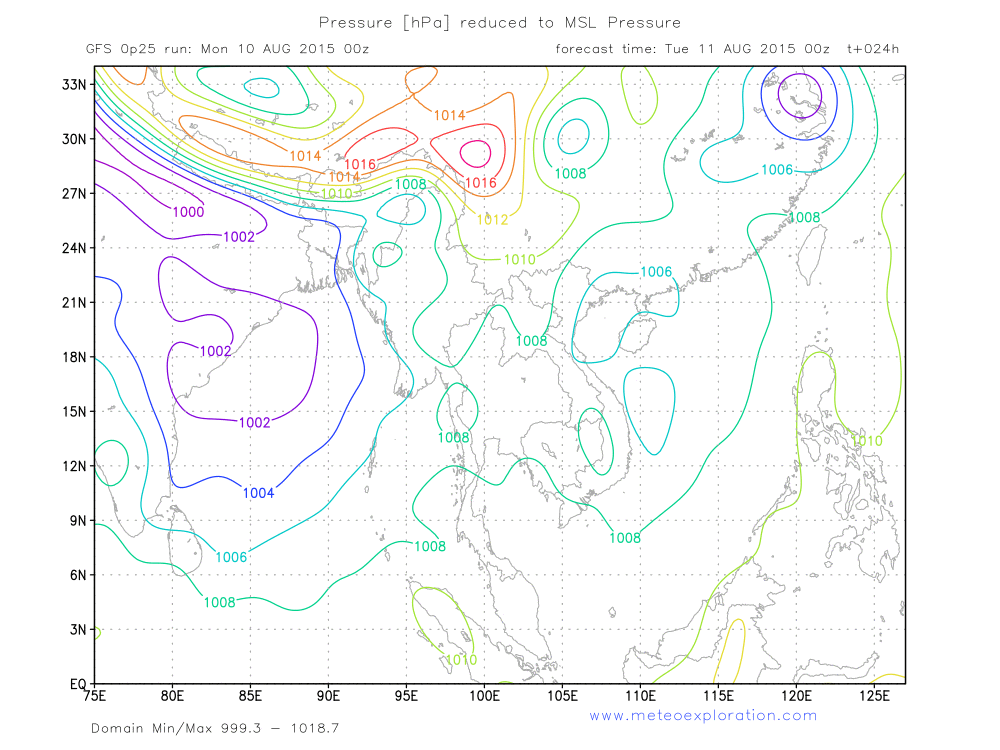
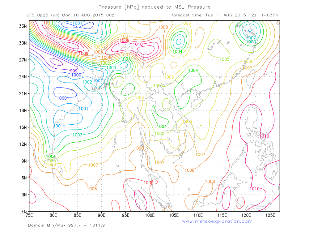
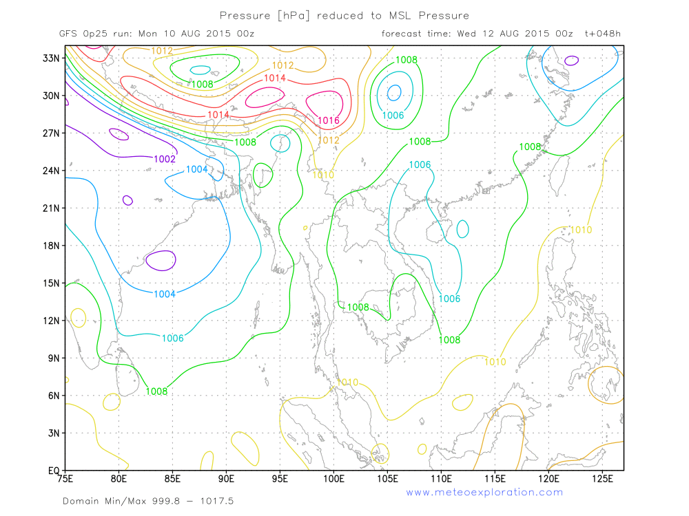
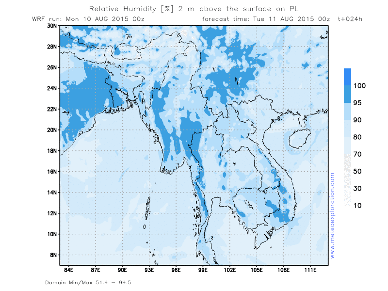
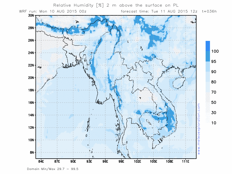
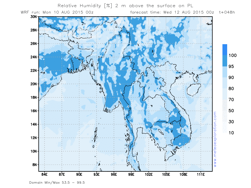
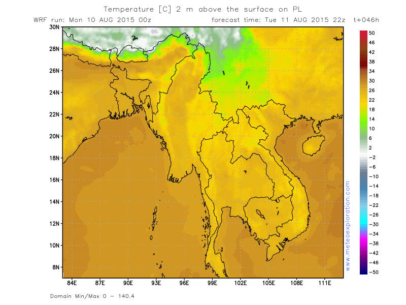
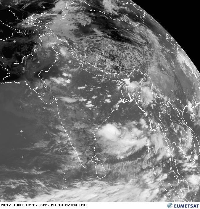
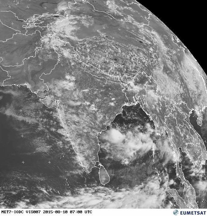
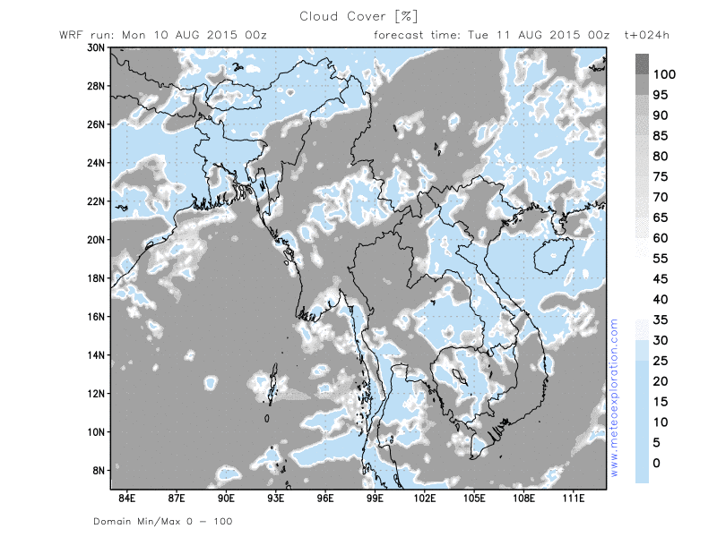
Two main pressure systems dominate the today’s Myanmar’s weather maps: firstly there is the low pressure belt over Northern India which extends towards the Bay of Bengal. There it meets the second pressure system that builds high pressure from the South. Where both pressure systems meet, the surface pressure gradient sharpens and as a result the wind increases over the Bay of Bengal. This reinforces the advection of warm and moist air towards Myanmar.
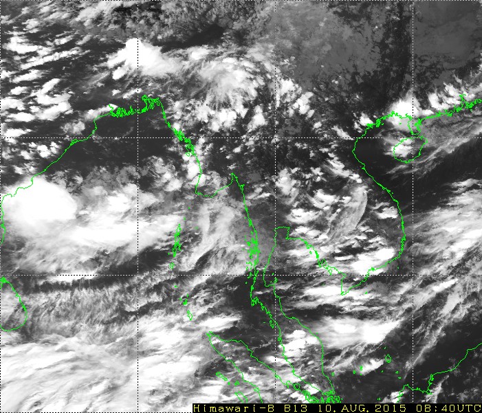
This air mass leads to the formation of convective cells that results in showery and thundery outbreaks spread over the inland of Myanmar. So a certain distance from the coast the most active cells can be expected especially over the Province of Chin. Tonight the active cells move further north, to the Provinces of Sagaing and Kachin. The Eastern parts of the country are likely to remain dry as a ridge of high pressure extends along the Eastern border.
This suppresses most instability, so only a few isolated showers are expected to develop in the province of Shan.
Over the Southern provinces there is some showery/thundery activity over the Provinces of Mon and Kayin-but the province of Tanintharyi it looks like no showers or thunderstorms will develop.
Warnings
-Moderate to severe turbulence in the vicinity of thunderstorms
-Province of Ayeyarwaddy: a few heavy showery/thundery outbreaks-heavy precipitation
Forecast for different areas
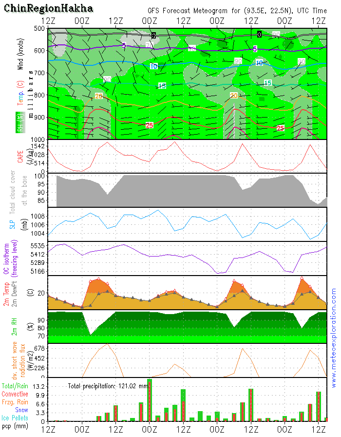
Province of Chin (Hakha: 22.6/93.6)
-Weather: mist and fog to start the early day with,short lived sunny spells. Soon clouds start to develop that after 6utc will lead to formation of convective cells with showery and thundery outbreaks. These showers become a little less after 12/15utc but still the occasional shower is possible
-Precipitation:a total of about 25-30mm
-Wind at surface: weak (2-4kt) to calm from variabledirections
-Outlook tomorrow (12 Aug 2015): remaining very cloudy to overcast with especially in the morning a few heavy showers/thunderstorms
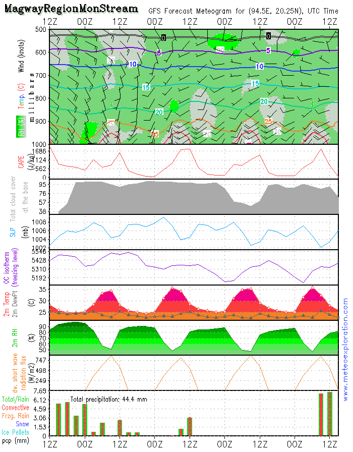
Province of Magway (Mon Stream: 20.2/94.4)
-Weather: a grey start with low clouds, mostly remaining very cloudy to overcast with some rain. Convective clouds develop and these result in showery outbreaks
-Precipitation: around this location precipitation is between 8-13mm.
-Wind at surface:3-6kt from S – no significant change
-Outlook tomorrow (12 Aug 2015): this is likely to be a pretty nice day with a mix of sunny spells and cloudy periods. Except from a local showery outbreak, it should remain dry.
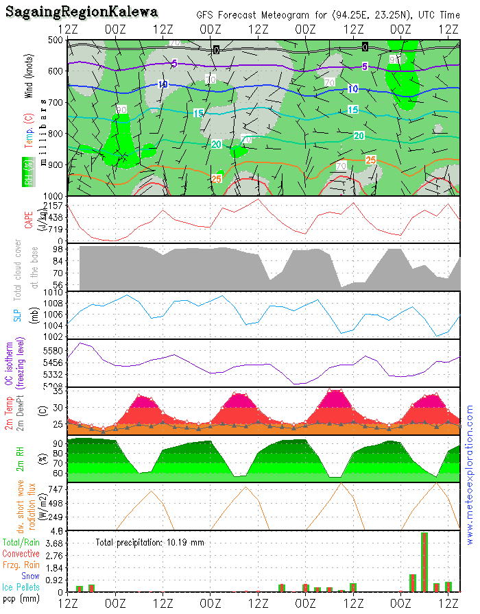
Province Sagaing (Kalewa: 23.2/94.3)
-Weather: very cloudy with low clouds and possibly some slight rain before 9utc. After 9utc a few weak sunny spells develop and, except from a local light showers it remains dry
-Precipitation: less than1mm
-Wind at surface: weak to calm from variable directions
-Outlook tomorrow (12 Aug 2015): mix of sunny spells and cloudy periods-this will lead to some more convective development the risk for showers is again bigger.
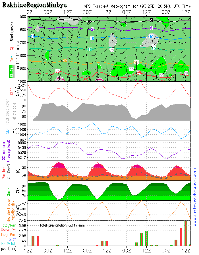
Province of Rakhine (Minbya: 20.4/93.3)
-Weather: in the morning there is risk for mist and fog, than cloudy with some sunny spells. Between 6 and 12utc a few local showery outbreaks may develop.
-Precipitation: little:0-2mm
-Wind at surface: ESE 10kt but soon increasing to SE13-18kt after 12utc again decreasing to 10kt
-Outlook tomorrow (12 Aug2015): low clouds with only a little sun-hardly any rain or showers are indicated
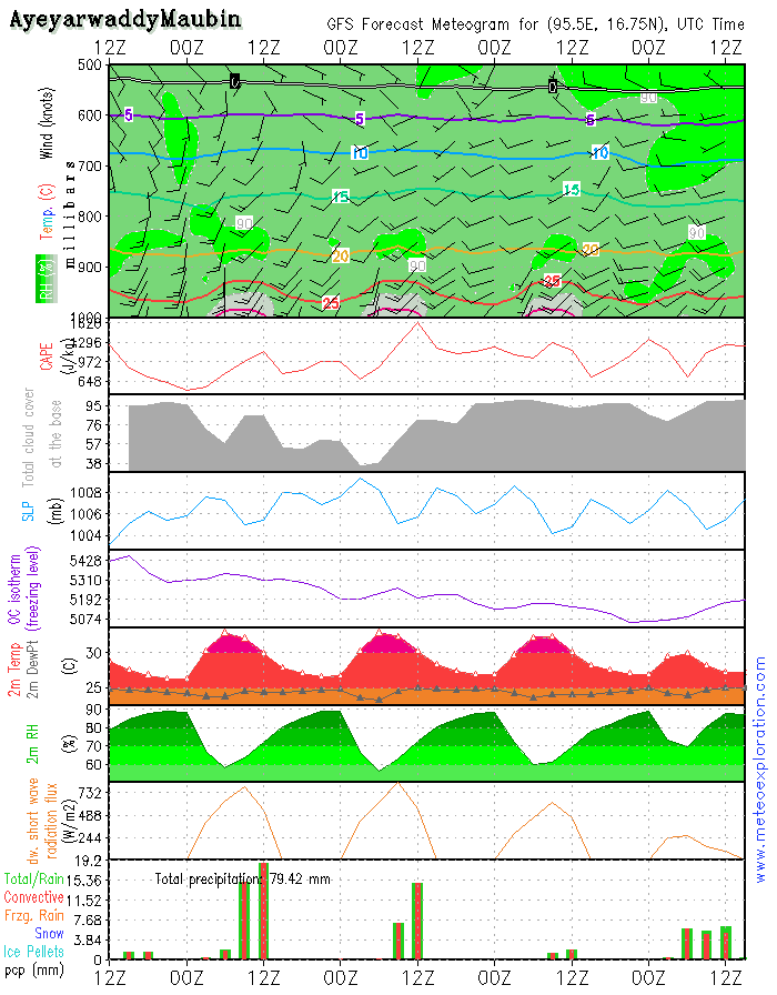
Province of Ayeyarwaddy(Maubin: 16.7/95.6)
-Weather: cloudy periods and sunny spells with convective clouds like Cumulus and Cumulonimbus and this leads to heavy showery/thundery outbreaks-after 12utc again decreasing.
-Precipitation: 30-40mm
-Wind at surface: SSE8-12kt gusting 20-25kt
-Outlook tomorrow:
again showers but slightly less active than today
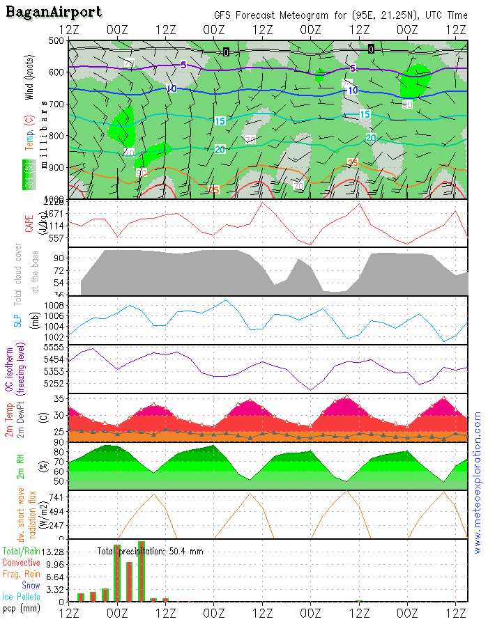
Bagan: 21.2/94.9 (Airport) - Airfield forecast
-Weather: very cloudy with only a few short lived sunny spells.Locally heavy showers and thunderstorms.Rain and showery outbreaks will gradually cease after 12utc
-Clouds: 5-7/8 St around 1000ft gradually becoming 4-6/8 Cu around 1500ft
-Visibility:moderate to poor during rain/showers.
-Precipitation: between 25-35mm
-Wind at surface: weak from Southerly directions after 12/14utc increasing to S 8-13kt
-Wind at 1000ft: SSE4-8kt becoming10-15kt
-Wind at 3000ft: S 10-15kt tempo 15-20kt
-Wind at 5000ft: SE to SSE 10kt tempo 15kt
-Turbulence: mod near the surface
-Outlook for Sunday10 August: improving conditions with larger sunny spells and less precipitation
Two main pressure systems dominate the today’s Myanmar’s weather maps: firstly there is the low pressure belt over Northern India which extends towards the Bay of Bengal. There it meets the second pressure system that builds high pressure from the South. Where both pressure systems meet, the surface pressure gradient sharpens and as a result the wind increases over the Bay of Bengal. This reinforces the advection of warm and moist air towards Myanmar.
This air mass leads to the formation of convective cells that results in showery and thundery outbreaks spread over the inland of Myanmar. So a certain distance from the coast the most active cells can be expected especially over the Province of Chin. Tonight the active cells move further north, to the Provinces of Sagaing and Kachin. The Eastern parts of the country are likely to remain dry as a ridge of high pressure extends along the Eastern border.
This suppresses most instability, so only a few isolated showers are expected to develop in the province of Shan.
Over the Southern provinces there is some showery/thundery activity over the Provinces of Mon and Kayin-but the province of Tanintharyi it looks like no showers or thunderstorms will develop.
Warnings
-Moderate to severe turbulence in the vicinity of thunderstorms
-Province of Ayeyarwaddy: a few heavy showery/thundery outbreaks-heavy precipitation
Two main pressure systems dominate the today’s Myanmar’s weather maps: firstly there is the low pressure belt over Northern India which extends towards the Bay of Bengal. There it meets the second pressure system that builds high pressure from the South. Where both pressure systems meet, the surface pressure gradient sharpens and as a result the wind increases over the Bay of Bengal. This reinforces the advection of warm and moist air towards Myanmar.
This air mass leads to the formation of convective cells that results in showery and thundery outbreaks spread over the inland of Myanmar. So a certain distance from the coast the most active cells can be expected especially over the Province of Chin. Tonight the active cells move further north, to the Provinces of Sagaing and Kachin. The Eastern parts of the country are likely to remain dry as a ridge of high pressure extends along the Eastern border.
This suppresses most instability, so only a few isolated showers are expected to develop in the province of Shan.
Over the Southern provinces there is some showery/thundery activity over the Provinces of Mon and Kayin-but the province of Tanintharyi it looks like no showers or thunderstorms will develop.
2) Warnings
Warnings
-Moderate to severe turbulence in the vicinity of thunderstorms
-Province of Ayeyarwaddy: a few heavy showery/thundery outbreaks-heavy precipitation
Two main pressure systems dominate the today’s Myanmar’s weather maps: firstly there is the low pressure belt over Northern India which extends towards the Bay of Bengal. There it meets the second pressure system that builds high pressure from the South. Where both pressure systems meet, the surface pressure gradient sharpens and as a result the wind increases over the Bay of Bengal. This reinforces the advection of warm and moist air towards Myanmar.
This air mass leads to the formation of convective cells that results in showery and thundery outbreaks spread over the inland of Myanmar. So a certain distance from the coast the most active cells can be expected especially over the Province of Chin. Tonight the active cells move further north, to the Provinces of Sagaing and Kachin. The Eastern parts of the country are likely to remain dry as a ridge of high pressure extends along the Eastern border.
This suppresses most instability, so only a few isolated showers are expected to develop in the province of Shan.
Over the Southern provinces there is some showery/thundery activity over the Provinces of Mon and Kayin-but the province of Tanintharyi it looks like no showers or thunderstorms will develop.
Warnings
-Moderate to severe turbulence in the vicinity of thunderstorms
-Province of Ayeyarwaddy: a few heavy showery/thundery outbreaks-heavy precipitation

No. (11) A , Khapaung Street , Hlaing Township ,
Yangon , Myanmar .

95 - 1 - 538549 , 504418

administrator@apexpetro.com

www.apexpetro.com