Meteorologist: Marc de Keyser
Contact: marc.achiel@gmail.com or mobile +32 473 72 76 41
Date: 10 August 2015
Forecast valid for the 10th of August - based on the 09/00utc run
Meteogram | Precipitation | Accumulated Precipitation | Pressure | Relative Humidity | Surface Wind | Temperature | 80m AGL Wind | Satellite Image | Cloud Cover
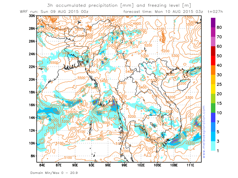
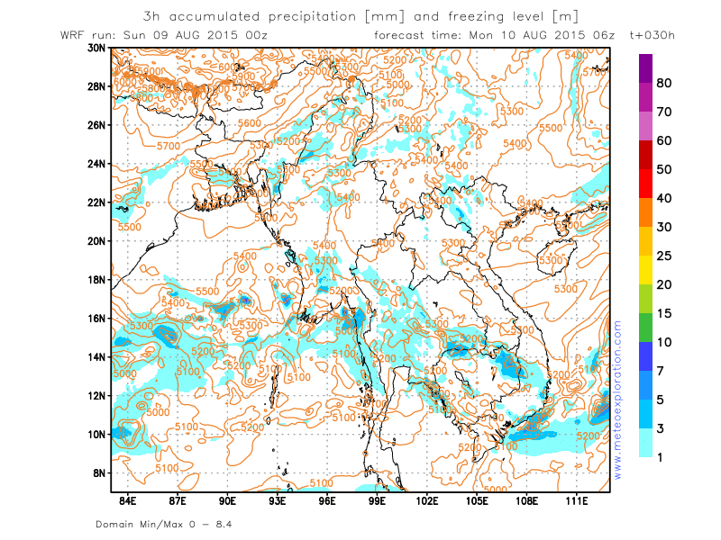
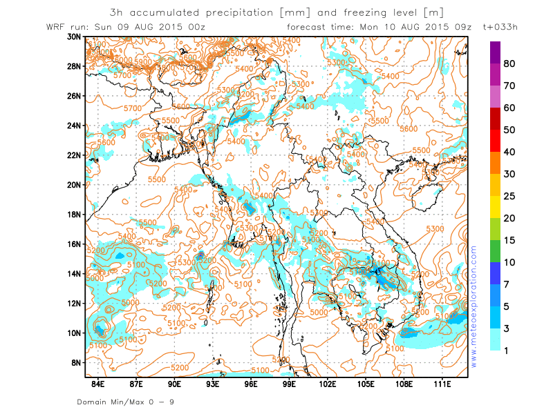
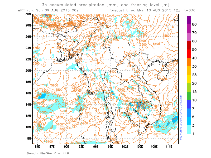
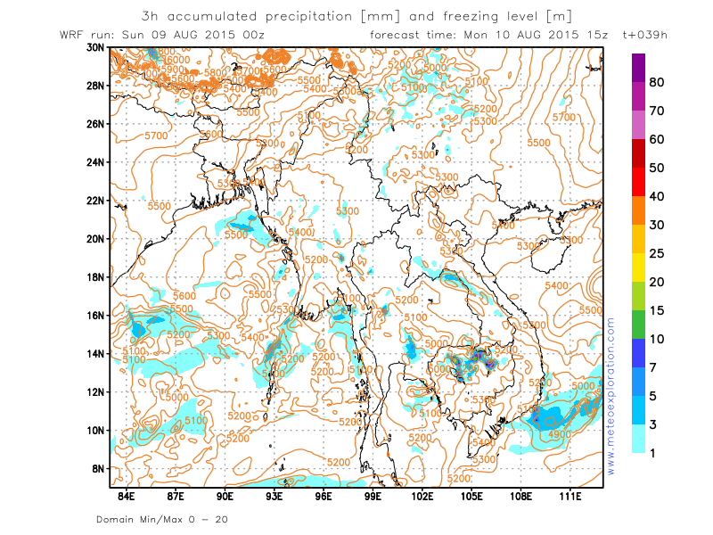
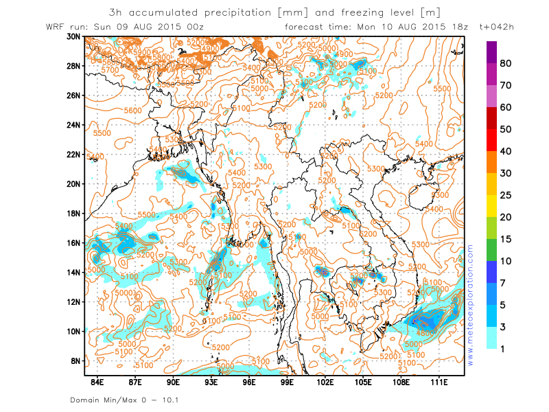
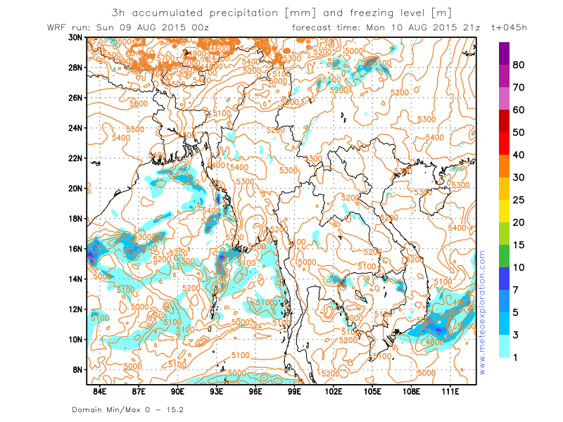
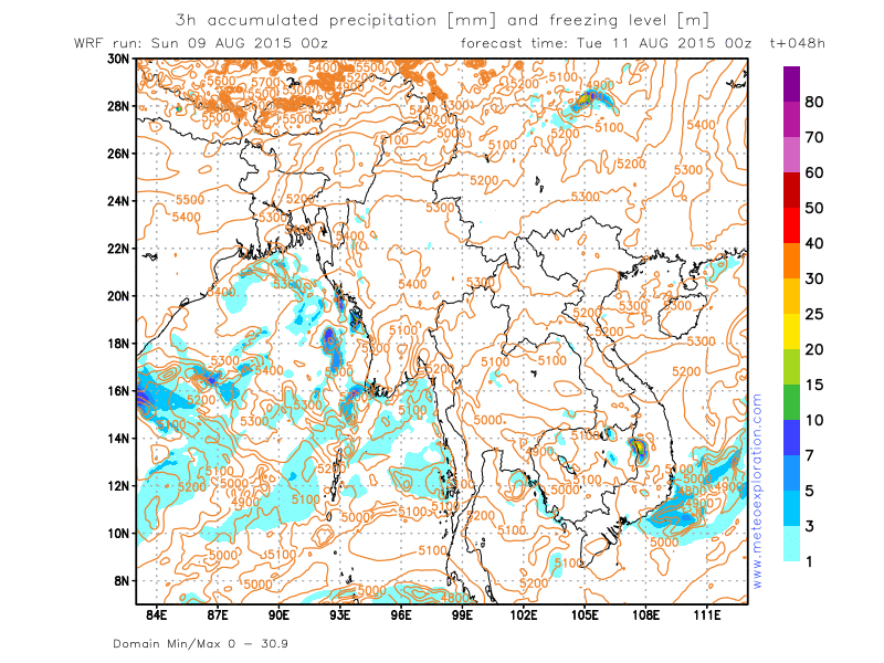
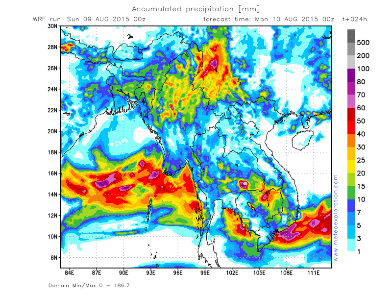
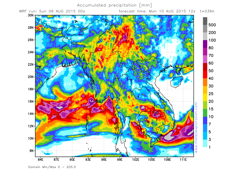
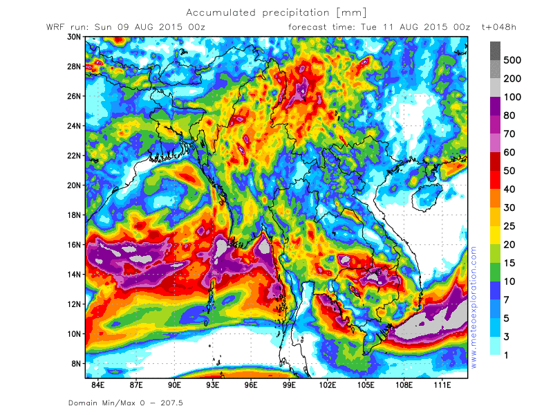
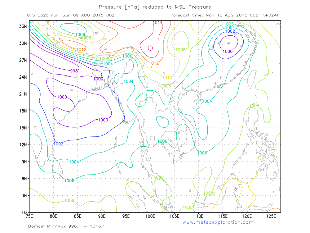
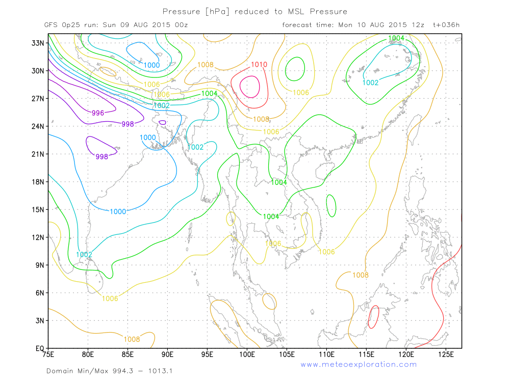
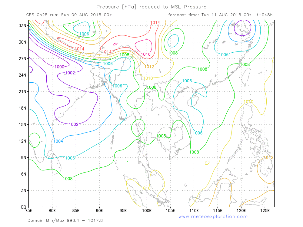
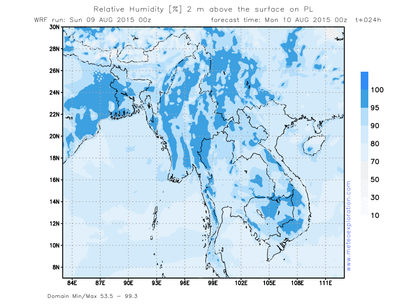
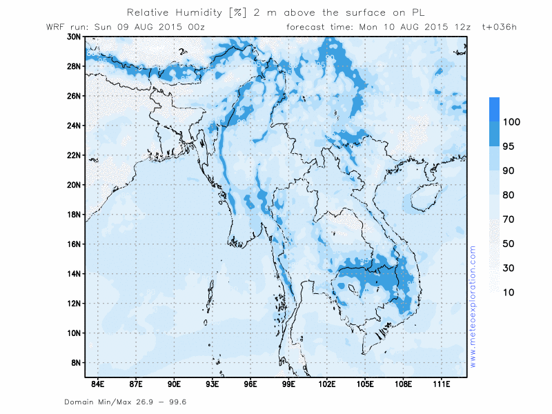
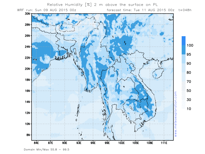
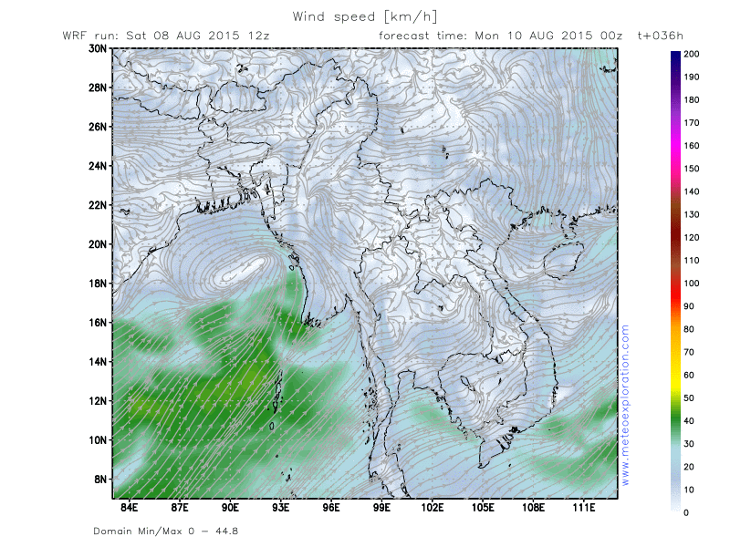
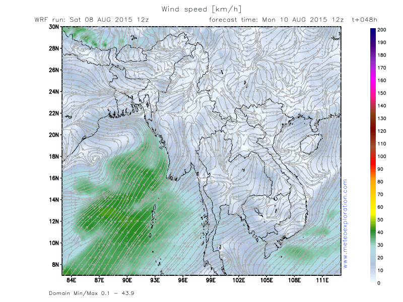
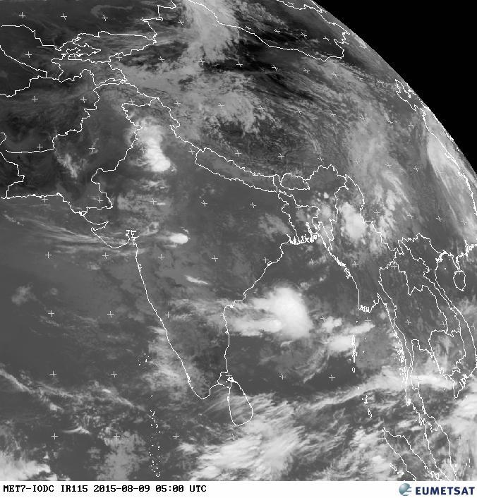
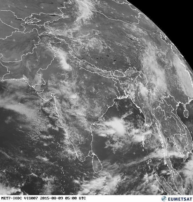
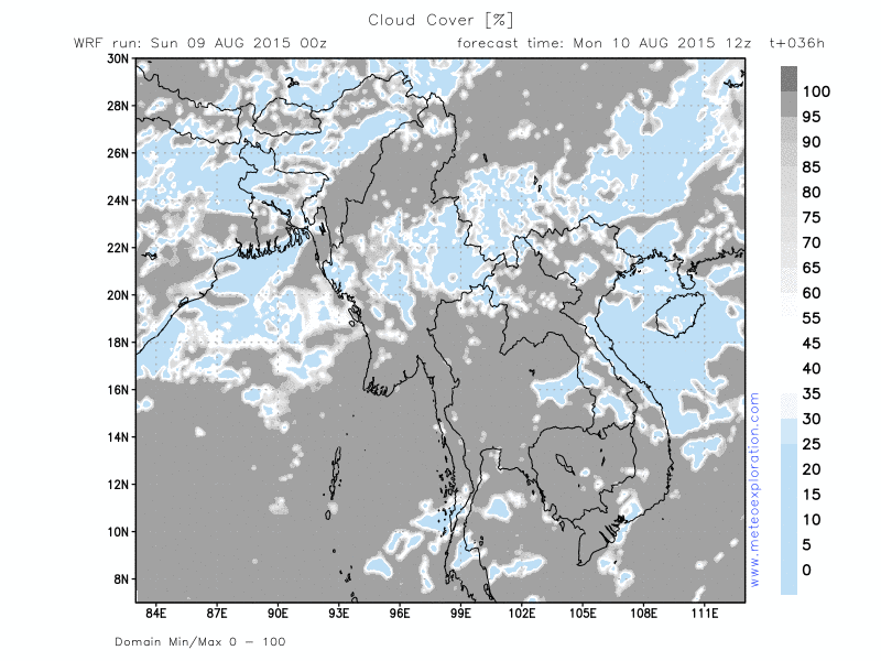
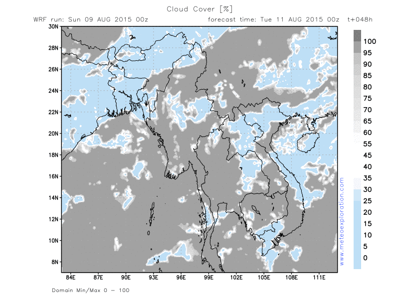
The ridge of high pressure that extended from the North and had a positive influence on the weather yesterday is gradually decaying and moving away. This high pressure makes place for the low pressure system that extends from Northern India into the Bay of Bengal and Western Myanmar. This means that the risk for showery and thundery outbreaks increases again.
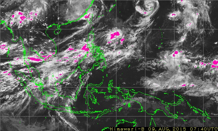
The tropical cyclone that crossed Taiwan is further moving up North and this means there is no further on the impact of Myanmar today and the next few days. There is a weak trough that extends from that cyclone towards Eastern Myanmar which could trigger some extra showery and thundery outbreaks, especially over the Eastern parts than.
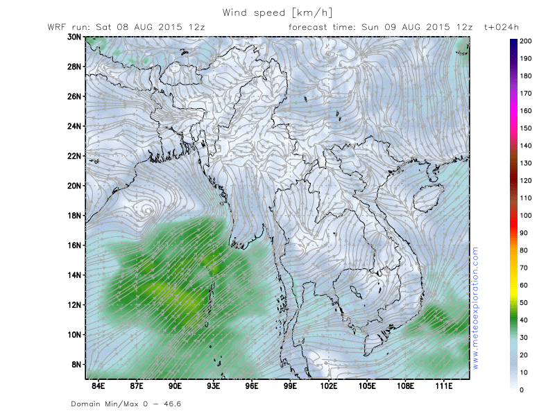
Also worth mentioning is that due to the pushing of the high pressure system to the South of the country, the pressure gradient over the Bay of Bengal will gradually increase, which means that high winds are expected to the West of Myanmar in the Bay of Bengal by tomorrow morning.
Warnings
-Moderate to severe turbulence in the vicinity of thunderstorms
Forecast for different areas
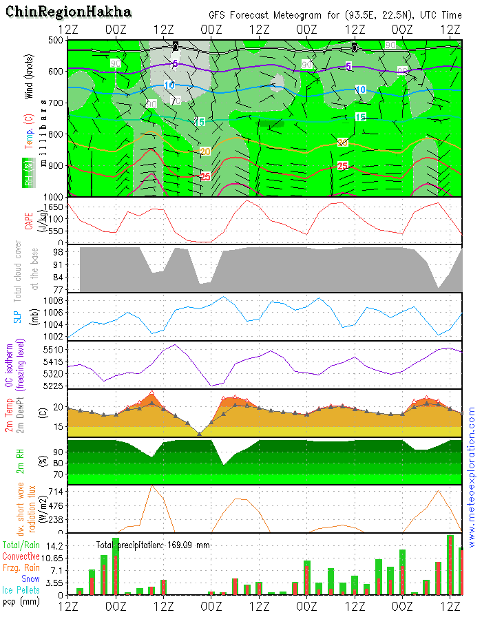
Province of Chin (Hakha: 22.6/93.6)
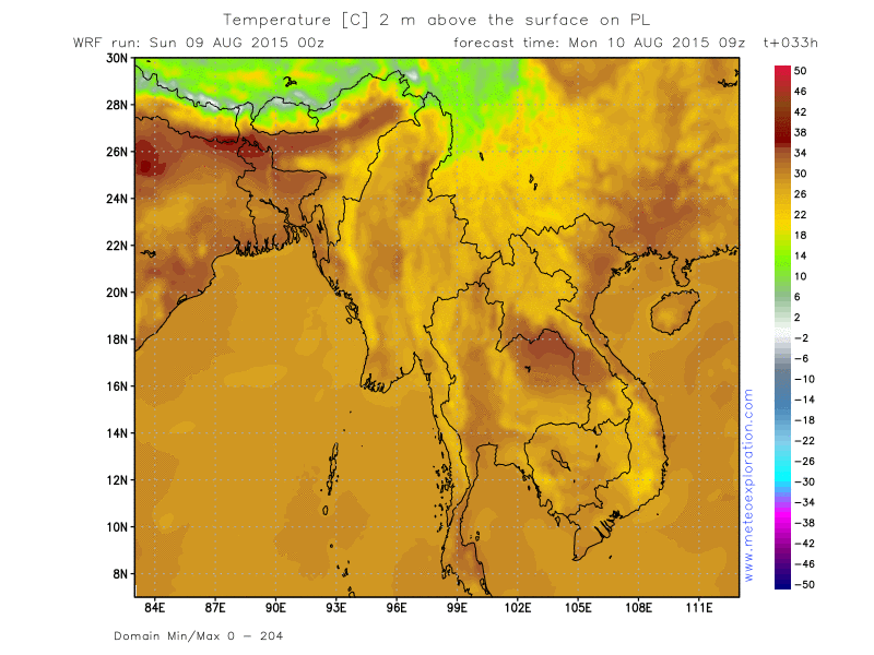
-weather: the rain fall from yesterday and last night will gradually die out. Possibly a few sunny spells develop which will make increase the temperature very quickly. This leads to formation of convective cell later during the day. With possibly showery and thundery outbreaks. After 12utc easing and becoming dry.
-precipitation: associated with the early morning rain still up to 10-20mm. Later during the day with the showers: 5-10mm
-wind at surface: weak 2-4kt to calm from variable to directions
-outlook tomorrow (11 Aug 2015): again an increase of the showery/thundery activity: higher frequency and higher intensity of the showers and thunderstorms. Again a higher amount of precip.
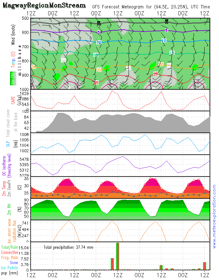
Province of Magway (Mon Stream: 20.2/94.4)
-weather: fog patches will soon dissipate and sunny spells develop. Later during the day towards the evening: formation of convective clouds with a few showery outbreaks after 12utc
-precipitation: around this location precipitation is between 5-10mm.
-wind at surface:weak from SE but at 1000ft SW 15-20kt: so risk for moderate to severe near sfc turbulence
-outlook tomorrow (11 Aug 2015): also for this location an increase of the showery and thundery activity. An increase of the amount of precipitation
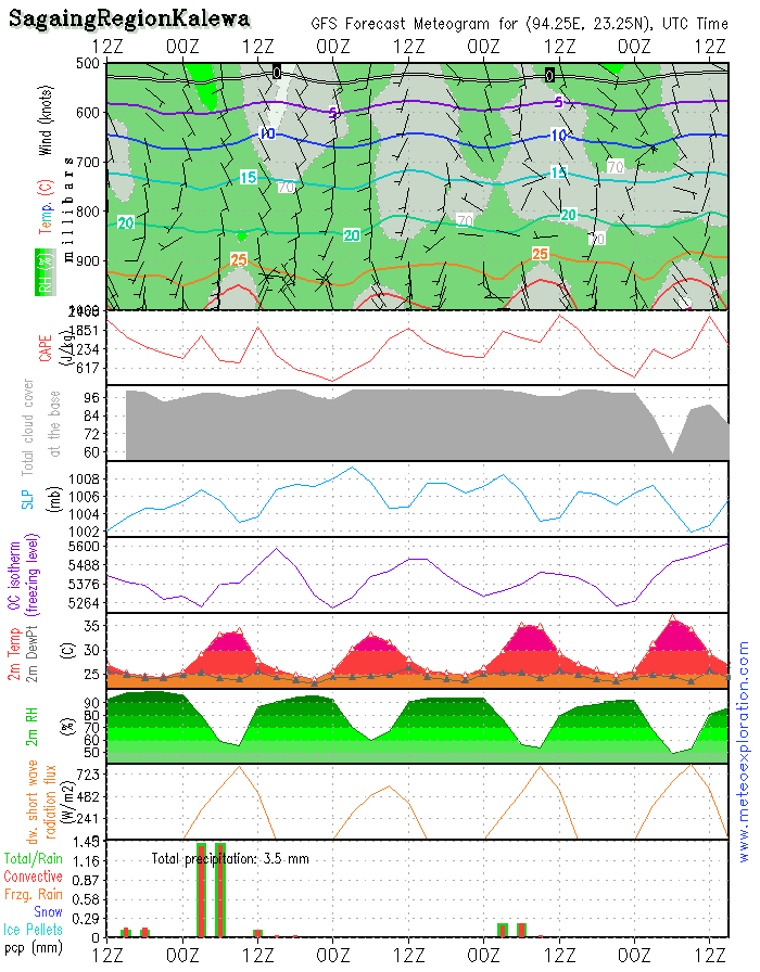
Province Sagaing (Kalewa: 23.2/94.3)
-weather: this area will still have showery and thundery outbreaks. After 9/12utc the showery activity should gradually die out and some sunny spells develop. In the early morning fog patches/poor visibility.
-precipitation: 5-10mm
-wind at surface: weak to calm from variable directions
-outlook tomorrow (11 Aug 2015): sunny spells in the morning and mainly dry conditions. After 6utc gradually more clouds and showery/thundery outbreaks develop.
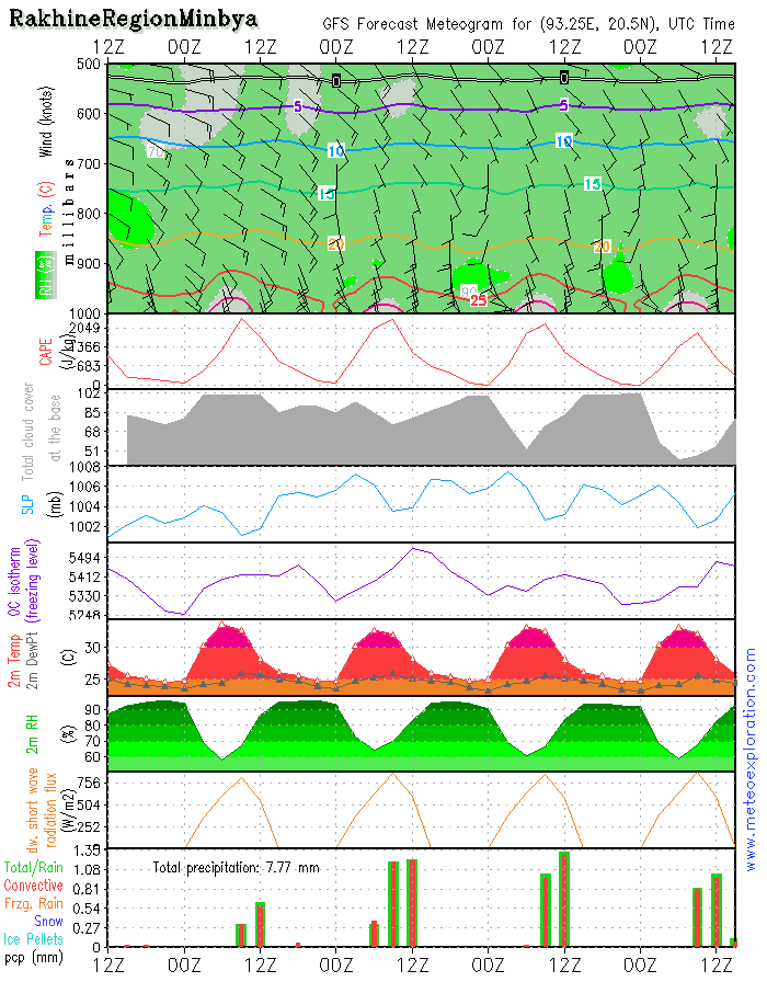
Province of Rakhine (Minbya: 20.4/93.3)
-weather: fog patches and sunny spells in the morning, after 6/9utc convective clouds start forming and as a result a few local showers develop. After 12utc again dry.
-precipitation: 2-4mm
-wind at surface: ESE 10-15kt temporarily increasing to ESE 15-20kt
-outlook tomorrow (11 Aug2015):
a few local light showers but nothing very big-
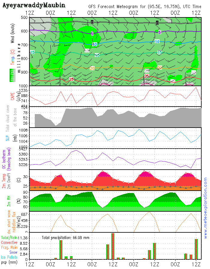
Province of Ayeyarwaddy(Maubin: 16.7/95.6)
-weather: sunny spells with gradually convective clouds that locally result in few slight showery outbreaks. No big amounts of precipitation expected. In general this looks like a pretty nice day, however take in account pretty strong winds.
-precipitation: during showersless than 5mm
-wind at surface: SSW 10-15kt after 8/10utc increasing up to 20-25kt, later again decreasing
-outlook tomorrow:
intense and frequent showers and thunderstorms
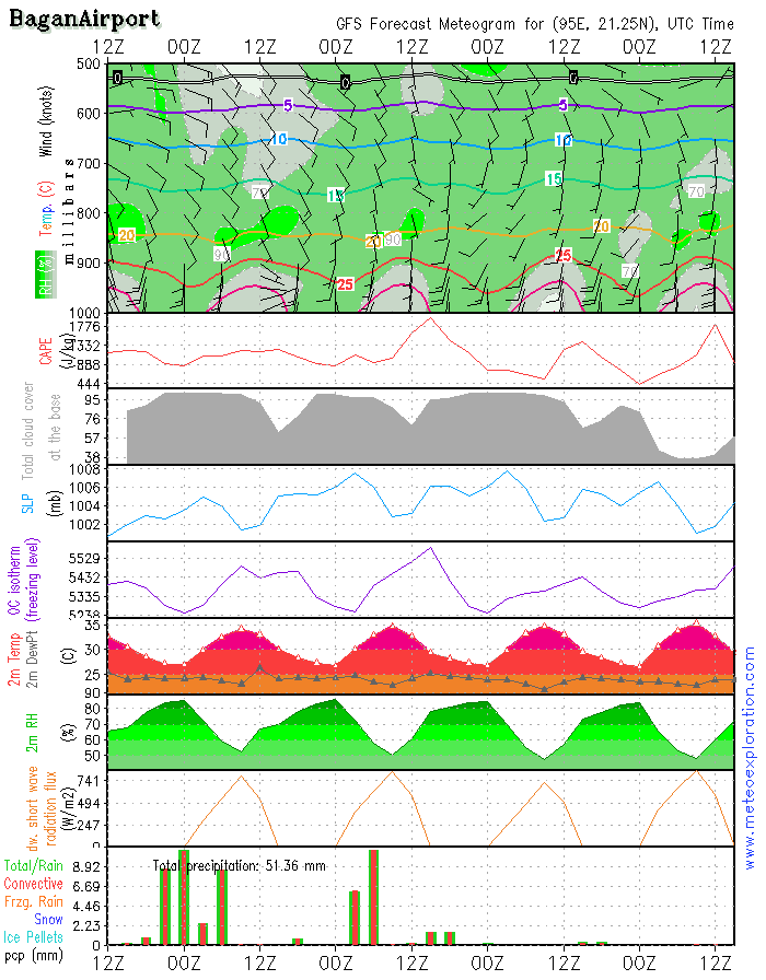
Bagan: 21.2/94.9 (Airport) - Airfield forecast
-Weather: mix of sunny spells and cloudy periods with after 6/9utc a few local light showery outbreaks.
-Clouds: 3-6/8 CuSc around 2500-3000ft –
-Visibility: in generalgood, except during the showers.
-Precipitation: less than 5mm
-wind at surface: weak from Southerly directions after 12/14utc increasing to S 8-13kt
-wind at 1000ft: weak becoming SSE10kt
-wind at 3000ft: SE to SSE10-15kt
-wind at 5000ft: SE to SSE 15kt
-Turbulence: mod near the surface
-Outlook for Sunday10 August:
looks like again more showers will develop.
The ridge of high pressure that extended from the North and had a positive influence on the weather yesterday is gradually decaying and moving away. This high pressure makes place for the low pressure system that extends from Northern India into the Bay of Bengal and Western Myanmar. This means that the risk for showery and thundery outbreaks increases again.
The tropical cyclone that crossed Taiwan is further moving up North and this means there is no further on the impact of Myanmar today and the next few days. There is a weak trough that extends from that cyclone towards Eastern Myanmar which could trigger some extra showery and thundery outbreaks, especially over the Eastern parts than.
Also worth mentioning is that due to the pushing of the high pressure system to the South of the country, the pressure gradient over the Bay of Bengal will gradually increase, which means that high winds are expected to the West of Myanmar in the Bay of Bengal by tomorrow morning.
Warnings
-Moderate to severe turbulence in the vicinity of thunderstorms

No. (11) A , Khapaung Street , Hlaing Township ,
Yangon , Myanmar .

95 - 1 - 538549 , 504418

administrator@apexpetro.com

www.apexpetro.com