Meteorologist: Marc de Keyser
Contact: marc.achiel@gmail.com or mobile +32 473 72 76 41
Date: 4 August 2015 Forecast valid for the 5th of August - based on the 04/12utc run
Meteogram | Precipitation | Pressure | Relative Humidity | Surface Wind | Temperature | 80m AGL Wind | Satellite Image | Cloud Cover
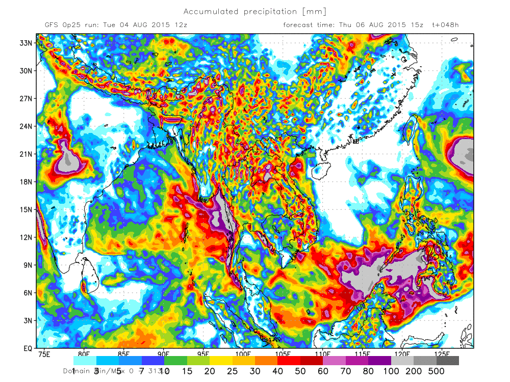
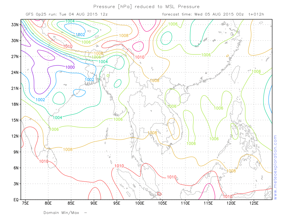
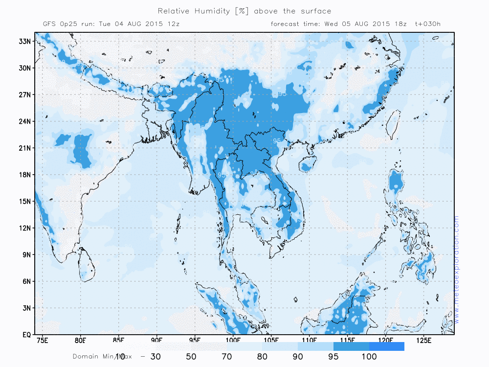
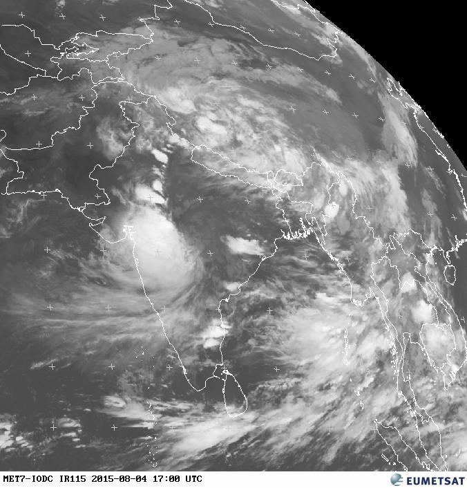
Still the same configuration on the surface pressure map of today: a belt of low pressure to the South of the Himalaya's. Along the Southern side of this low, a moist and warm airmass is pushed from the Bay of Bengal towards Myanmar. This leads to quite a lot of precip, especially along the Western coastal areas.
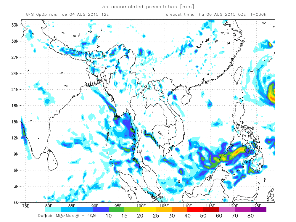
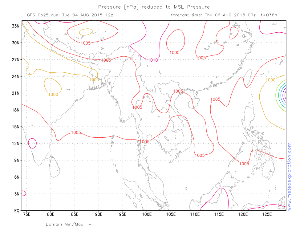
Later during the day the Indian depression is slowly filling, which is the first sign of a change. By the end of the night a tropical cyclone is visible on the weather maps. But at this stage it is still to the East of Taiwan.
Warnings
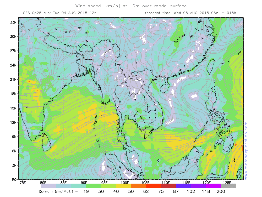
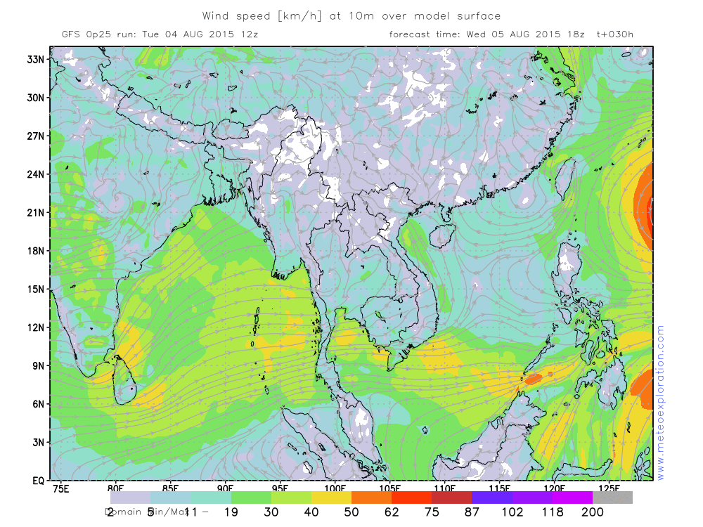
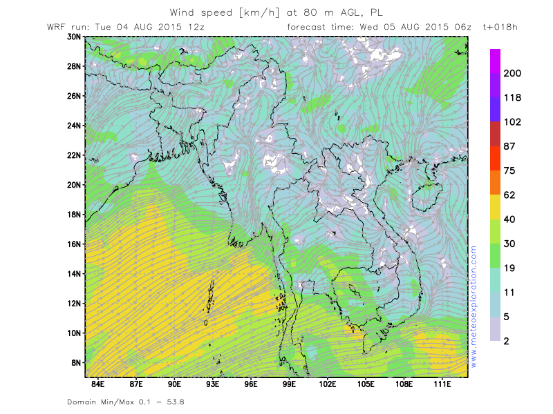
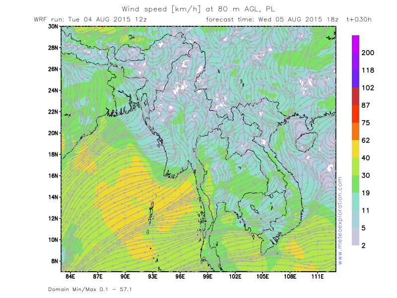
- strong winds at Ayeyarwaddy/Maubin
- heavy precipitation at Minbya, Kalewa and Hakha
Forecast for different areas. Valid from 00utc/4 Aug 15 till 00utc tomorrow (5 Aug 2015)
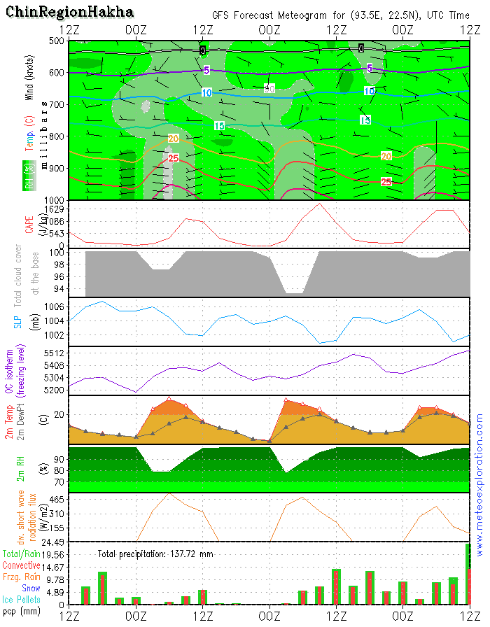
*/Chin Region/Hakha: 22.6/93.6North and Northeast Myanmar
-weather: possibly sunny spells to start the day but gradually convective clouds form which result in showers/rain-for the rest of the day. The heaviest showers are expected between 9-12utc
-precipitation: total precipitation: 12-16mm
-wind at surface: weak: 2-4kt from westerly directions - no significant change
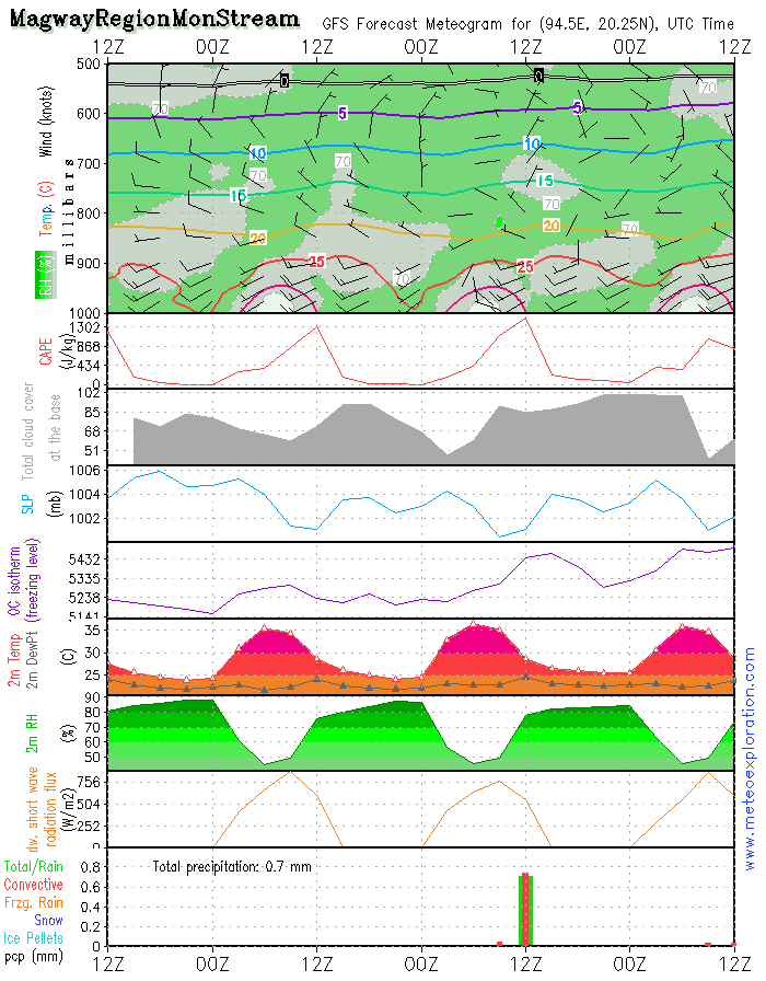
*/Magway Region/Mon Stream: 20.2/94.4
-weather: in general pretty weather conditions with good visibility. sunny spells with scattered convective clouds and a few slight local showers
-precipitation: no significant precipitation indicated-around 1-3mm around 12utc.
-wind at surface: SW 4-8kt increasing to SW 15kt
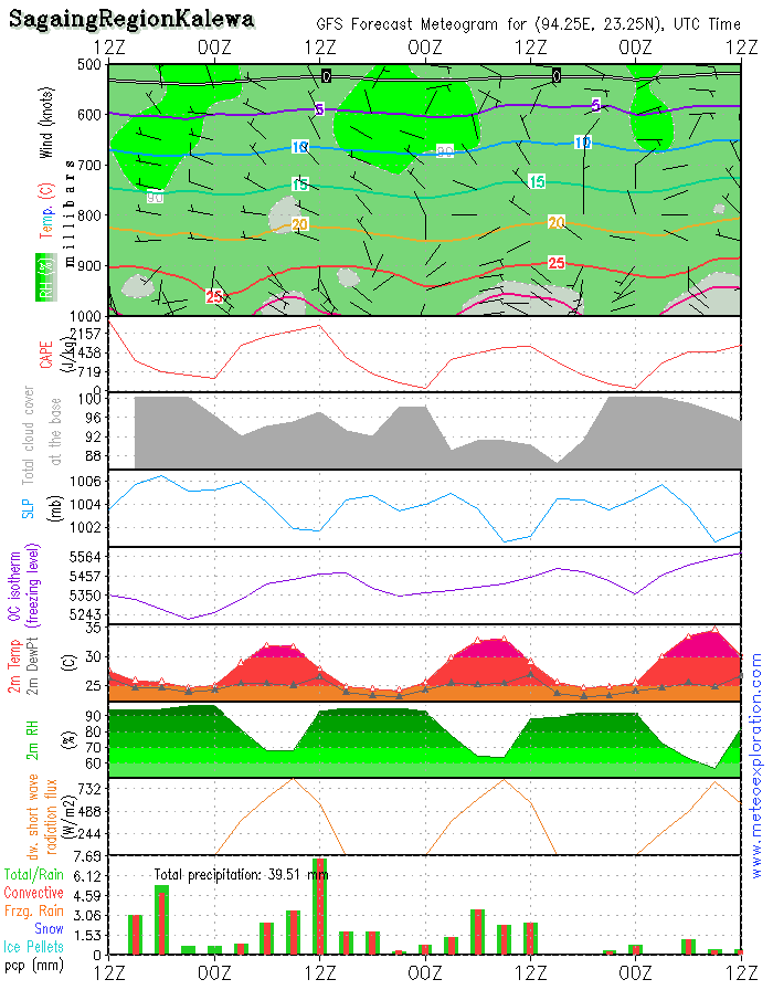
*/Sagaing Region: Kalewa: 23.2/94.3
-weather: a few sunny spells but soon convective clouds start to build, resulting in rain or showery outbreaks for the rest of the day. Before 6/9utc the visibility will be good, but once rain and showers start the visibility will become moderate to poor.
-precipitation: over the whole day a total of about 15-20mm
-wind at surface: weak from SSE’ly directions temporarily calm
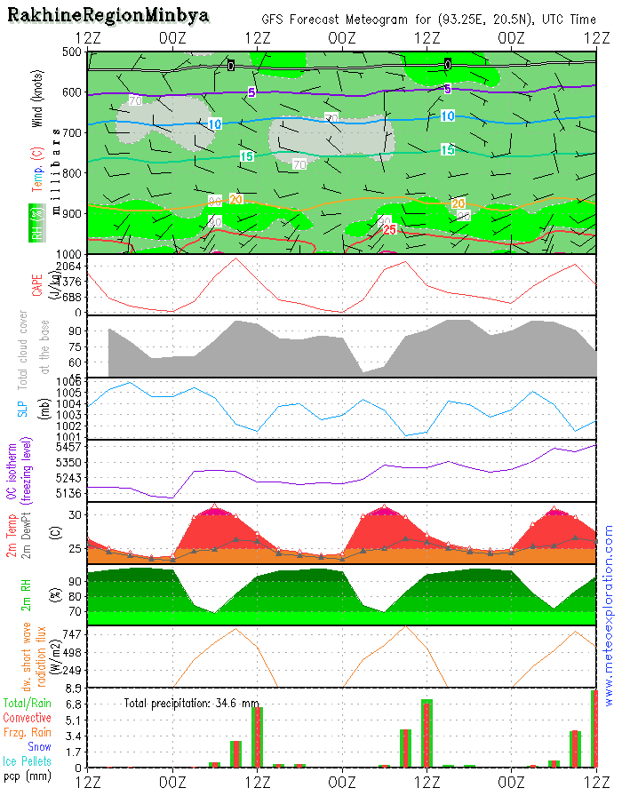
*/Rakhine Region: Minbya: 20.4/93.3
-weather: very cloudy to solidly overcast with ver low clouds or even fog. Outbreaks of heavy rain or showers mainly between 9 and 15 utc.
-precipitation: over the whole day a total of about 12-16mm
-wind at surface: is weak from variable directions - no significant change
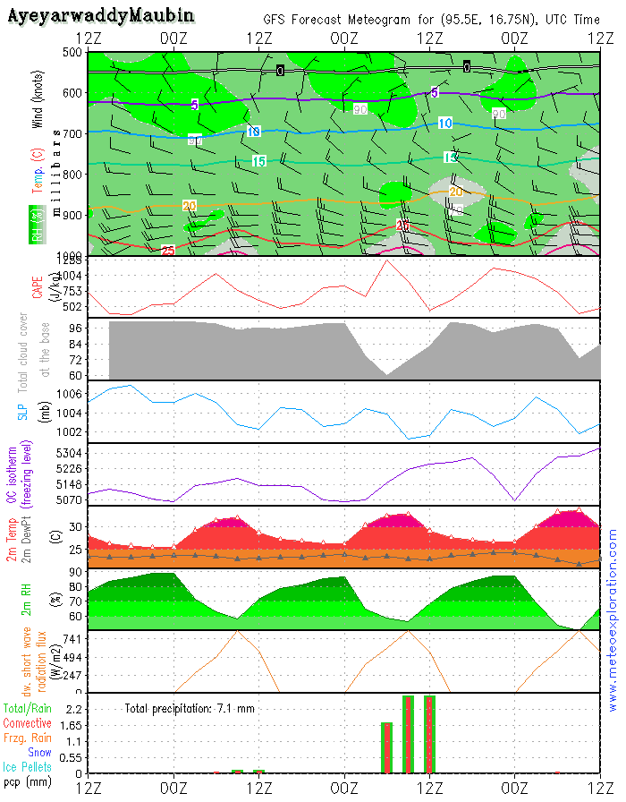
*/Ayeyarwaddy: Maubin: 16.7/95.6
-weather: very cloudy to overcast with 5-7/8 St around 1000ft and above 6-8/8 Sc around 5-6000ft - most precip fall before 12utc, after 12/15utc mostly dry.
-precipitation: between 00 and 12utc: 2-4mm, after 12/15utc dry
-wind at surface: WSW 15kt increasing to W 25kt after 12utc.
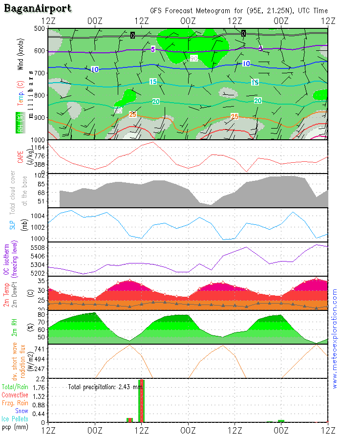
*/Bagan: 21.2/94.9 (Airport) - Airfield forecast
-Weather:
sunny spells with formation of convective clouds with base around 2-2500ft. This results in a few showery outbreaks around 12utc.
-clouds: 4-6/8 Cu around 2-2500ft - sunny spells in between
-Visibility: good except during any showers when the visibility is reduced to 4-8km.
-Precipitation: a few little shower will collect no more than 1-2mm of rain
-wind at surface: S 6-10kt temporarily decreasing to 2-6kt,after 15utc again increasing to 15kt from SSW
-wind at 1000ft: SSW 4-8kt tempo calm
-wind at 3000ft: SSW 2-6kt tempo calm
-wind at 5000ft: weak/calm
Be aware of light/moderate turbulence between 1500-2000ft;
Still the same configuration on the surface pressure map of today: a belt of low pressure to the South of the Himalaya's. Along the Southern side of this low, a moist and warm airmass is pushed from the Bay of Bengal towards Myanmar. This leads to quite a lot of precip, especially along the Western coastal areas.
Later during the day the Indian depression is slowly filling, which is the first sign of a change. By the end of the night a tropical cyclone is visible on the weather maps. But at this stage it is still to the East of Taiwan.
Warnings
- strong winds at Ayeyarwaddy/Maubin
- heavy precipitation at Minbya, Kalewa and Hakha
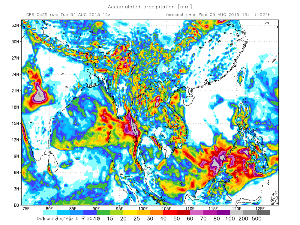
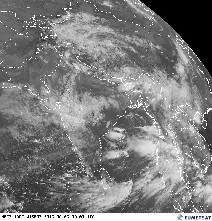
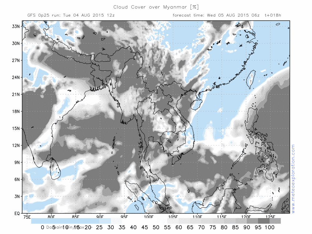
This latest sat image of the region (3utc) shows that the main cloud cover for today is being pushed towards the South of Rakhine and the provinces of Ayeyarwady and Mon. It looks like the Northern provinces will have much less clouds.
Still the same configuration on the surface pressure map of today: a belt of low pressure to the South of the Himalaya's. Along the Southern side of this low, a moist and warm airmass is pushed from the Bay of Bengal towards Myanmar. This leads to quite a lot of precip, especially along the Western coastal areas.
Later during the day the Indian depression is slowly filling, which is the first sign of a change. By the end of the night a tropical cyclone is visible on the weather maps. But at this stage it is still to the East of Taiwan.
Warnings
- strong winds at Ayeyarwaddy/Maubin
- heavy precipitation at Minbya, Kalewa and Hakha

No. (11) A , Khapaung Street , Hlaing Township ,
Yangon , Myanmar .

95 - 1 - 538549 , 504418

administrator@apexpetro.com

www.apexpetro.com