Meteorologist: Marc de Keyser
Contact: marc.achiel@gmail.com or mobile +32 473 72 76 41
Date: 5 August 2015 Forecast valid for the 6th of August - based on the 05/00utc run
Meteogram | Precipitation | Accumulated Precipitation | Pressure | Relative Humidity | Surface Wind | Temperature | 80m AGL Wind | Satellite Image | Cloud Cover
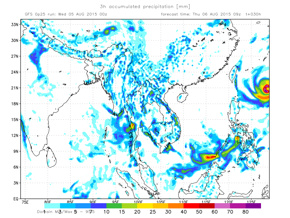
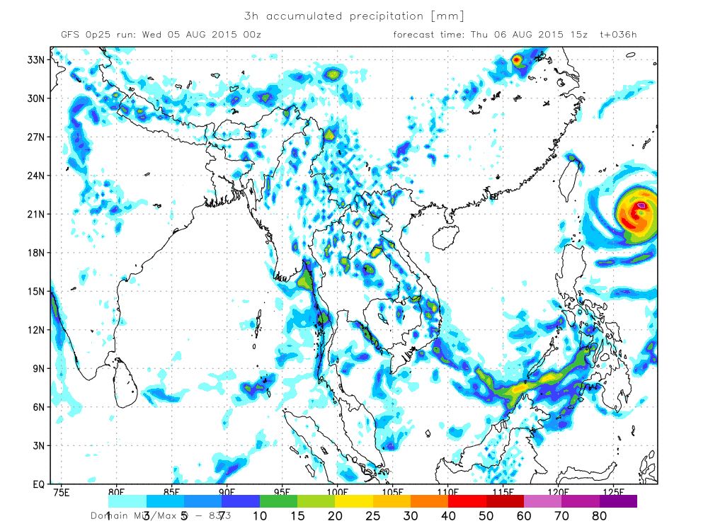
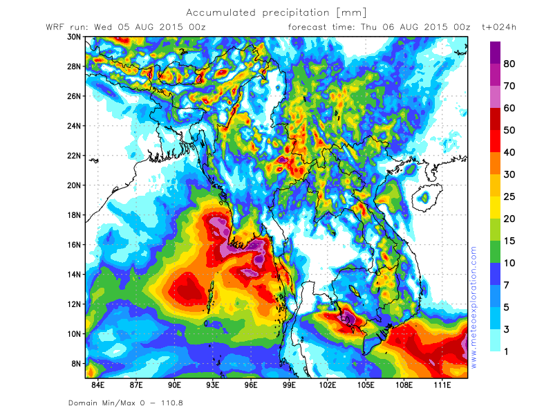
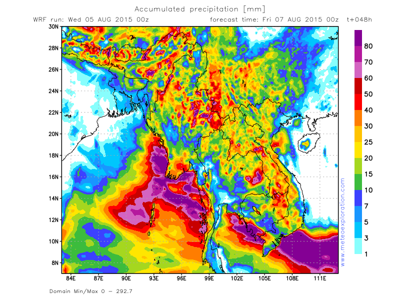
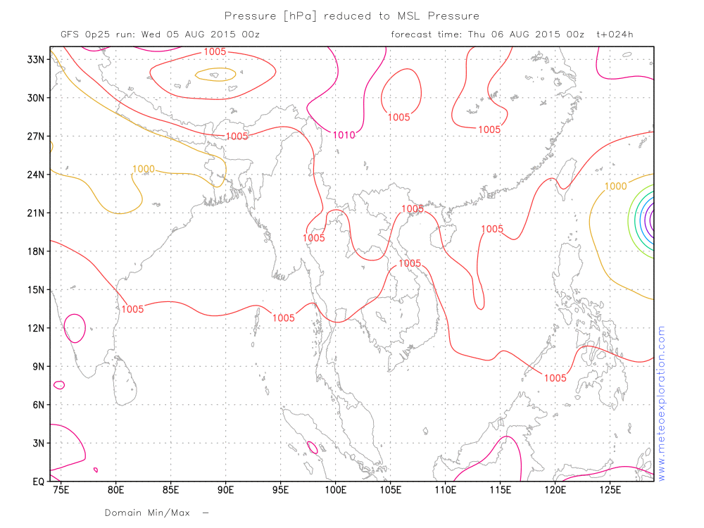
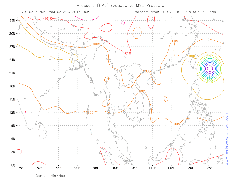
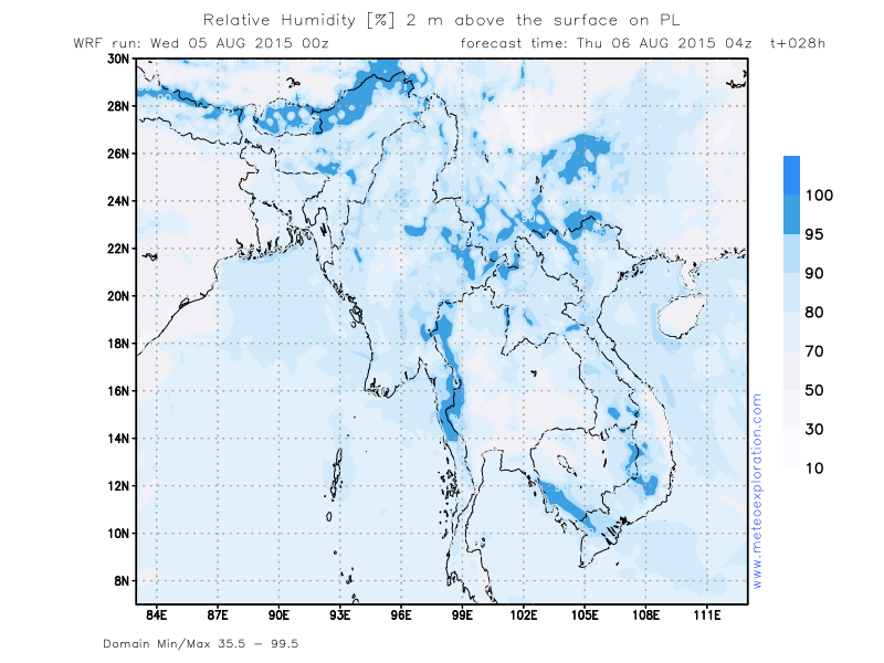
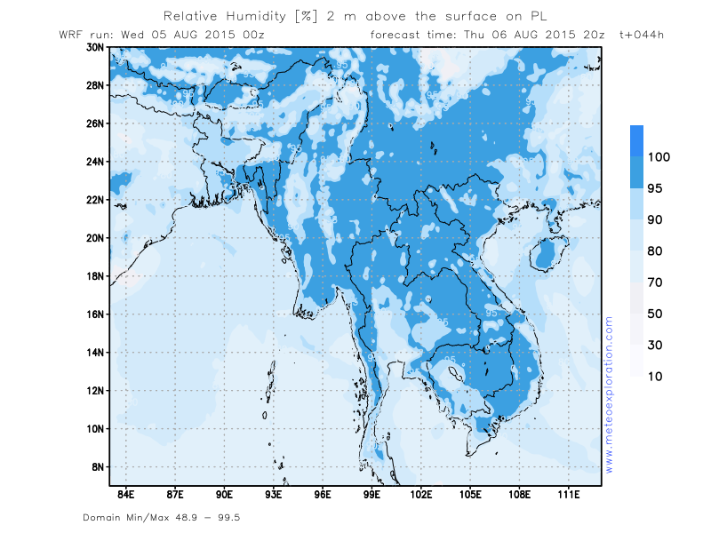
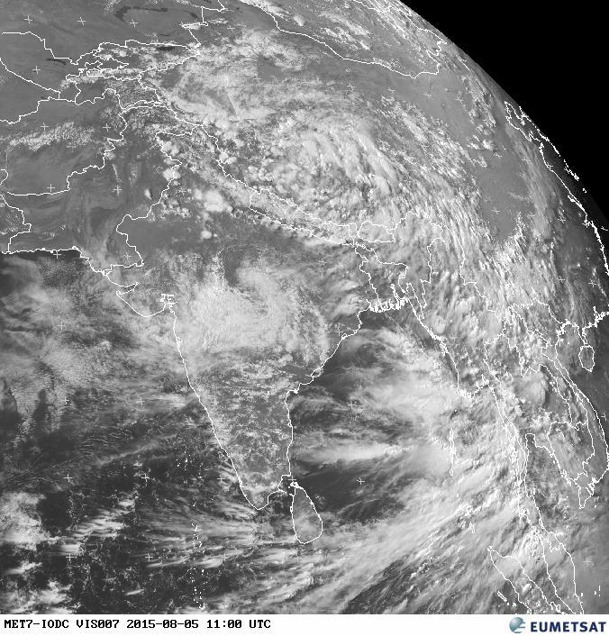
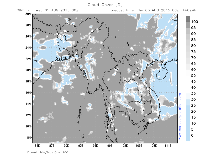
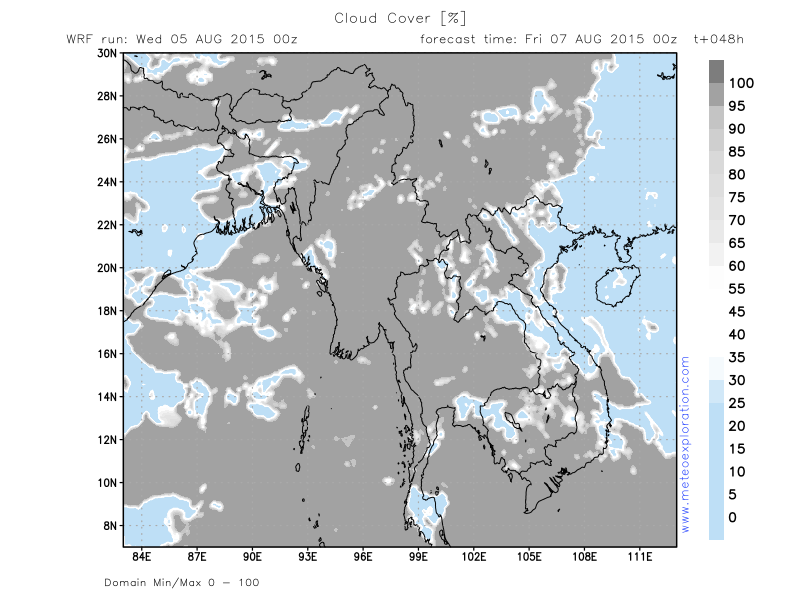
The main change with the previous days is that the low pressure system over the North of India is gradually filling and getting weaker. An important result of this is that the advection of the warm, moist airmass has become very weak towards the North of Myanmar but is still going to the Southern parts. This means that especially the Northern regions will gradually get drier weather whilst the Southern and Southwestern regions remain prone for rain and showers. Especially the coastal areas of Ayeyarwady. On the MSL pressure map valid +48 you can see the tropical cyclone heading towards Taiwan-Thursday night.
Warnings
- heavy precipitation at Hakha
Forecast for different areas
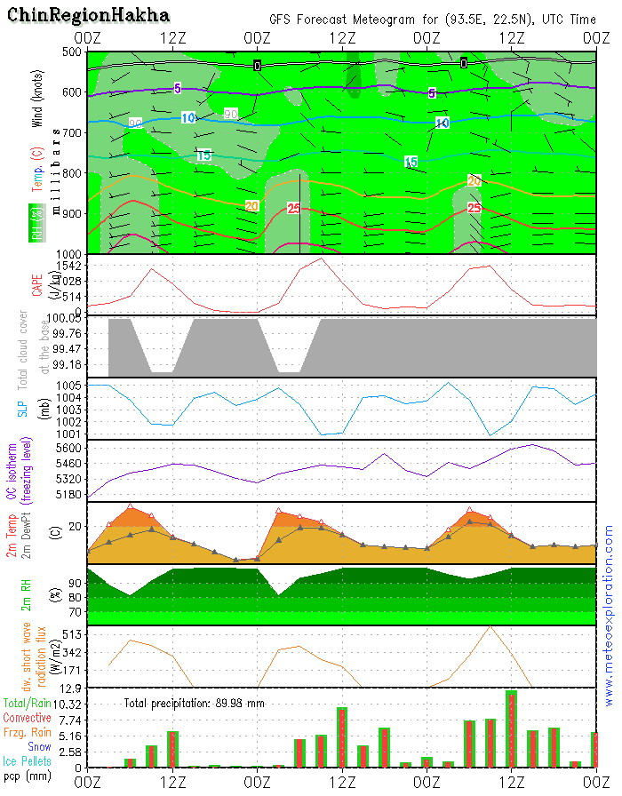
*Chin Region/Hakha: 22.6/93.6North and Northeast Myanmar
-weather: fog patches are possible. The surface relative humidity remains pretty high during the whole of the day. So I would expect that the risk for moderate to poor visibility remains present. For the rest it remains very cloudy to overcast with periods of heavy precipitation, starting from 6/9utc, continuing almost the rest of the day.
–The best period of the day will possibly be between 00 and 6utc.
-precipitation: total precipitation: 30-40mm!!!
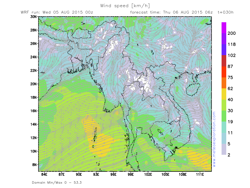
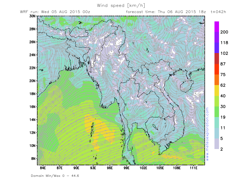
-wind at surface: weak 2-4kt from variable directions
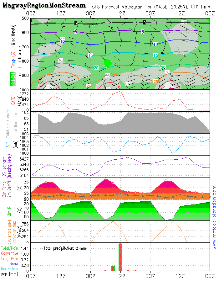
*Magway Region/Mon Stream: 20.2/94.4
-weather: conditions do not look too bad for this location: sunny spells but gradually convective cloudiness (base around 2-2500ft) builds and this results in a few showers around 12utc.
-precipitation: around 2-4mm around 12utc.
-wind at surface: weak: 2-4kt from Southerly to variable directions – after 10utc turning to W and becoming 8-
12kt-decreasing again after 21utc
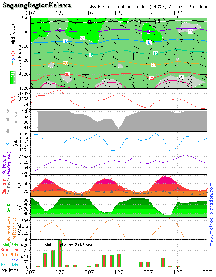
*Sagaing Region: Kalewa: 23.2/94.3
-weather: very cloudy to overcast with periods of rain/showers. The best period of the day should be between 12utc and 18utc. After 15utc the risk for fog increases.
-precipitation: over the whole day a total of about 12-18mm: between 12 and 18utc relatively dry
-wind at surface: weak from variable directions temporarily calm
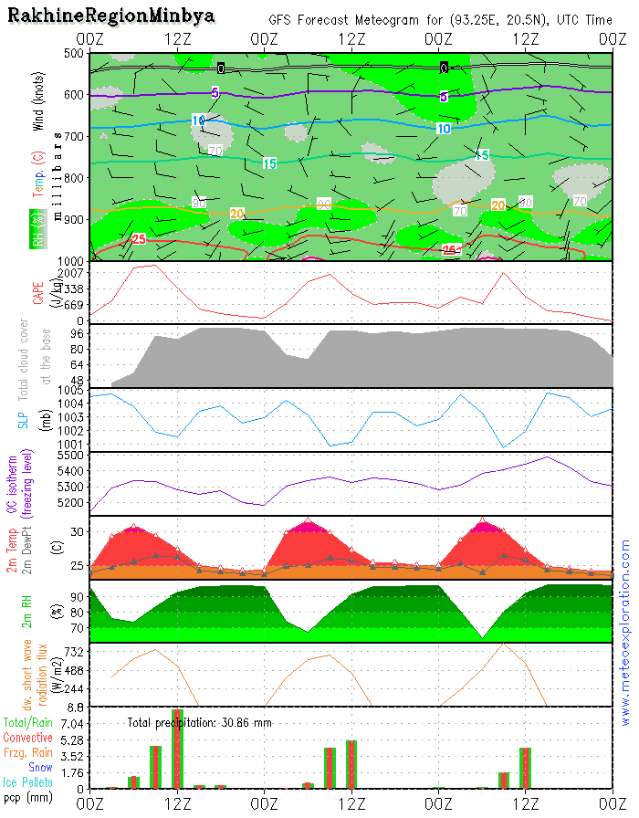
*Rakhine Region: Minbya: 20.4/93.3
-weather: very cloudy to solidly overcast with very low clouds (base around 1000ft) or even fog. Most precip falls between 6 and 12utc; After 12utc mainly dry.
-precipitation: over the whole day a total of about 10-15mm
-wind at surface: is weak from variable directions - no significant change
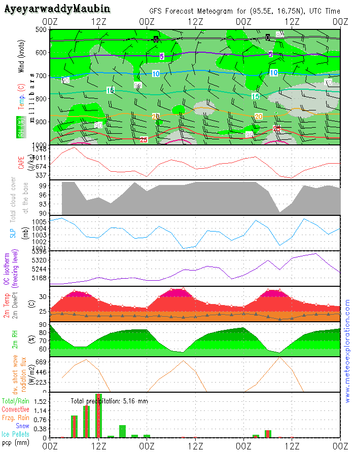
*Ayeyarwaddy: Maubin: 16.7/95.6
-weather: very cloudy with 4-6/8 St around 1000-1500ft and above 5-7/8 Sc around 6-7000ft – remaining mainly dry/most precipitation falls along the coasts
-precipitation: between 0-2mm
-wind at surface: W 15-20kt decreasing after 12utc WSW 10-15kt
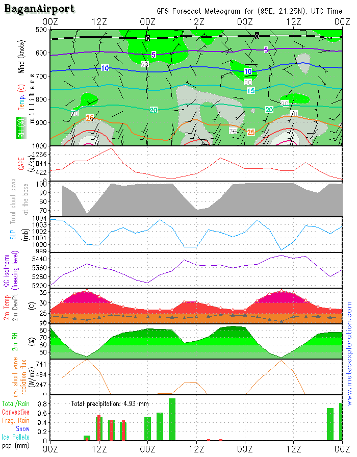
*Bagan: 21.2/94.9 (Airport) - Airfield forecast
-Weather: very cloudy to overcast during the first part of the day with some slight rain/drizzle. After 6/9utc the conditions improve and some weak sunny spells develop. During the afternoon there can still be a local shower
-Clouds: 4-6/8 St around 2-2500ft - sunny spells in between. Risk for fog after 18/21utc
-Visibility: good except during any precip, visibility is than reduced to 3-5km.
-Precipitation: a little rain between 00utc and 6/8utc
-wind at surface: SW 4-6kt temporarily decreasing to 2-6kt,after 15utc again increasing to 15kt from SSW
-wind at 1000ft: SW 3-5kt tempo calm
-wind at 3000ft: SSW 2-6kt tempo calm
-wind at 5000ft: weak/calm
The main change with the previous days is that the low pressure system over the North of India is gradually filling nd getting weaker. An important result of this is that the advection of the warm, moist airmass has become very weak towards the North of Myanmar but is still going to the Southern parts. This means that especially the Northern regions will gradually get drier weather whilst the Southern and Southwestern regions remain prone for rain and showers. Especially the coastal areas of Ayeyarwady.
On the MSL pressure map valid +48 you can see the tropical cyclone heading towards Taiwan-Thursday night.
Warnings
- heavy precipitation at Hakha
The main change with the previous days is that the low pressure system over the North of India is gradually filling and getting weaker. An important result of this is that the advection of the warm, moist airmass has become very weak towards the North of Myanmar but is still going to the Southern parts. This means that especially the Northern regions will gradually get drier weather whilst the Southern and Southwestern regions remain prone for rain and showers. Especially the coastal areas of Ayeyarwady.
On the MSL pressure map valid +48 you can see the tropical cyclone heading towards Taiwan-Thursday night.
Warnings
- -heavy precipitation at Hakha
The main change with the previous days is that the low pressure system over the North of India is gradually filling and getting weaker. An important result of this is that the advection of the warm, moist airmass has become very weak towards the North of Myanmar but is still going to the Southern parts. This means that especially the Northern regions will gradually get drier weather whilst the Southern and Southwestern regions remain prone for rain and showers. Especially the coastal areas of Ayeyarwady.
On the MSL pressure map valid +48 you can see the tropical cyclone heading towards Taiwan-Thursday night.
Warnings
- heavy precipitation at Hakha

No. (11) A , Khapaung Street , Hlaing Township ,
Yangon , Myanmar .

95 - 1 - 538549 , 504418

administrator@apexpetro.com

www.apexpetro.com